
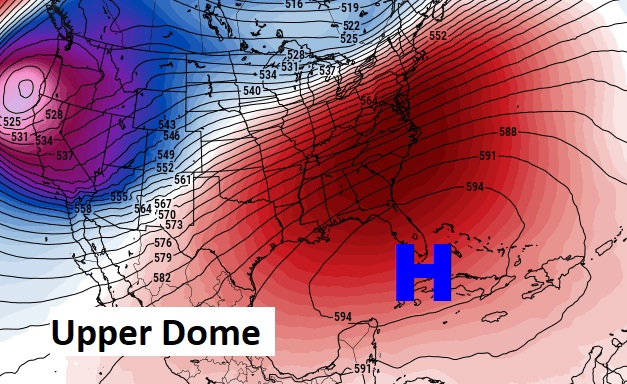
Good Morning! The calendar says February, but our weather pattern is more like May. A huge protective dome of upper level high pressure over Cuba is still in control. Yesterday we had a record high of 85. Like yesterday, isolated showers are possible. I’ll include a small rain chance Saturday, but much of the weekend is warm and dry. Scattered showers return Monday. At the moment, there is no Arctic Air in sight. That’s good news in the Dead of Winter. Here’s my brief forecast discussion.
CLIMATE DATA: Yesterday’s high in Montgomery was 85. (Tied the Record High from 2019). Morning low was 68. (Normal 67/42). Max wind gust 25 mph
TODAY: Another much above normal day. Mostly cloudy. Widely scattered showers possible, High near 80. (Normal 67/42) Southwest wind 6 to 12, gusts to 18 mph today. Mostly cloudy very mild tonight. Low near 62.
Future Radar…1:00PM….Not many showers around. Isolated.

That huge, strong upper level ridge of High Pressure over Cuba is still in control of our weather. It promotes warmth and diverts storm systems away from us.
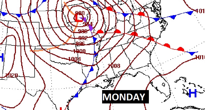
NEXT FEW DAYS: Our Spring preview will continue. There will be a small chance of showers on Saturday. We should be back in the lower 80’s over the weekend. Risk of showers returns Monday and Monday night. Tuesday will be a cooler day. Another warm-up begins Wednesday.

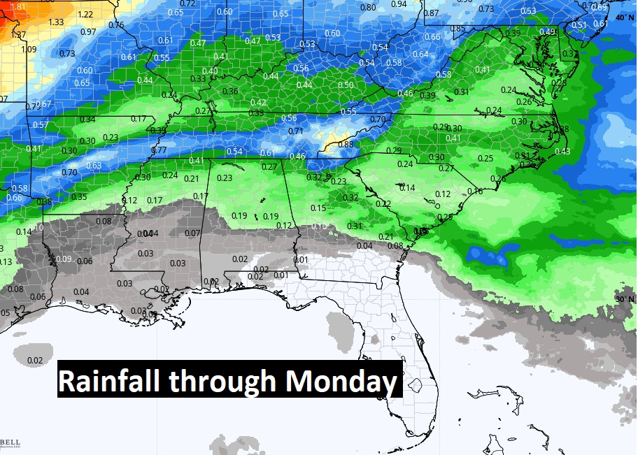
Here’s expected rainfall through Monday. NOT MUCH across the southern half of Alabama.
The above normal temperatures for the rest of February and over the first few days of March. Here’s the 10 day Model Temp. trend. The Arctic Flood Gates are still closed for now.

The next Storm System holds off until early next week.
Thanks for reading this Blog this morning! This morning we are LIVE on the radio from 6 to 9 on NewsTalk 93.1. Watch us on TV on CBS 8 and ABC 32. I’ll have another update for you in the morning. Enjoy this Fat Tuesday! –Rich