
Good Morning! Today is likely to be the fourth day in a row of 80+ degree weather in the Dead of Winter. Our Spring Preview continues through the weekend and into early next week. There is no return to winter in sight. Rain chance is very low today, but not zero. Isolated showers at best. The next front approaches by late Monday. Scattered showers are possible, but no severe weather. Tuesday will be a little cooler, behind the front, but not for long. Warmer days are on the way by the middle of week. Here’s my brief forecast discussion.
CLIMATE DATA: Yesterday’s high in Montgomery was 83. Morning low was 59. (Normal 67/42).
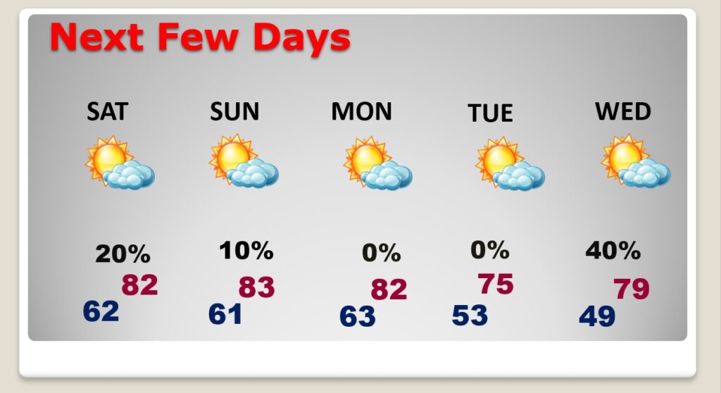
TODAY: Another much above normal day. Mostly cloudy. Widely scattered showers possible, High near 82. Southwest wind 6 to 12. Mostly cloudy very mild tonight. Low near 61.
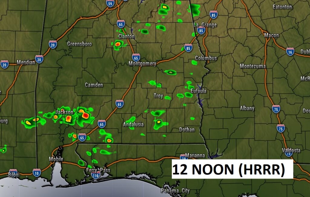
Future Radar…12 Noon….Not many showers around. Like yesterday, Isolated.
NEXT FEW DAYS: Our Spring preview will continue. Sunday should be dry and warm. Risk of showers returns Monday and Monday night. Nothing severe. Tuesday will be a cooler day. Another warm-up begins Wednesday & Thursday.
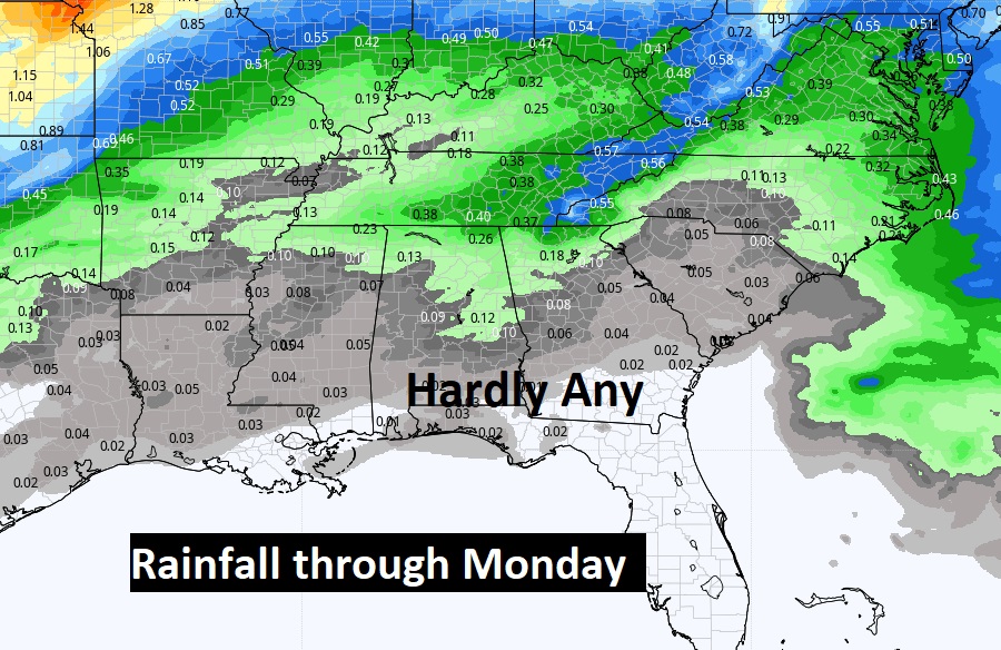
Here’s expected rainfall through Monday. NOT MUCH across the southern half of Alabama.
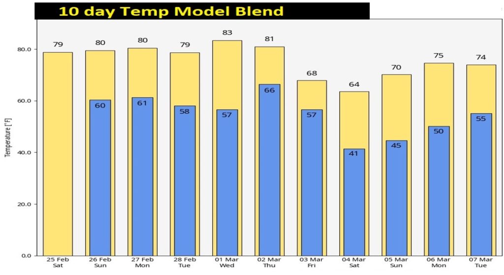
The above normal temperatures for the rest of February and over the first few days of March. Here’s the 10 day Model Temp. trend. The Arctic Flood Gates are still closed for now.
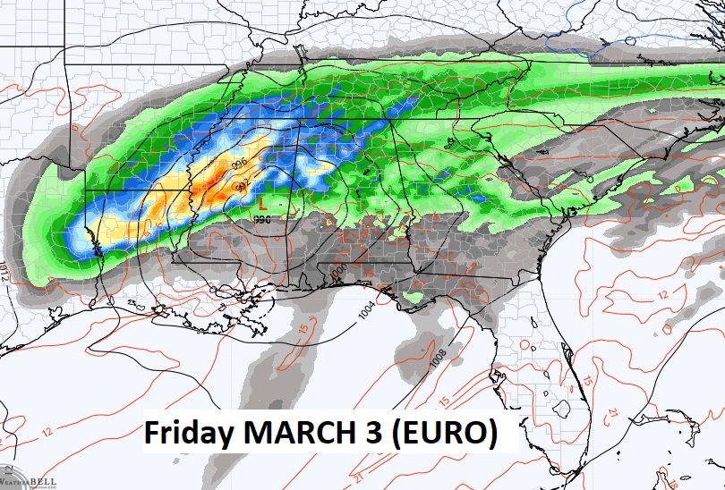
Looks like another storm system will affect the area by next Friday.
Thanks for reading this Blog this morning! I’ll have another update for you in the morning. Have a nice day!
–Rich