
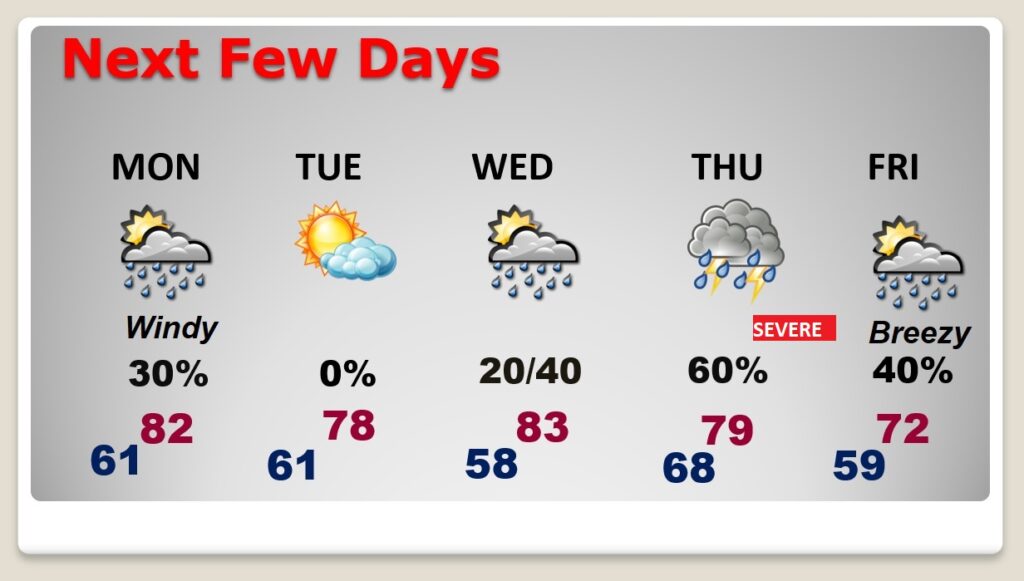
Good Morning! Today is likely to be the fifth day in a row of 80+ degree weather in the Dead of Winter. We tied a 105 year old record yesterday with 84. Our Spring Preview continues. Even the trees are starting to bloom. The next front approaches by late Monday. Scattered showers are possible, but no severe weather. Tuesday will be a little cooler, behind the front, but not for long. Warmer days are on the way by the middle of week. Looks like we may be in for SEVERE weather event in the overnight hours Thursday night into early Friday.
CLIMATE DATA: Yesterday’s high in Montgomery was record tying 84. (Previous record 84 from 1918) Morning low was 58. (Normal 67/43).
TODAY: Another much above normal day. Partial sunshine. High near 82. Southwest wind 6 to 12. Partly cloudy very mild tonight. Low near 61.
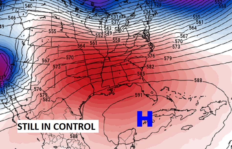
Still in control. The MASSIVE, strong upper level high over Cuba up at 20,000 feet is the reason we’ve been so warm for so long. It’s anchored. It also is the mechanism that is diverting storm systems around us. Make no mistake about it. The upper high continues to be the controlling feature in our weather.
NEXT FEW DAYS: A significant storm system Monday will largely bypass US. Monday will be a very windy day. Wind advisory in effect, Winds could gust 30+ mph. I’ll include a small chance of showers and storms Monday and Monday night. This storm will terrorize the Great Lakes and the Northeast. Tuesday looks dry, and less humid. We’re back to the 80’s Wednesday. Looks like a “Big Deal” weather system late week. Already SPC has outlooked us for Severe Weather in the overnight hours Thursday night into early Friday. It has my attention.
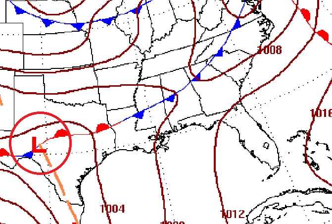
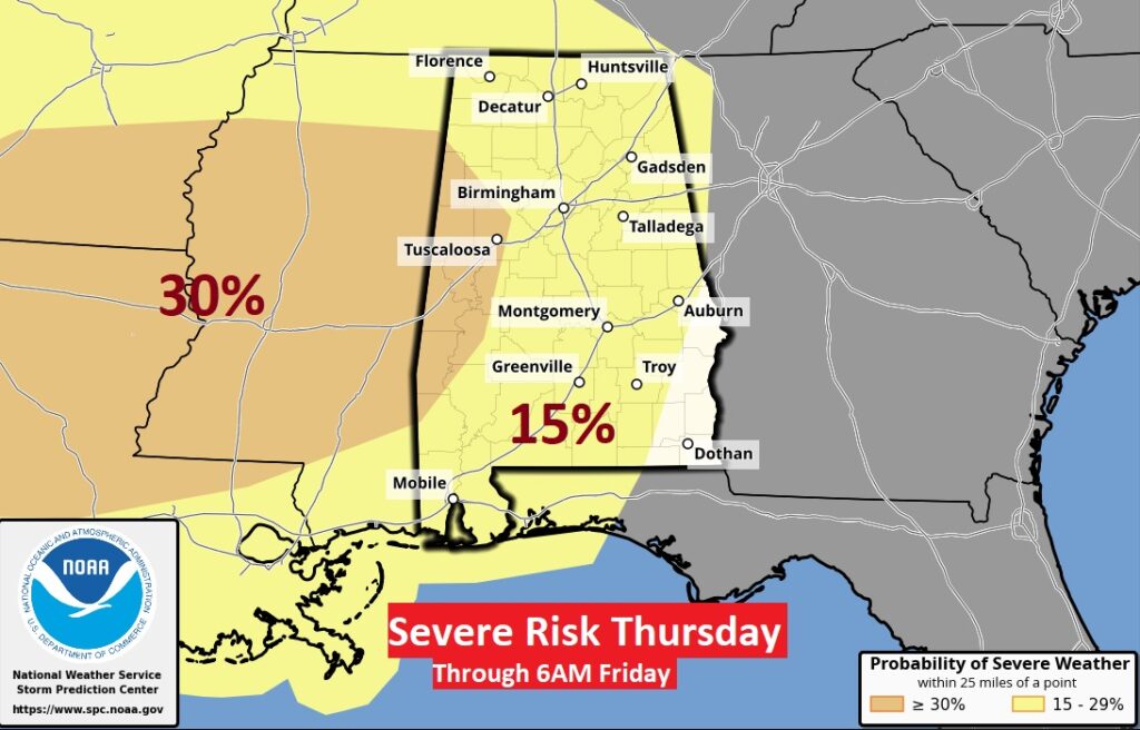
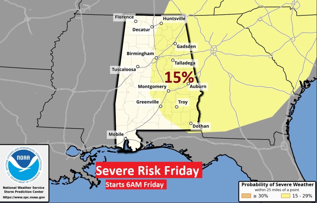
LATE WEEK SEVERE THREAT: It’s always a big deal when the Storm Prediction Center issues a Severe Threat beyond Day 3. Already SPC has outlooked us for Severe Weather in the overnight hours Thursday night into early Friday. Another dreaded overnight event. All modes of severe weather are on the table including tornadoes. Here’s the set up.
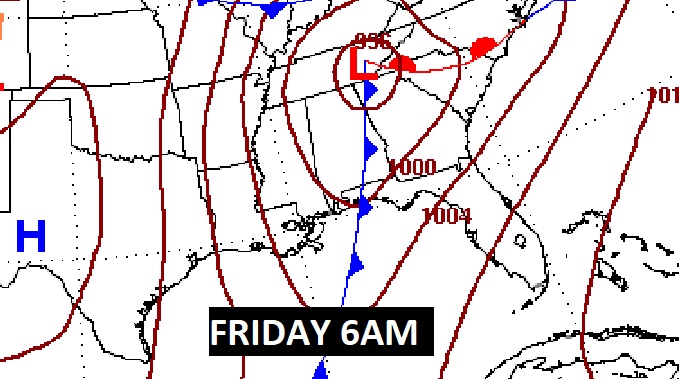
This is the Day 5 and Day 6 outlook from the Storm Prediction Center. Stay tuned.
Thanks for reading this Blog this morning! I’ll have another update for you in the morning. Have a nice day!
–Rich