
Good Morning! Welcome to the last day of February. We’ve been in the 80’s for the last six days and today will be the 7th day. We’ve been in record territory for the last 3 straight Today a 75 year-old record is in jeopardy. March will start on a warm note Wednesday. A “big deal” storm system will approach the state Thursday. Still looks like we’re in for a severe weather event in the overnight hours Thursday night into the pre-dawn hours of Friday morning. All modes of severe weather are possible, including a tornado threat. Much cooler air arrives for the weekend. Here’s my brief forecast discussion.
CLIMATE DATA: Yesterday’s high in Montgomery was record tying 84. (Previous record 84 from 1962) Morning low was 61. (Normal 68/43). Peak wind gust 33 mph. (Monday with the 6th day of 80+ degree weather)
TODAY: Another potential record high again today. Breezy & Warm today. Clouds will dominate most of the times. Widely scattered showers, perhaps a thunderstorm. High near 84. (Record 83 from 1948) Southwest wind 10 to 15 gusting to 20 mph. Low tonight near 66.
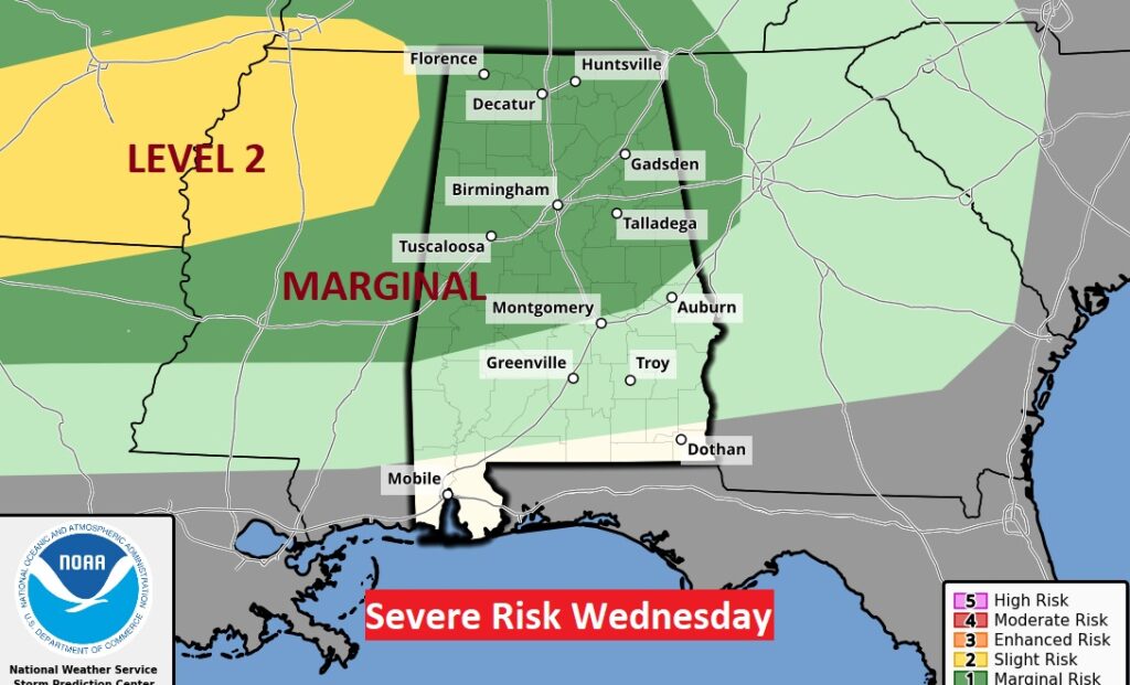
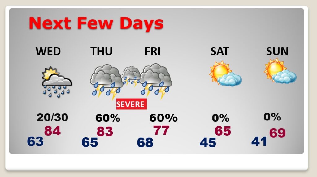
WEDNESDAY: Expect another warm day. High 84. Widely scattered. showers and a few thunderstorms
SPC Has a Marginal Severe Weather Risk mainly from US 80/I-85 northward. Damaging wind gusts is the main threat.
THURSDAY NIGHT SEVERE WEATHER : A powerful storm system will take shape west of us during the day Thursday. Scattered showers and thunderstorms daytime Thursday with a high in the lower 80’s
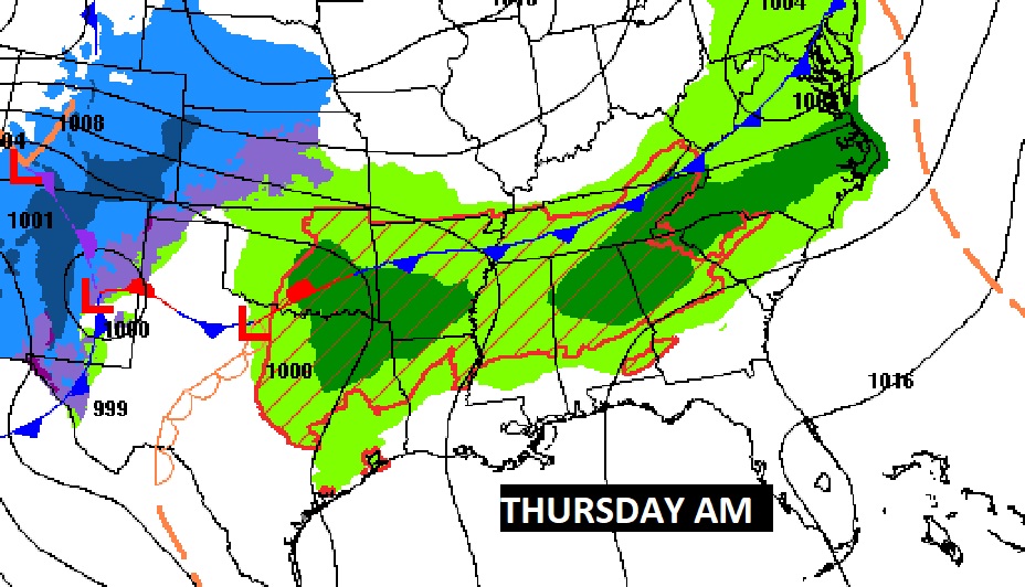
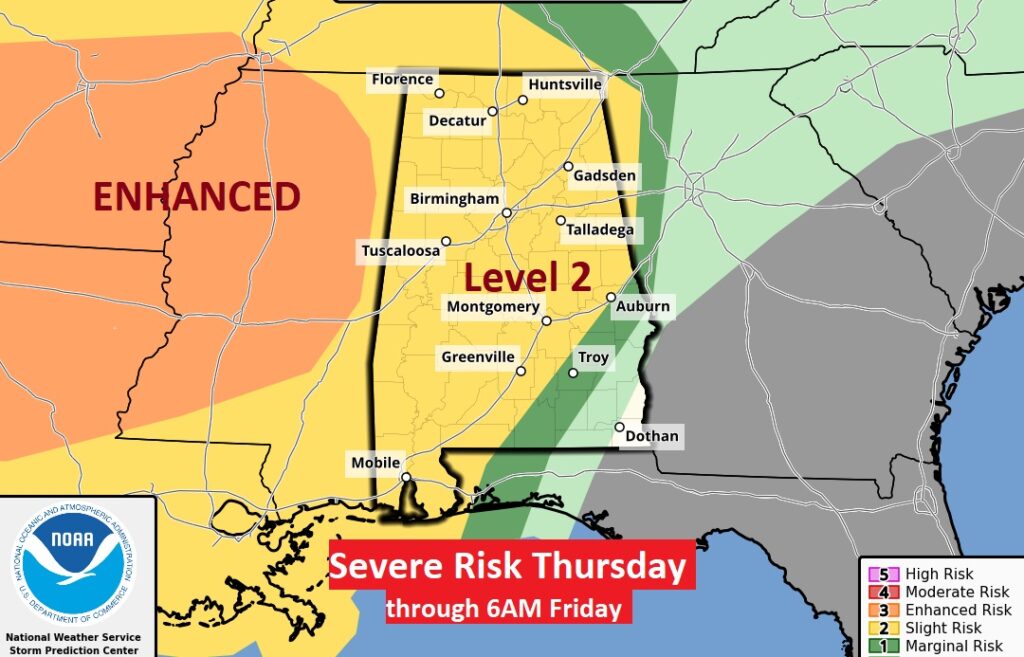
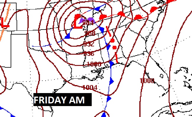
The primary Severe Weather threat moves in the overnight ours Thursday night into early Friday. All modes of severe weather are on the table including the risk of tornadoes. Most of the action will occur along a strong line of storms in the pre-dawn hours.
The Storm Prediction Center has a Level 2 Severe Risk along and northwest of an Auburn to Pensacola line. All but Southeast Alabama is included in the Day 3 threat, which continues through 6AM Friday.
On Friday, the Severe Risk (starting at 6AM) shifts eastward with front.
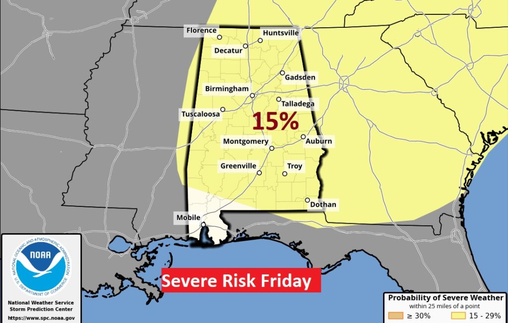
The severe threat will end early Friday with the frontal passage.
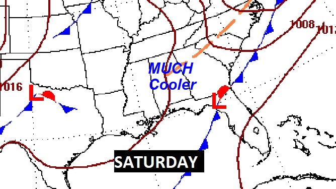
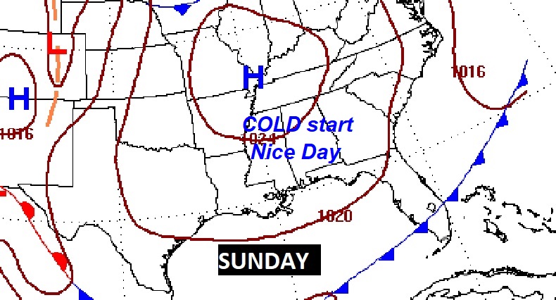
NEXT FEW DAYS: The risk of strong/severe storms will end early Friday with the frontal passage. Expect improvement by mid-day. The weekend will be much cooler with lows in the 40’s and highs in the 60’s.
Much cooler air follows the front for the weekend.
Thanks for reading this Blog this morning! This morning we are LIVE on the radio from 6 to 9 on NewsTalk 93.1. Watch us on TV on CBS 8 and ABC 32. I’ll have another update for you in the morning. Have a nice day!
–Rich