
Good Morning! Welcome to March. We’ve been in the 80’s for the last seven days and today will be the 8th day. We’ve been in record territory for the last 4 straight. March will start on a warm note today with mid 80’s Today is the first day of Meteorological Spring. Spotty showers & maybe a few thundershowers are possible today and Thursday That threat we’ve been tracking now looks like a Friday morning situation. It should move through fairly quickly. All modes of severe weather are possible, including a tornado threat. It will be noticeably cooler by Friday night and Saturday. Here’s my brief forecast discussion.
CLIMATE DATA: Yesterday’s high in Montgomery was record tying 84. (Previous record 84 from 1948) Morning low was 67. (Normal 68/43).
TODAY: Expect a warm first day of March. Clouds will dominate most of the times. Widely scattered showers, perhaps a thunderstorm or two today and tonight. High near 84. (Record 85 from 2017) Southwest wind 6 to 12 mph. Low tonight near 66.
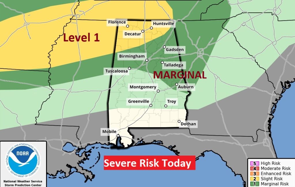
SPC Has a Marginal Severe Weather Risk mainly across north Alabama. There could be a couple of stronger storms in East Alabama, too. There is a also a Level 2 threat in NW Alabama Damaging wind gusts and large hail are the main threat.
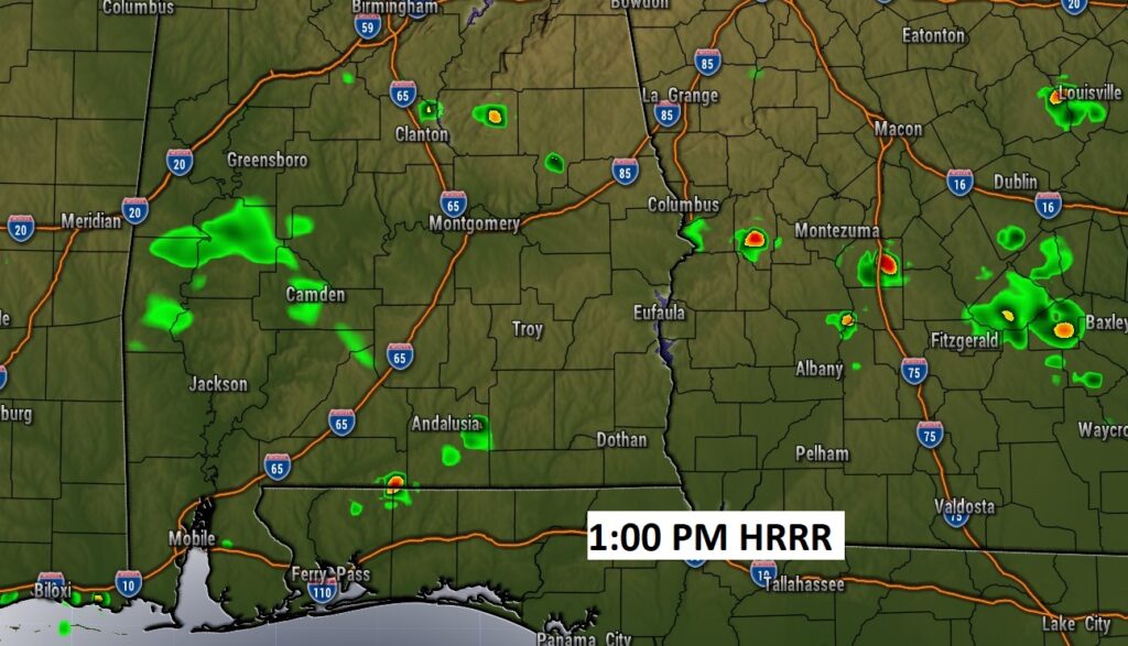
Showers will be very isolated in nature today and tonight. Perhaps 20% coverage. Here’s a Future Radar snapshot early this afternoon.
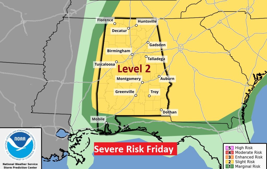
SEVERE WEATHER THREAT: The approaching storm system and cold front has slowed down. The expected severe weather threat has turned into more of a Friday morning event. All modes of severe weather are on the table including the risk of tornadoes. Showers and storms will enter the state before Dawn Friday
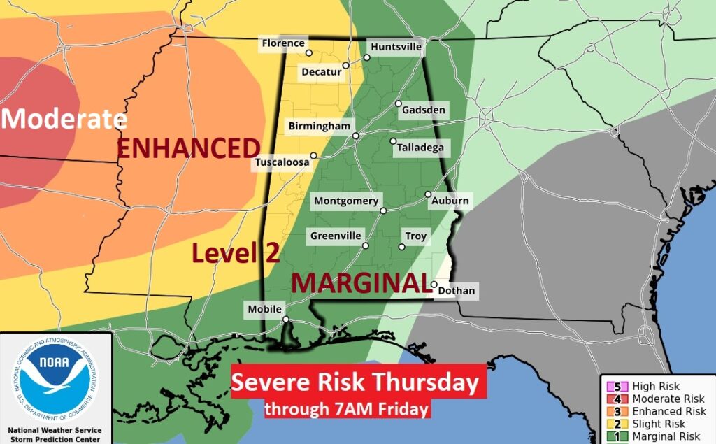
Here’s the Thursday Severe Threat from SPC. Significant Moderate Risk in the ArkLaTex region, and Enhanced risk in Mississippi. This outlook continues until 6AM Friday. Note the Level 2 risk edges into extreme west Alabama at that hour.
On Friday, the Severe Risk (starting at 6AM) shifts eastward. The Level 2 threat covers the entire state. (Including the risk of a few tornadoes) However, because this will be mainly a morning event, perhaps for Alabama this Event will be, hopefully, a little tamer for us, than the states west of us. Fingers crossed.
.
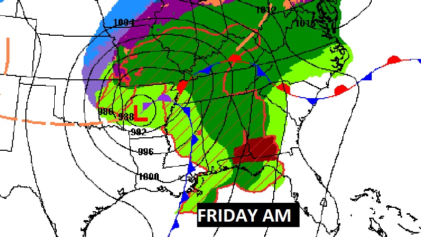
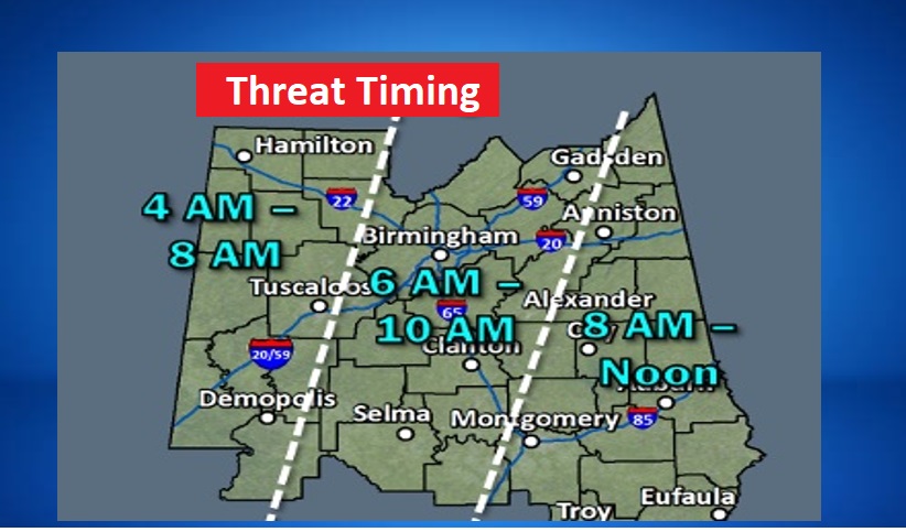
Here’s the updated timing map. The fact that we won’t have to deal with a middle of the night event is a good thing. And, the system is moving quickly. Smaller time window.
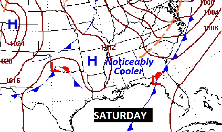
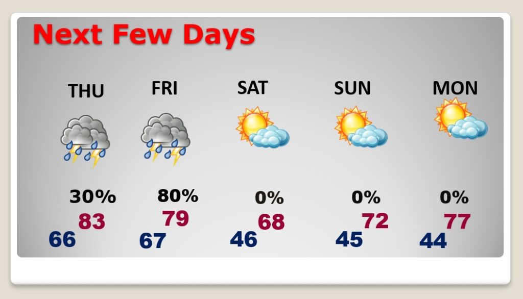
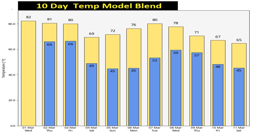
NEXT FEW DAYS: Showers and storms will move out by afternoon. Noticeably cooler Friday night with lows in the 40’s. Saturday’s high in the upper 60’s Sunday looks nice. Chilly start, but a nice warm up. Back to the upper 70’s Monday.
Here’s the 10 day model trend. Still no arctic air in sight. Not right away.
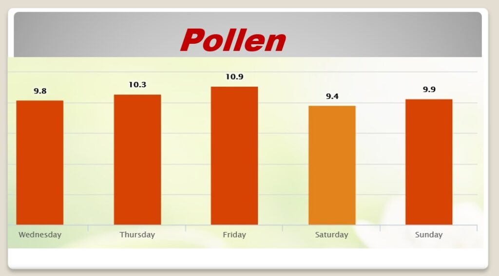
‘Tis the season to talk pollen. I’m sure you’re aware, it’s bad already. We’re in the high range for the next few days. My brown car is yellow.’
TRAGIC WEATHER ANNIVERSARY.…The deadly Enterprise EF-4 Tornado occurred on this date in 2007.

Thanks for reading this Blog this morning! This morning we are LIVE on the radio from 6 to 9 on NewsTalk 93.1. Watch us on TV on CBS 8 and ABC 32. I’ll have another update for you in the morning. Have a nice day!
–Rich