
Good Morning! The warmth continues. Today we’ll be near 80. Showers and thunderstorms will dot the radar screen today and widely scattered storms tonight. Storms should stay below severe limits today. But, by early Friday morning, a band of strong to severe storms will move across the state ahead of a cold front. The severe weather window is relatively small. Storms should clear the area by about lunchtime. All modes of severe weather are on the table including the risk of tornadoes. Noticeably cooler air will follow for Friday night and Saturday. We’ll be in the mid 40’s by Sunday Dawn. Here’s my brief forecast discussion.
CLIMATE DATA: Yesterday’s high in Montgomery was record tying 84. (Just shy of the Record of 85) Morning low was 68. No rain at the Airport. (Normal 68/43).
TODAY: Another warm day. Clouds will dominate most of the times. Spotty, scattered showers and thunderstorms today and this evening. High today near 80. (Record 83 from 2018) Southwest wind 10 to 15 mph. TONIGHT: Thunderstorms may redevelop in the overnight hours, but likely closer to Friday morning. Becoming windy. Wind Advisory begins at Midnight. Southwest wind 15 to 25 gusting to 30 mph. Low tonight near 68.
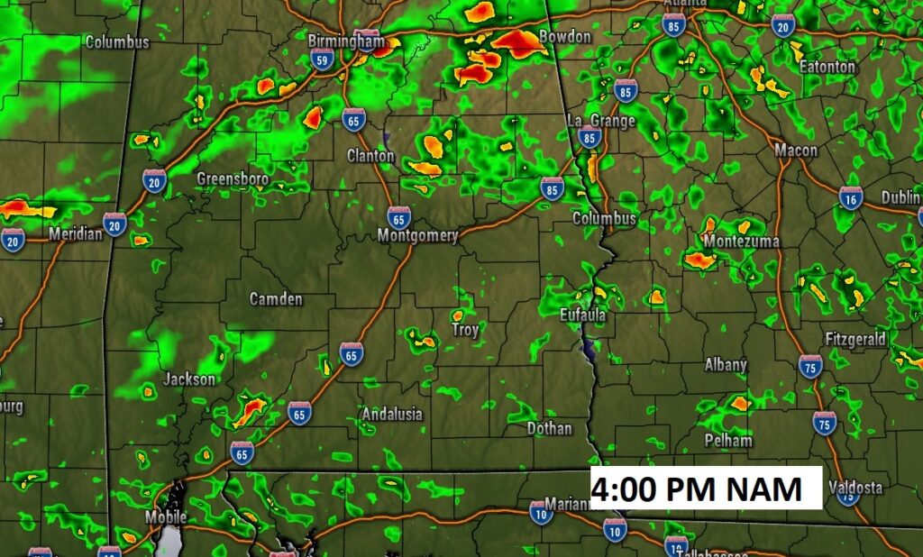
Scattered showers and thunderstorms this afternoon and this evening. Perhaps 40-50% coverage. Here’s a Future Radar snapshot at 4:00 PM from the NAM model.
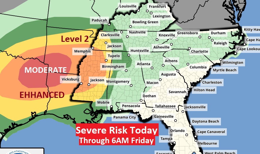
SEVERE WEATHER THREAT: Here’s today’s Severe Threat from SPC.
Significant Moderate Risk in the ArkLaTex region, and Enhanced risk in Mississippi. Could be a significant tornado outbreak today. This outlook continues until 6AM Friday. Note the severe risk risk edges into extreme west Alabama at that hour.
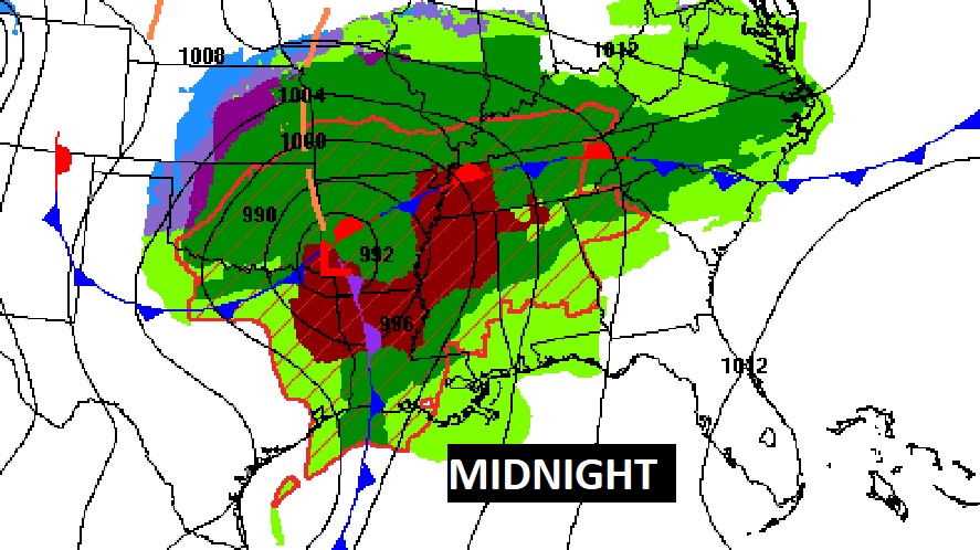
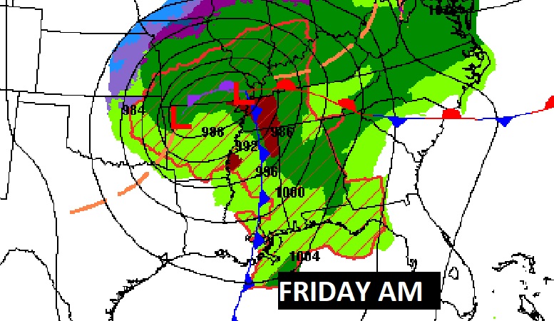
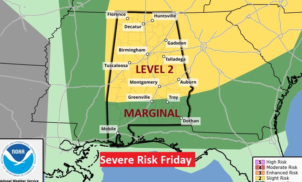
On Friday, the Severe Risk (starting at 6AM) shifts eastward. The Level 2 threat covers the northern 2/3 of the state, generally north of a Greenville/Troy line. South Alabama has a Level 1 Marginal Severe Risk. All modes of severe weather are on the table including the risk of tornadoes. Showers and storms will enter the state before Dawn Friday
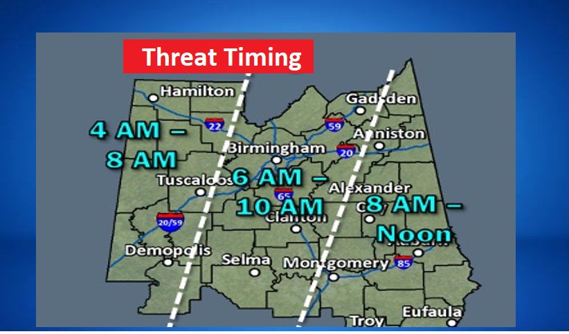
This timing map show the severe risk beginning perhaps as early as 4AM in West Alabama, and as late at about Noon in the far eastern counties. A relatively face paced severe window.
.
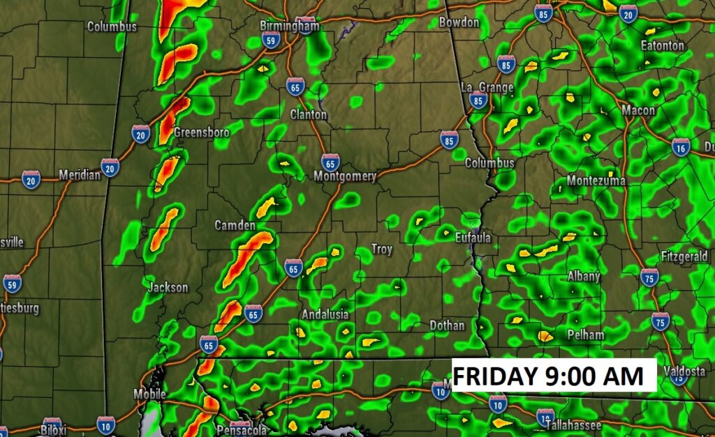
Here’s a Future Radar Snapshot at 9AM Friday.
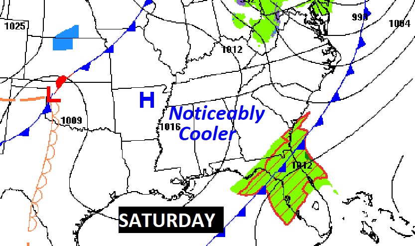
NEXT FEW DAYS: Showers and storms will move out by afternoon. Noticeably cooler Friday night with lows in the 40’s. Saturday’s high in the upper 60’s Sunday looks nice. Chilly start, but a nice warm up. Back to the upper 70’s Monday. Could be some more showers by either Monday night or more likely Tuesday. Back to the lower 80’s again on Tuesday.

Much cooler air follows the front for the weekend.
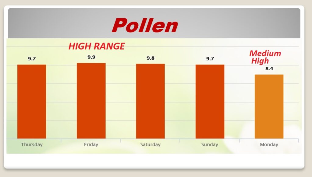
POLLEN: Unfortunately, it’s that time of the year. You’ve probably noticed the pollen has already reached a very high level. This will continue for the next few days through Sunday. Medium high on Monday.
Thanks for reading this Blog this morning! This morning we are LIVE on the radio from 6 to 9 on NewsTalk 93.1. Watch us on TV on CBS 8 and ABC 32. I’ll have another update for you in the morning. Have a nice day!
–Rich