
Good Morning! Cooler air is funneling into the state. After a record of 85 yesterday, we’ll be in the low 70’s today and the mid 40’s tonight. It should be just a beautiful weekend. Sunday starts off chilly, but there will be a nice afternoon warm-up. We’ll be back near 80 by Monday. On this Blog update, we’ll look ahead to the distant horizon. Could we see a big pattern chance to colder air by the middle of the month? There are more and more signals from the models hinting at a big change.
Here’s my brief forecast discussion.
YESTERDAY’S CLIMATE REPORT: Yesterday was a rather remarkable day. Montgomery had a record high of 85, breaking the record of 84 from 1899. 10th day of 80+ degree highs. Morning low 56. (Normal 69/42) Rainfall: .02” Maximum wind gust 45 mph from the SW.
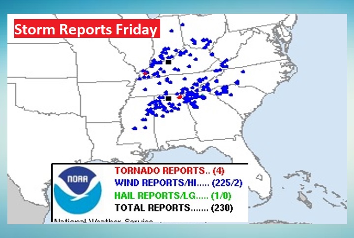
FRIDAY’S SEVERE WEATHER: There were dozens of warnings across north Alabama Friday. Multiple reports of wind damage and at least 4 tornado reports from north Alabama to Ohio. A total of 225 severe weather reports. Fortunately, for many of us, the southern end of the squall line fell apart.
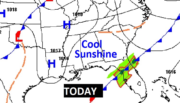
TODAY: Sunshine. Cooler, but nice. High 73. Northwest wind 6 to 12 mph. Clear, chilly tonight. Low 47.
.
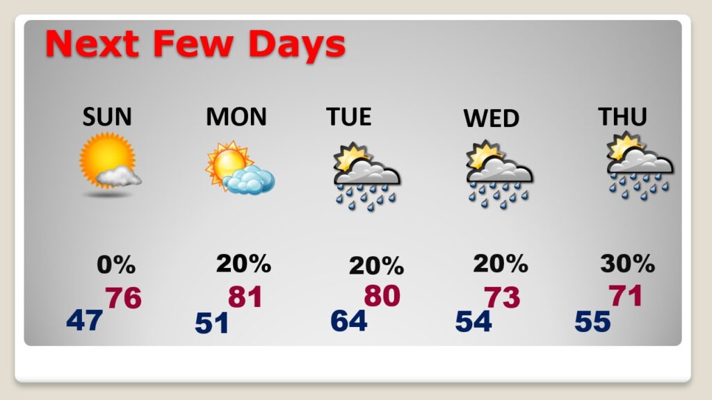
NEXT FEW DAYS: Sunday starts off chilly, with a nice afternoon recovery. We’ll be at least in the mid 70’s by afternoon. A beautiful Sunday. The warm-up continues Monday. We’ll be near 80 both Tuesday and Wednesday. Cooler by Wednesday and Thursday. Widely scattered showers Tuesday through Thursday. Small chance of rain.
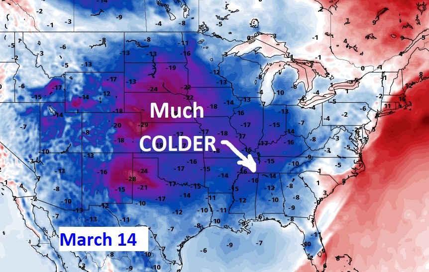
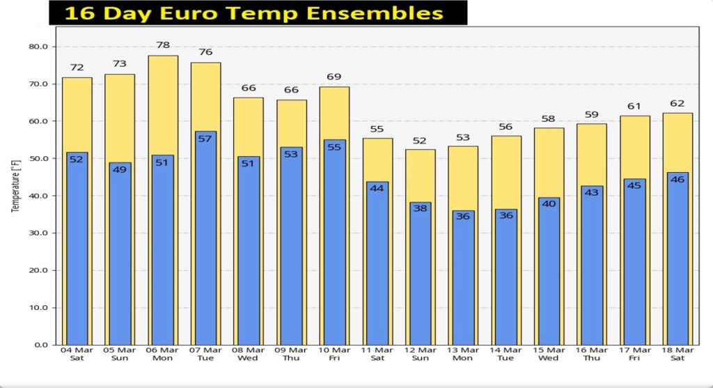
MID-MONTH PATTERN CHANGE ?: All signs point to a potentially significant pattern change around the middle of the month. Important cold front brings showers and storms around Monday the 13th. Sharply colder air will follow.
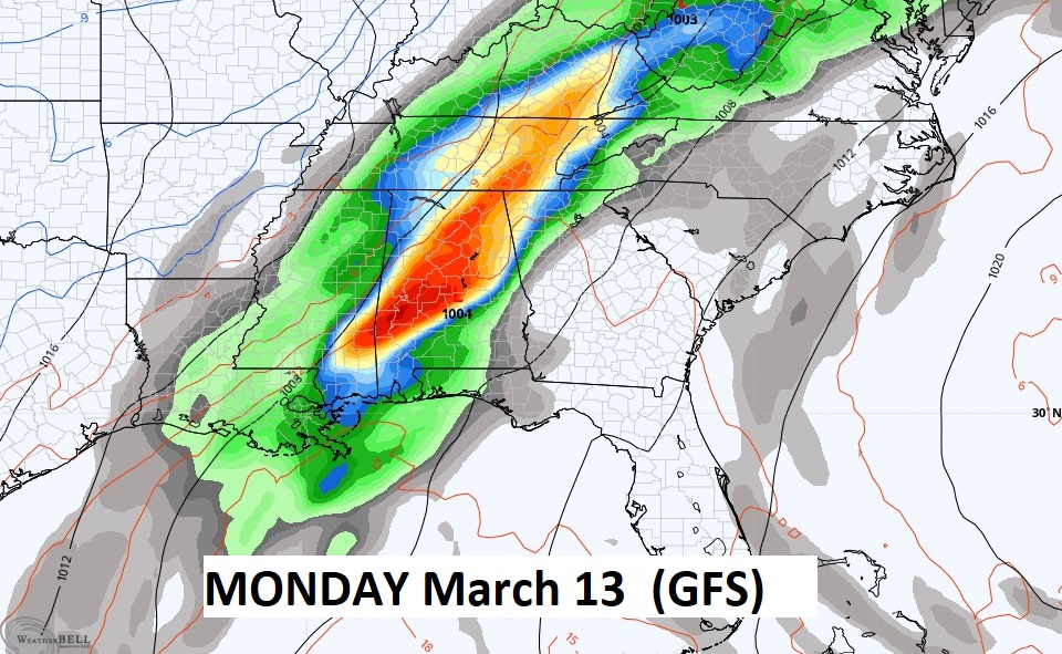
The Ensemble models are just starting to pick up on the intensity of the temperature drop. Will there be a late season freeze? Too early to say. Average date of the last freeze is March 8th. Stay tuned.
Thanks for reading this Blog this morning! This morning we are LIVE on the radio from 6 to 9 on NewsTalk 93.1. Watch us on TV on CBS 8 and ABC 32. I’ll have another update for you in the morning. Have a nice day!
–Rich