
Good Morning! Our beautiful weekend continues. Saturday was warmer than first expected. We made it to the upper 70’s. Toady will start out chilly but, we’ll end up warm & comfortable. Expect upper 70’s again. It should be a text-book perfect March day. Monday looks nice. We’ll be in the low to mid 80’s Tuesday and Wednesday. Widely scattered showers are the forecast Tuesday through Thursday. Better Rain chances return Friday as the next front approaches. We’re still looking for a Big Cool-down starting in the middle of the month.
YESTERDAY’S CLIMATE REPORT: Yesterday was warmer than expected. Montgomery ‘s high reached 78. Morning low 51. (Normal 69/44) Rainfall: 0.00. Rainfall for the month: .04”
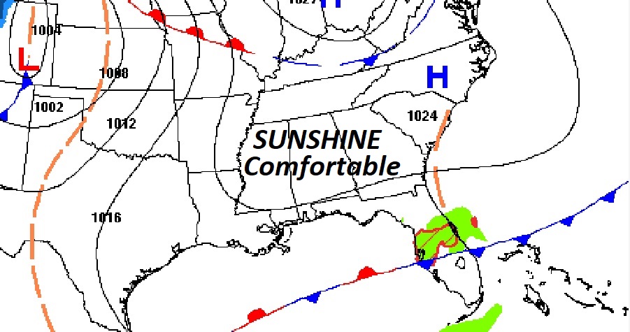
TODAY: Sunshine. Nice Day. Comfortable. High 78. Northeast wind 6 to 12 mph. Clear tonight. Not as cool. Low 53.
.
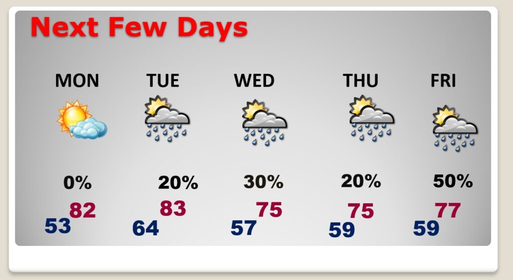
NEXT FEW DAYS: The warm-up continues Monday. Look for lower 80’s Monday and Tuesday. We’ll be in the 70’s Wednesday and Thursday. Widely scattered showers Tuesday through Thursday. Small chance of rain. Showers are more likely Friday as a Cold Front approaches.
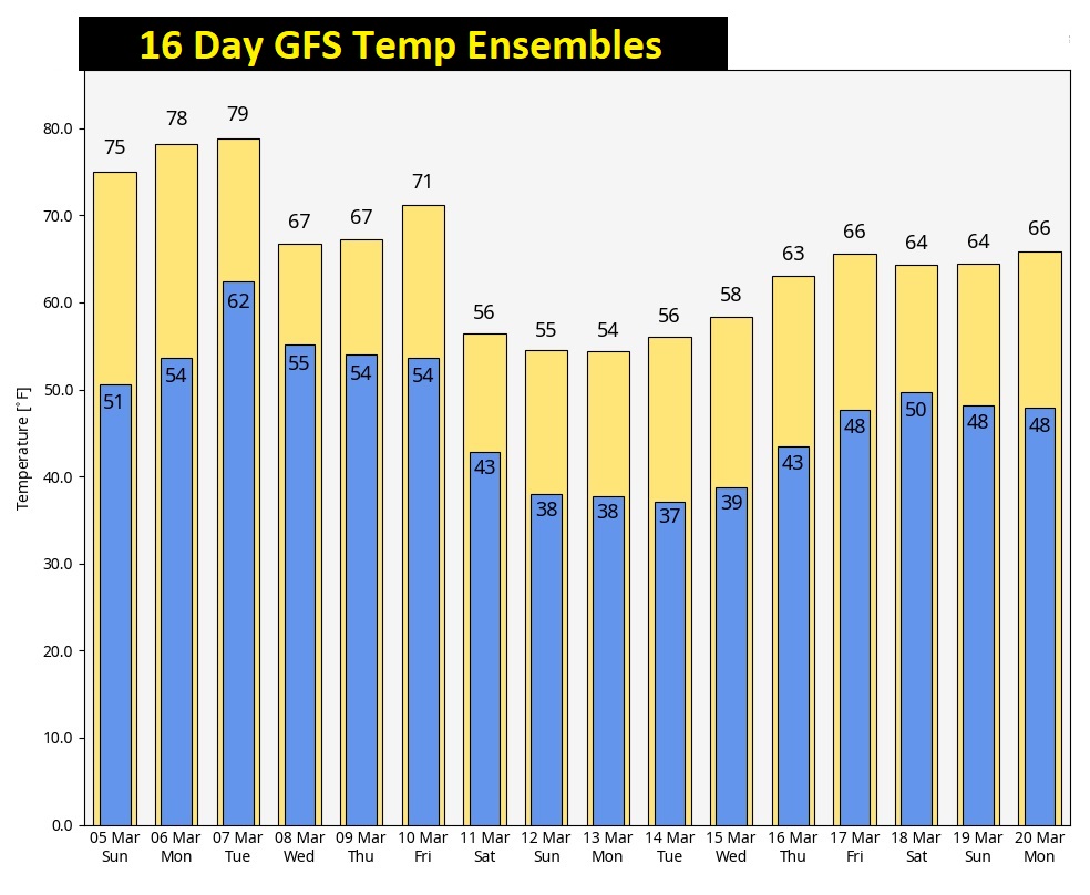
MID-MONTH PATTERN CHANGE: Much cooler air is in our future by mid to late month. But, there are new question marks. Will the core of the cold air stay north of us? Maybe. Cool down….YES. But, how cold? And, how long? That remains to be seen. Stay tuned.
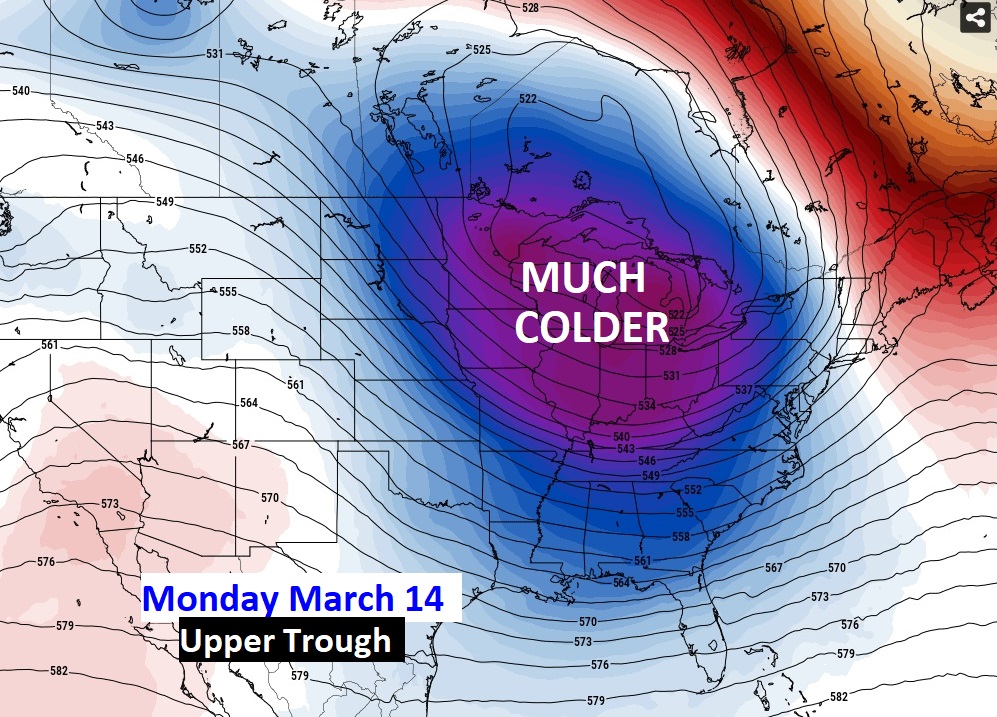
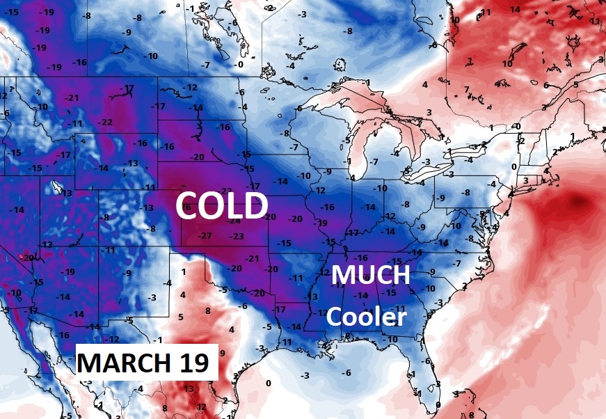
Here’s the 16 day GFS Ensemble forecast. You can clearly see a big cool-down. But, this latest model run is NOT excessive on the cold. Stay tuned. Average date of the last freeze is March 8th. Stay tuned.
Thanks for reading this Blog this morning! I’ll have another update for you in the morning. Have a nice day!
–Rich