
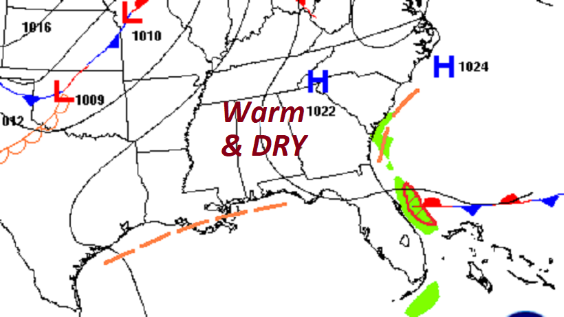
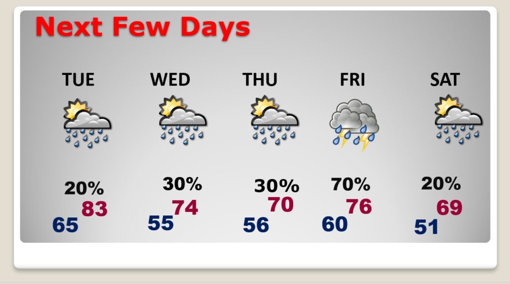
Good Morning! Our beautiful weather continues today. We were in the upper 70’s over the weekend. Today, we will start this new week in the low to mid 80’s. Tuesday will also be warm, but we will turn noticeably cooler Wednesday & Thursday. Widely scattered showers are the forecast Tuesday through Thursday. Better Rain chances return Friday as the next front approaches. Showers & thunderstorms. We’re still looking for a Big Cool-down in the middle of the month, but I don’t see anything shocking yet.
.
YESTERDAY’S CLIMATE REPORT: Montgomery ‘s high reached 79. Morning low 48. (Normal 69/45) Rainfall: 0.00. Rainfall for the month: .04”
TODAY: Sunshine. Nice Day. Comfortable. High 83. East wind 6 to 12 mph. Increasing Clouds tonight. Isolated showers possible. Very mild. Low 64.
.
NEXT FEW DAYS: Warm Tuesday. Low to mid 80’s. Cooler Wednesday and Thursday. Scattered showers Wednesday and Thursday. Best chance of rain Friday. Showers and thunderstorms as a cold front approaches. Cooler next weekend.
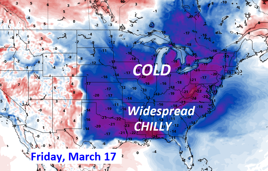
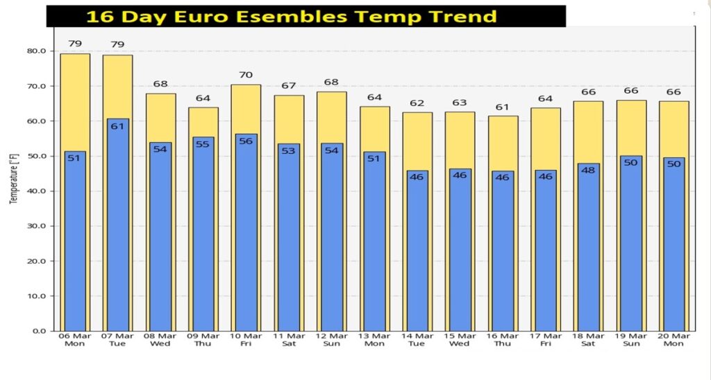
MID-MONTH PATTERN CHANGE: Much cooler air is in our future by mid to late month. But, how cool? The models are not as definitive on the intensity of the cool-down and how long. Stay tuned. Looks like the cool-down begins on The Ides of March. St. Patrick’s Day looks very chilly for much of the country.
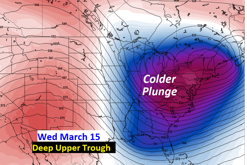
Here’s a sample of the Euro Ensembles out 16 days. Cooler? Yes. Shocking? No.
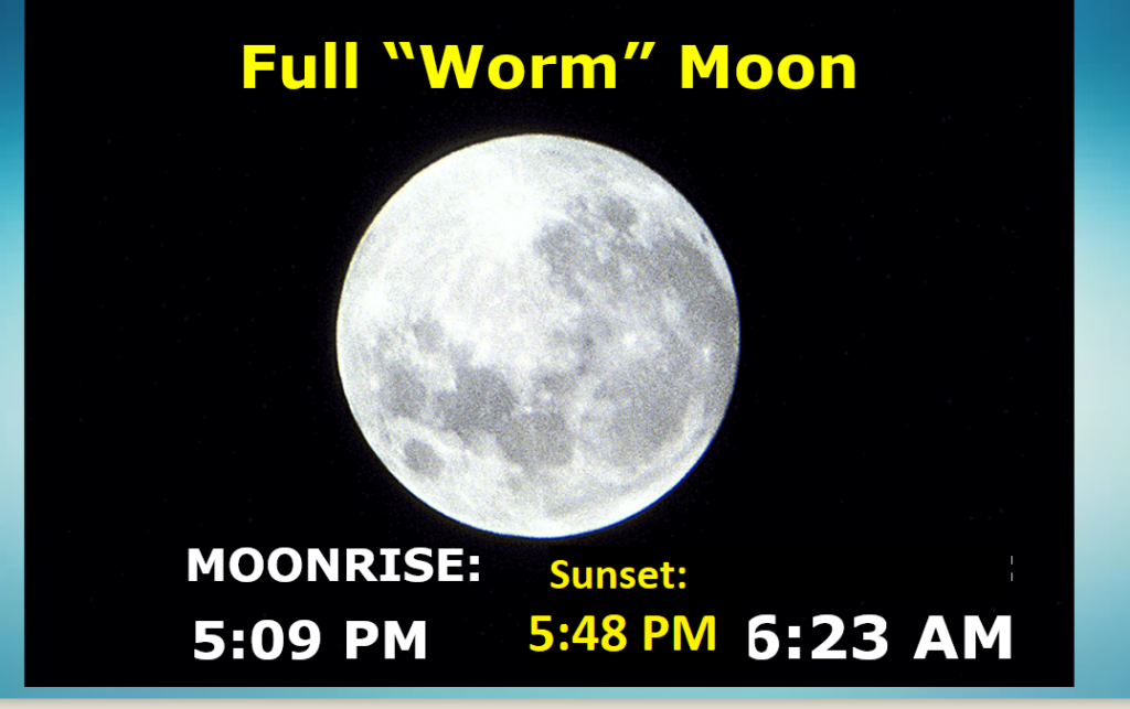
FULL MOON: Full “Worm” moon tonight.
POLLEN: Another tough week ahead.

Thanks for reading this Blog this morning! I’ll have another update for you in the morning. Have a nice day!
–Rich