
Good Morning! Our comfortably warm weather continues today. Yesterday we nearly broke another record. Today we’ll be back in the low to mid 80’s. Could be a few spotty showers first half of the day. Wednesday & Thursday will be quite a bit cooler. Risk of showers Thursday, but the best chance of showers and storms will be on Friday as the next cold front approaches. It will turn cooler over the weekend. Another batch of showers arrive Sunday. Here’s my brief discussion.
.
YESTERDAY’S CLIMATE REPORT: Montgomery ‘s high reached 85. Nearly a record. The Record was 86 from 2022. Morning low 48. (Normal 70/45) Rainfall: 0.00. Rainfall for the month: .04”
TODAY: Risk of morning showers. Mostly cloudy, then gradually sunny High 84. (Record high 85 from 1956) West wind 6 to 12 mph. Mostly clear tonight. Low 55.
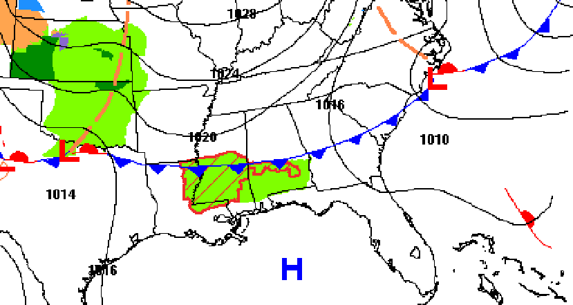
Weak southward moving front could touch off a few showers.

.
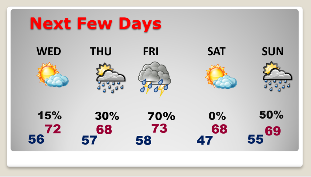
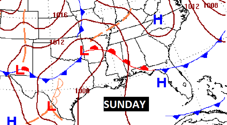
NEXT FEW DAYS: Turning cooler Wednesday and Thursday. Scattered showers Thursday. Best chance of rain Friday. Showers and thunderstorms as a cold front approaches. Sunshine, cooler Saturday. High in the upper 60’s. Showers return Sunday.
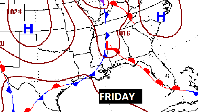
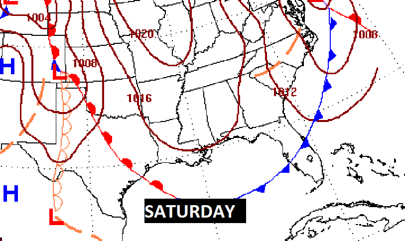
Showers and thunderstorms Friday. Dry and cooler Saturday. More showers Sunday.
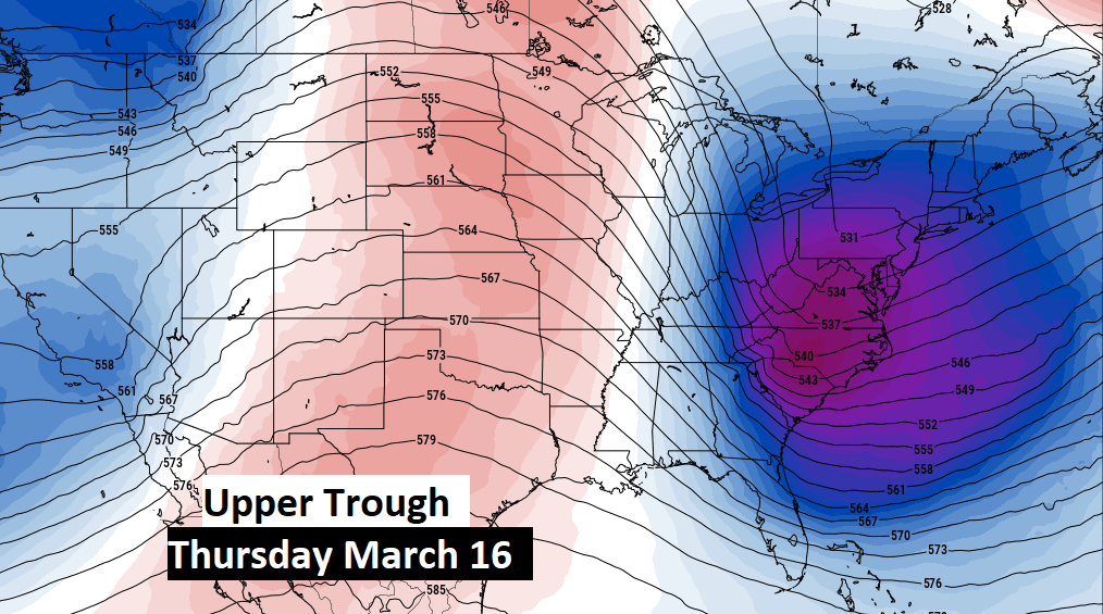
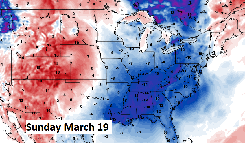
MID-MONTH PATTERN CHANGE: Much cooler air is in our future by month. But, how cool? But, the models are backing off on the intensity of the cold and the duration.
.
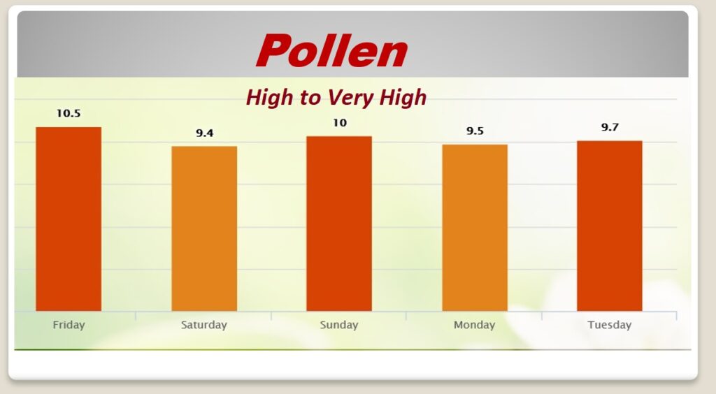
POLLEN: No relief in sight, I’m afraid.
Thanks for reading this Blog this morning! This morning we are LIVE on the radio from 6 to 9 on NewsTalk 93.1. Watch us on TV on CBS 8 and ABC 32. I’ll have another update for you in the morning. Have a nice day!
–Rich