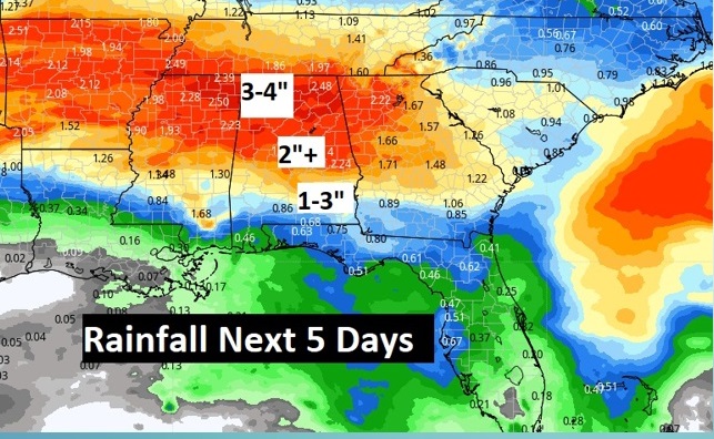
Good Morning! Tuesday was the warmest day of the year so far. Montgomery ‘s high reached a record of 87. Today will be about 14 degrees cooler. Today will be dry, but It will be wet at times over the next several days. We’re easing into a very active weather pattern, as a series of storm systems swing through the area. We’re done with the 80’s for the next several days. Expect 60’s and 70’s. Normal high is 70. Here’s my brief discussion.
.
YESTERDAY’S CLIMATE REPORT: Tuesday was the warmest day of the year so far. Montgomery ‘s high reached a record of 87. The previous record was 85 from 1956. Morning low 67. (Normal 70/45) Rainfall: 0.00. Rainfall for the month: .04”. Today will be about 14 degrees cooler.
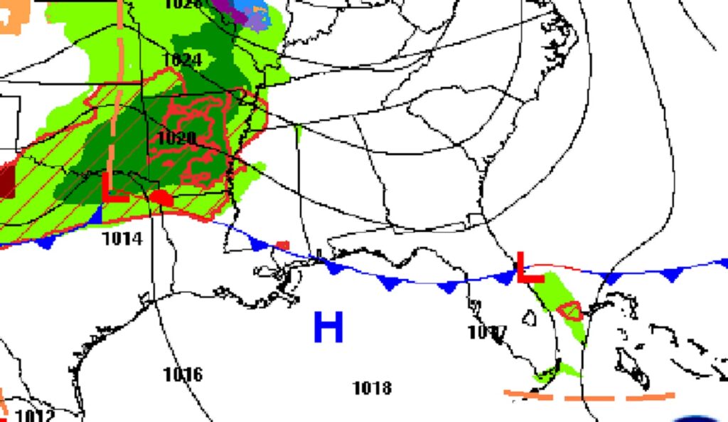
TODAY: A much cooler day. Sun/cloud mix.. High 73. Breezy. East wind 10 to 15 gusting to 25. Mostly cloudy tonight. Low 55.
.
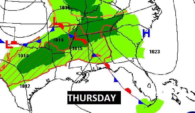
NEXT FEW DAYS: Scattered showers and maybe some thunderstorms Thursday & Thursday night, and first half of the day Friday. Sunshine, cooler Saturday. High in the upper 60’s. Showers return Sunday. Cool Monday. Widely scattered showers. Mid 60’s.
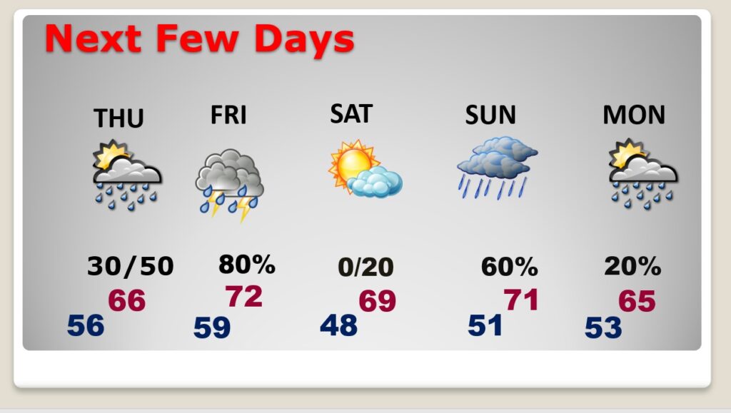
Wet at times over the next several days. Active weather pattern.
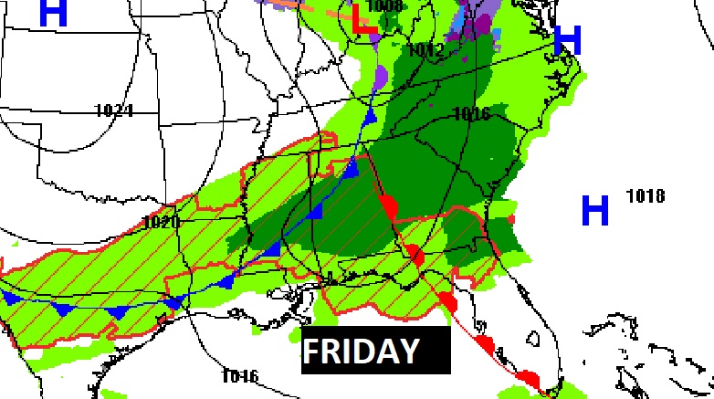
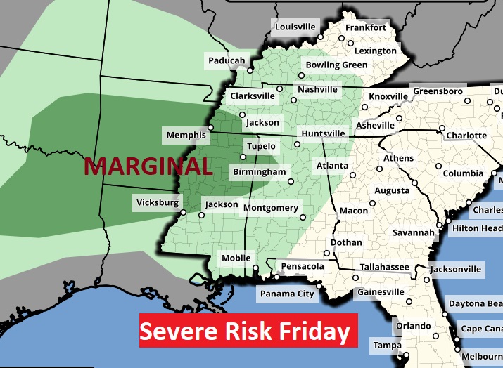
Severe weather outlook on Friday has a Marginal Risk from the ArkLaTex area to northwest Alabama.
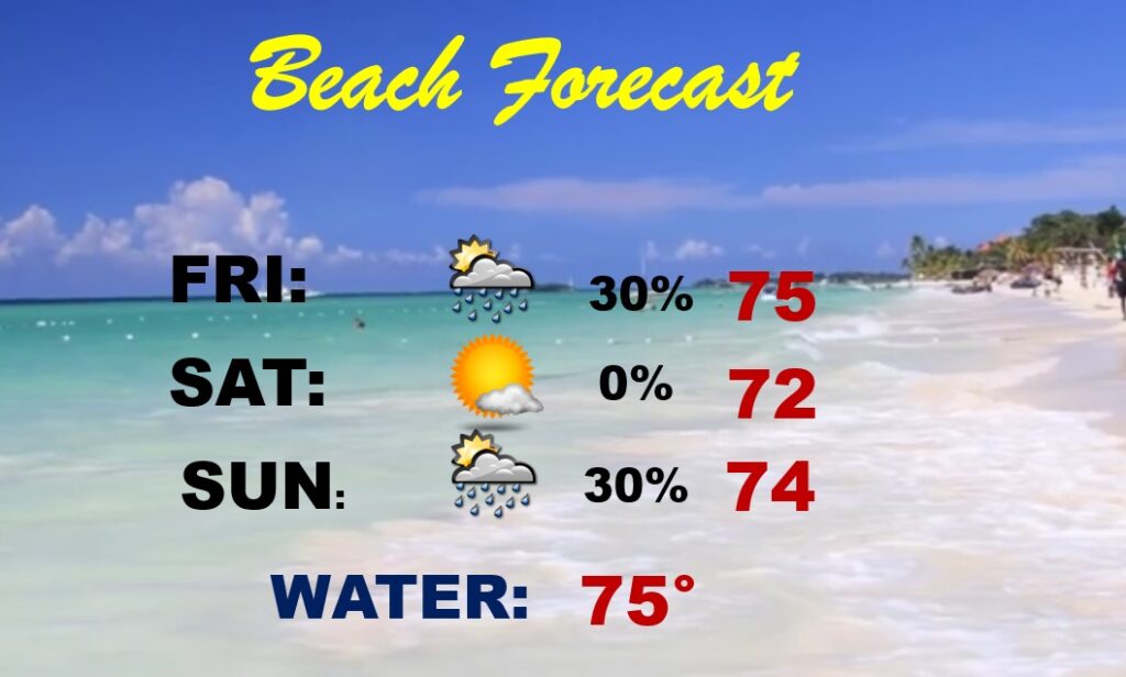
BEACH FORECAST: It’s Spring Break time at the Beach.
ARE WE DONE WITH FREEZES?: Today is the average date of the last freeze. Last year the final freeze was March 14th. (Our last freeze this season was on February 18th)
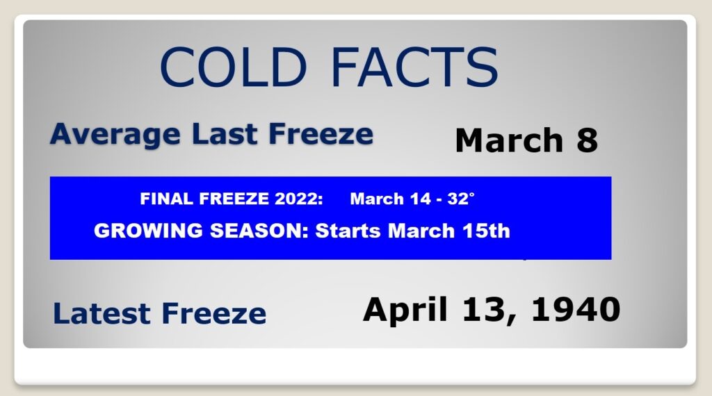
Looking at the next 16 day trend, I don’t any freezing temperatures. The latest freeze in 150 years of Montgomery records was April 13, 1940.
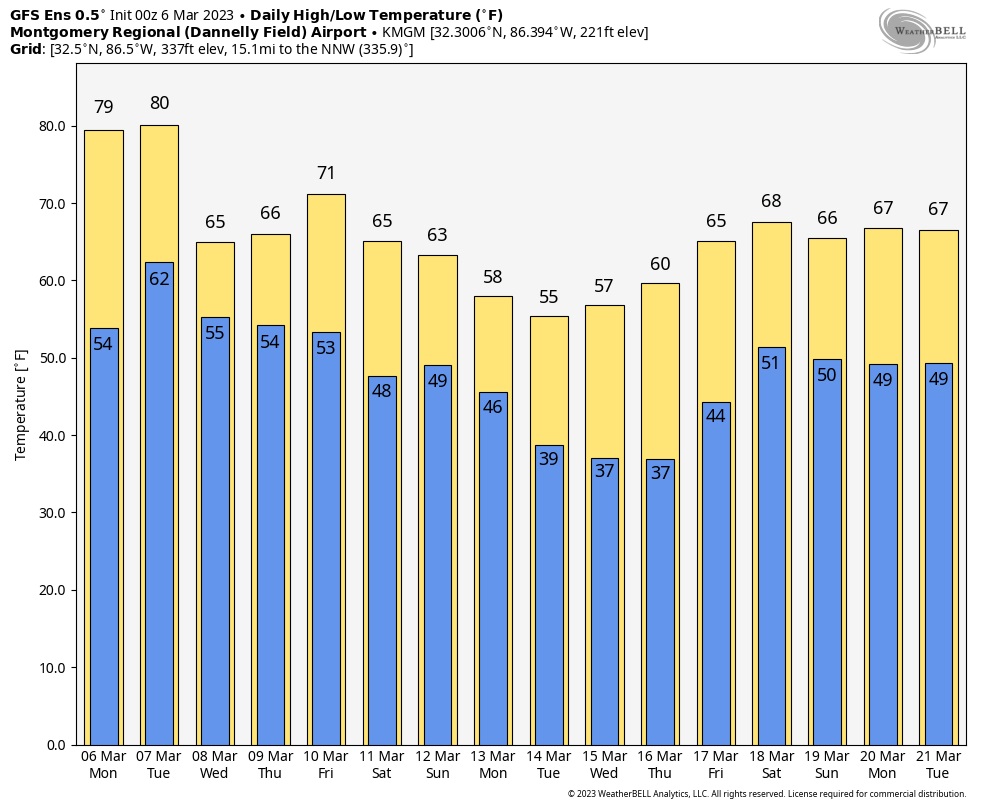
There is a myth that it always gets cold one more time around Easter. THAT IS SIMPLY NOT TRUE. It does sometimes, but frequently it does not.
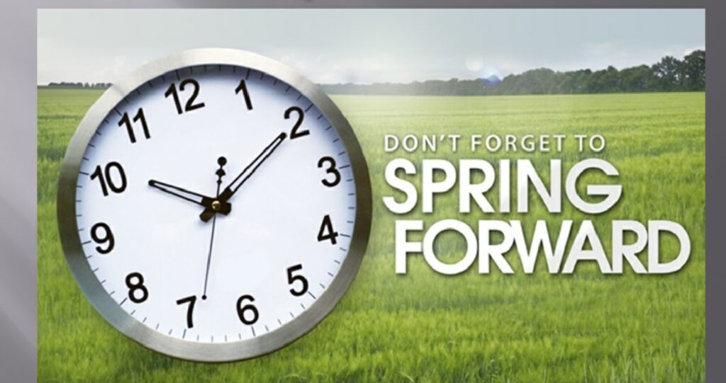
SPRING FORWARD THIS WEEKEND:
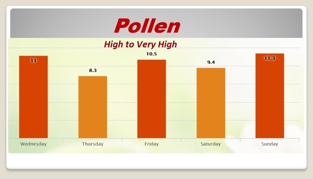
POLLEN: No relief in sight, I’m afraid.
Thanks for reading this Blog this morning! This morning we are LIVE on the radio from 6 to 9 on NewsTalk 93.1. Watch us on TV on CBS 8 and ABC 32. I’ll have another update for you in the morning. Have a nice day!
–Rich
