
Good Morning! We ‘ll see a brief, nice break between storm systems today. Sunny & cool. Sunday looks potentially stormy. Level 2 Severe Weather Risk. Damaging winds are the main threat. Tornadoes can’t be ruled out. By Tuesday, we may not make it out of the 50’s. Could we flirt with a freeze on Wednesday AM?
.
.
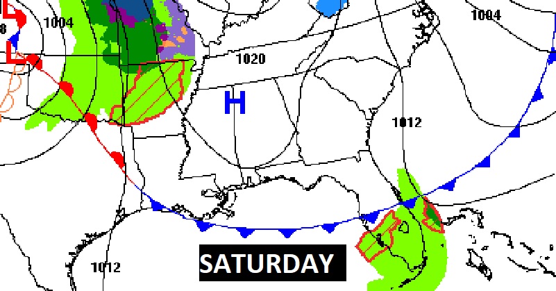
TODAY: Mostly sunny. High near 69. Becoming cloudy tonight. Low tonight 55.
.
NEXT FEW DAYS: Widespread Showers & thunderstorms return by Sunday afternoon and Sunday night. Level 2 Severe Weather Risk. Chilly air is expected Monday & Tuesday. Tuesday’s high perhaps only in the 50’s. Low Wednesday morning in the lower 30’s. Not quite as cool Wednesday.
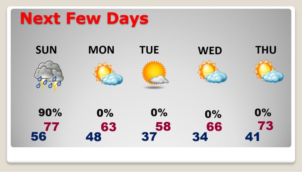
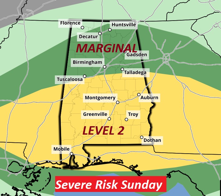
Sunday looks potentially stormy. Level 2 Severe Weather Risk. Damaging winds are the main threat. Tornadoes can’t be ruled out.
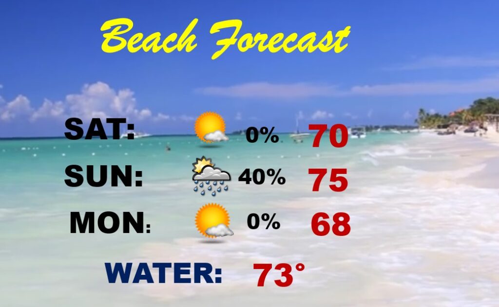
BEACH FORECAST: Wet at times. Best day will be today. A little cool, Strong storms possible by Sunday afternoon.
.
SPRING FORWARD THIS WEEKEND: This is the shortest weekend of the year. Shorter by one hour. Spring Forward tonight. Back to DST.

Thanks for reading this Blog this morning! I’ll have another update for you in the morning. Have a nice day!
–Rich