
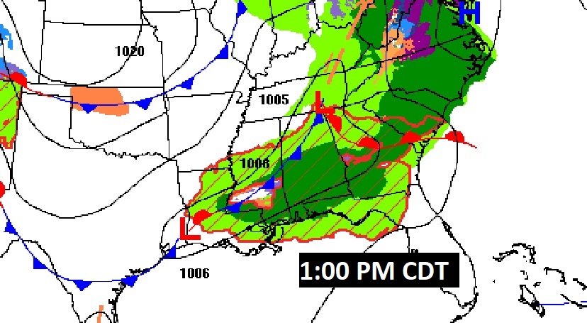
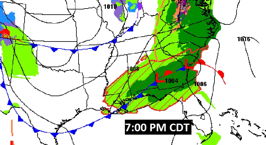
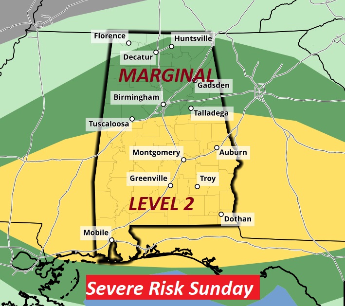
Good Morning! Welcome to Daylight time. There’s much to talk about. A frontal system will bring a round of strong storms to the state today. The timetable is faster. The activity begins this morning for some of us and shifts to south Alabama this afternoon. Some storms could be severe. SPC has a Level 2 Severe Risk for many of us in central & south Alabama. Damaging winds and large hail are the main threat. Behind the storm system, colder air is on the way.
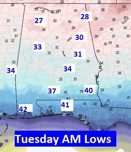
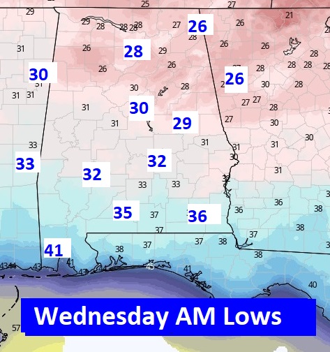
In fact, late-season Patchy Frost is a good bet both on Tuesday & Wednesday morning. We may not make it out of the 50’s Tuesday. It looks more and more like we will be at least near the freeze mark Tuesday morning, and especially Wednesday AM. A big temperature recovery starts Thursday. More showers & thunderstorms return on Friday.
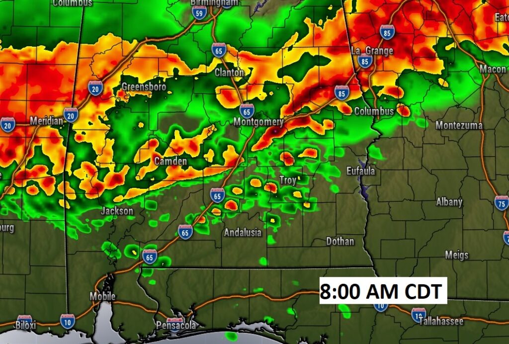
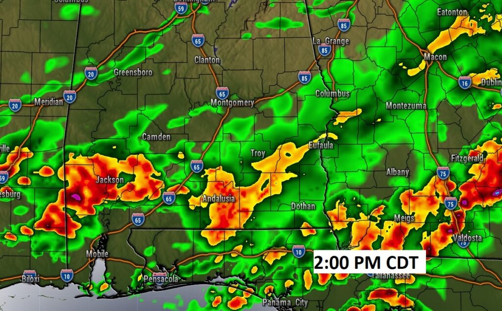
TODAY: A band of thunderstorms, some strong, possibly severe. We are on a faster timetable. (Timetable map below.) The storm risk will shift to south Alabama during the afternoon. High today 74. Southwest wind 6 to 12 mph. The shower risk continues this evening, ending later tonight. Colder overnight. Low 48.
The Storm Prediction Center has a Level 2 Severe Risk for many of us in central & south Alabama. Damaging winds and large hail are the main threat.
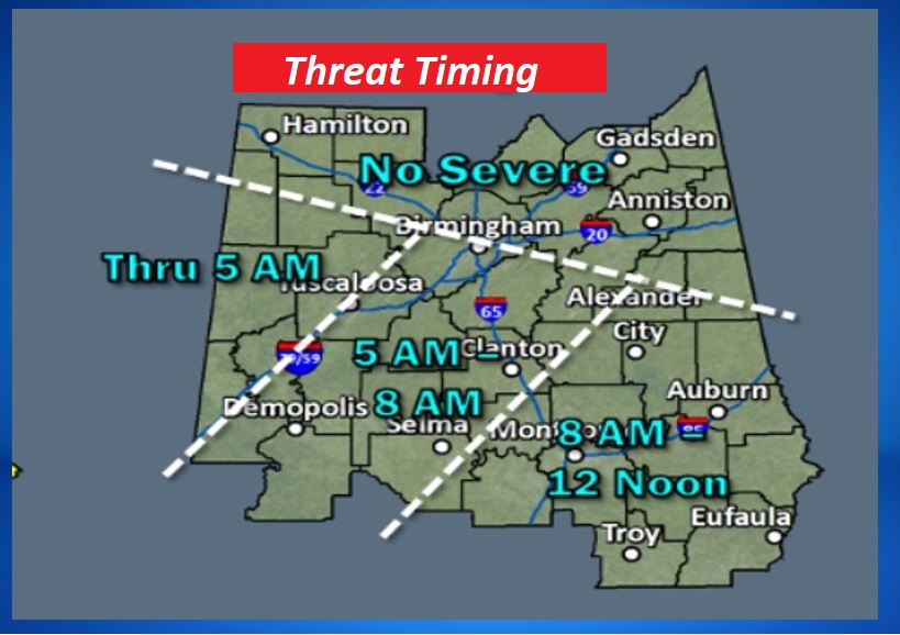
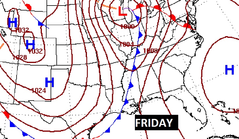
The updated Threat Timing Map shows this morning event for many of us here in central Alabama, shifting to south Alabama this afternoon.
NEXT FEW DAYS: Much cooler air follows the storm system. Monday’s high will only be in the low 60s. Tuesday’s high may not make it out of the 50’s. Morning lows will be the BIG story of the week. Frost now appears likely Tuesday and Wednesday. Not only that. It appears we’ll threaten the freeze mark Tuesday morning and especially Wednesday.
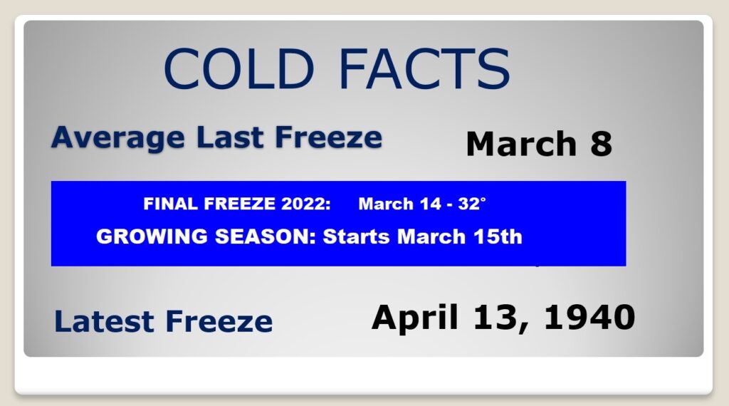
Average date of the last freeze was back on March 8th. Last year the final freeze was March 14th. The growing season officially begins this week.
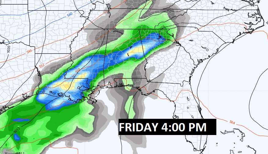
A big temperature recovery starts Thursday. More showers & thunderstorms return on Friday.

SUPER STORM ANNIVERSARY – BLIZZARD OF ’93: I once experienced Thunder Snow with green lightning during a Blizzard. But, it wasn’t in my hometown Cleveland, Ohio when I was growing up. The Thunder Snow I experienced was in Montgomery, Alabama during the so called “Superstorm of the Century”. The Blizzard of ’93. March 12, 1993. Tomorrow is the 30th anniversary. Here’s a feature I wrote for my Weather Blog on the 25th anniversary in 2018
NEW REALITY: Did you remember to Spring Forward? Welcome to Daylight time. On this new reality, sunrise will be at 7:01 AM, and Sunset at 6:52.
Thanks for reading this Blog this morning! I’ll have another update for you in the morning. Have a nice day!
–Rich