
Good Morning! Temperatures will be way below normal today through Wednesday. Unfortunately, plants started to bud very early this season due to the warm weather. It’s very likely we’re headed for a frost Tuesday & Wednesday mornings. In fact, we’ll tease the freeze mark Wednesday morning, much like this week last year. Expect a big warm-up starting Thursday. Another strong front will bring in another round of showers & storms Friday. Much cooler air will follow the storm system by Saturday. We’ll be up and down for much of the next 10 days ahead. Here’s my brief forecast discussion.
TODAY: Mostly sunny, breezy, quite cool for March. High 62. (Normal 71/46) Northwest wind at 10 to 20 mph. Clear and cold tonight. Low 35. Patchy frost by morning.
TWO COLD FROSTY MORNINGS AHEAD:
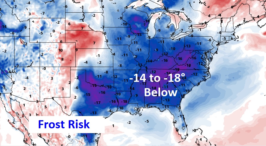
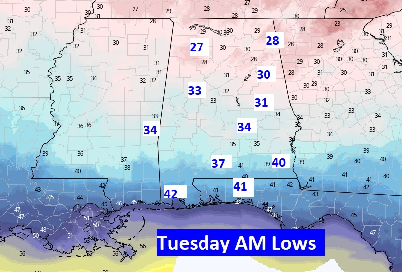
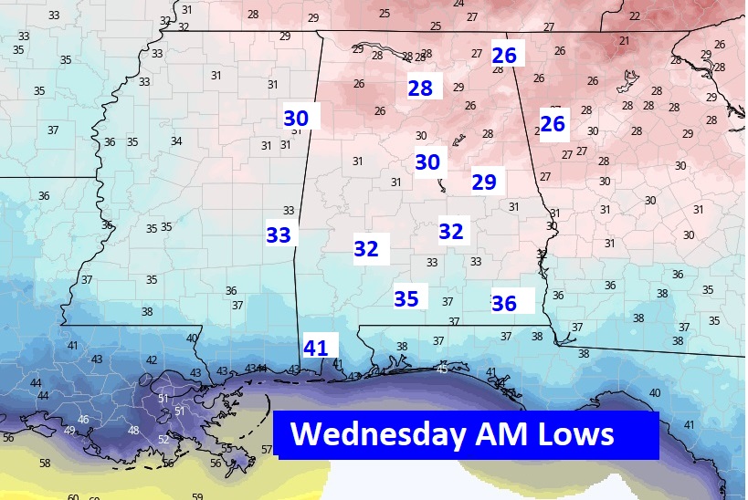
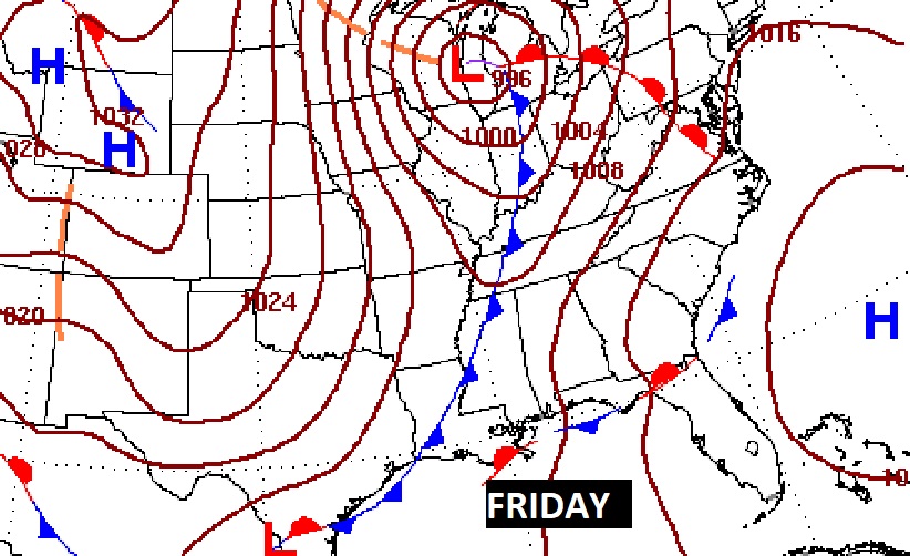
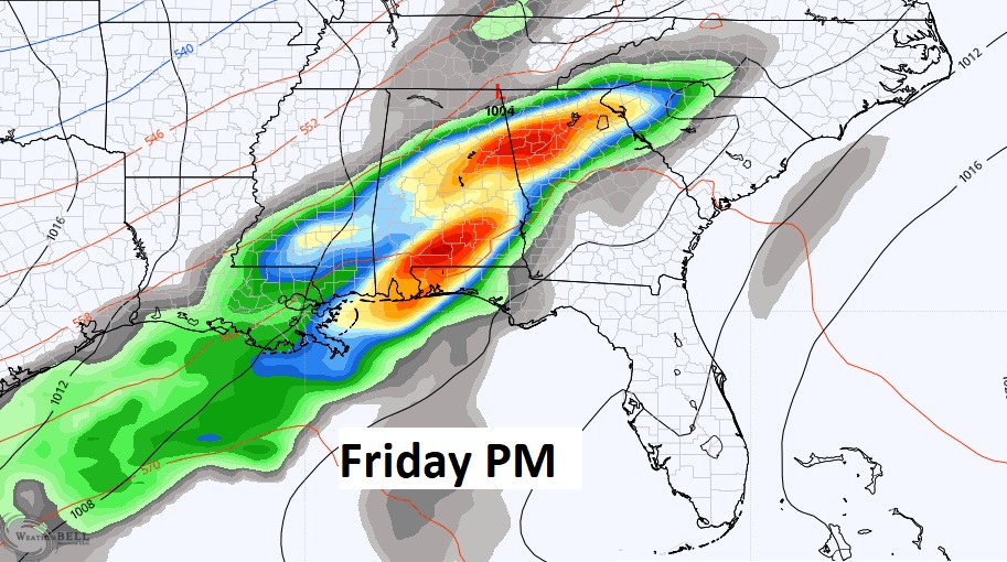
NEXT FEW DAYS: Late season cold snap. Tuesday’s high may not make it out of the 50’s. Frost now appears likely Tuesday and Wednesday morning. It appears we’ll threaten the freeze mark and especially Wednesday morning. Warmer Thursday. Showers and thunderstorms Friday. Breezy and much cooler Saturday.
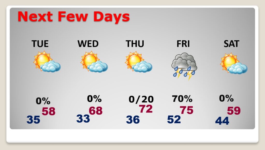
We’ll be monitoring the Friday storm system for any signs of strong to severe storms. SPC is hinting that Severe Weather is certainly possible Friday. Highs in the mid 70’s.
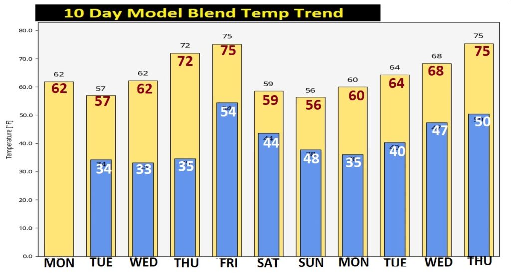
Here’s the 10 Day Model Temperature Blend from WPC. Chilly early and mid week. Warmer Thursday and Friday. Then, another cold snap. We could be back to the mid 30’s on the first day of Spring, before temperatures rebound again. Another storm system somewhere around March 22nd.
Thanks for reading this Blog this morning! This morning we are LIVE on the radio from 6 to 9 on NewsTalk 93.1. Watch us on TV on CBS 8 and ABC 32. I’ll have another update for you in the morning. Have a nice day!
–Rich