
Good Morning! Today is the Last Day of Winter. But, today will resemble a day in mid-winter. We have a Freeze Warning this morning and another freeze warning tonight. In fact, we could be very close to yet another freeze by Tuesday dawn. Today’s highs will be ridiculous for this late in the season. Spring begins Monday with lows in the 20’s and highs in the 50’s. But, hang on, because we’ll back in the 70’s by Wednesday and into the 80’s on Thursday. Next storm system is on Friday.
TODAY: FREEZE WARNING this morning. Low near 32 by Dawn. Mostly sunny an very cold for March today. High near 50. Northwest wind 6 to 16 mph. FREEZE WARNING again tonight. Clear and quite cold. Low near 28 by Monday dawn. (Record is 25 from 1923. (Normal 72/47) Alabama growers…take all necessary precautions.
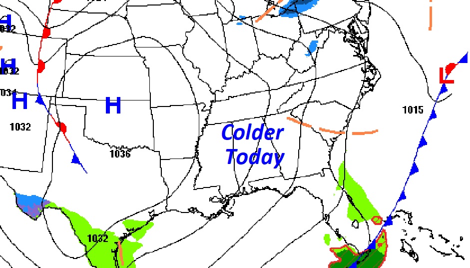
A secondary surge of cold air arrives today. So, today will be colder than yesterday. We’ll be more than 20 degrees below normal. Still breezy today, but not as windy as yesterday.
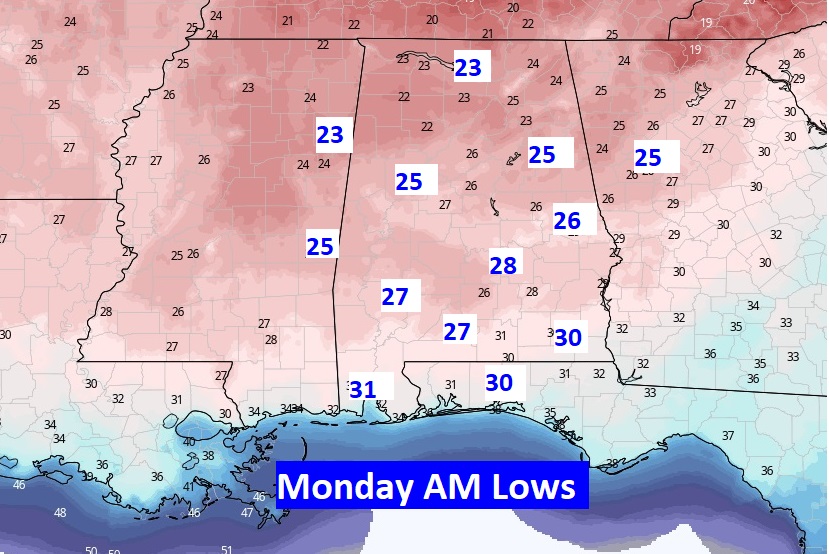
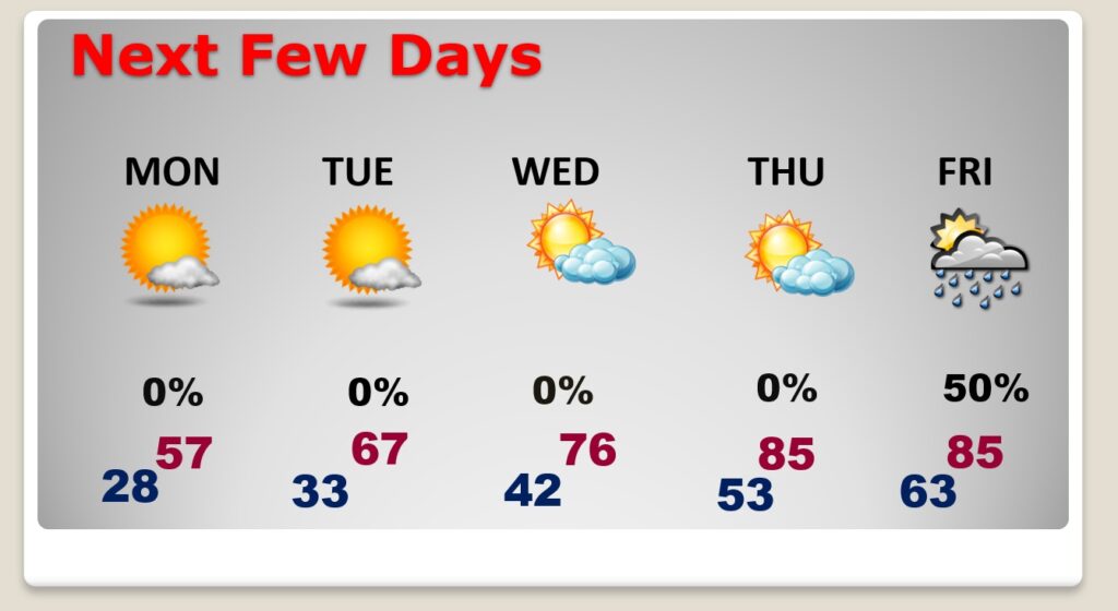
NEXT FEW DAYS: Monday will be a COLD first day of Spring. After that sub-freezing start, we’ll in the 50’s for a high. And, we’ll be very CLOSE to another freeze by Dawn Tuesday. We’ll rebound to the 60’s Tuesday, 70’s Wednesday and 80’s Thursday. The next storm system arrives Friday.
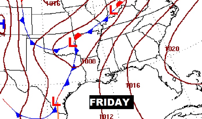
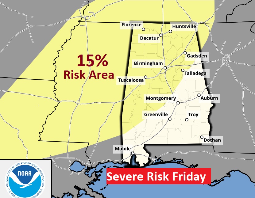
The next Storm System will bring a Severe weather threat to Alabama on Friday.
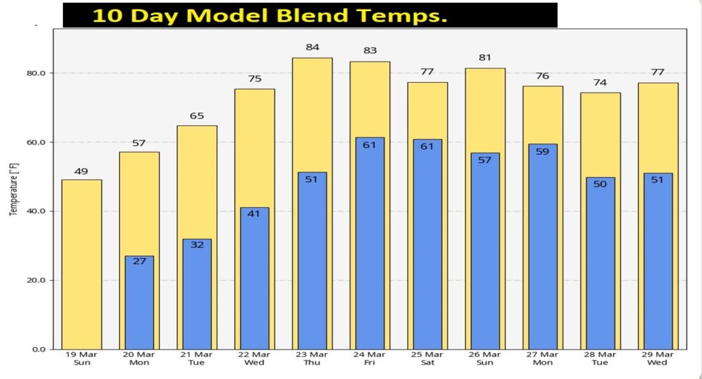
Here’s the 10 Day Model Temperature Blend. Hang on. But, a nice Warm-up next week
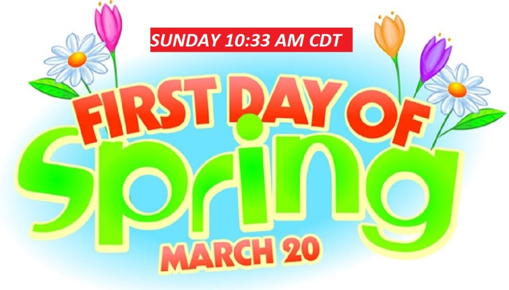
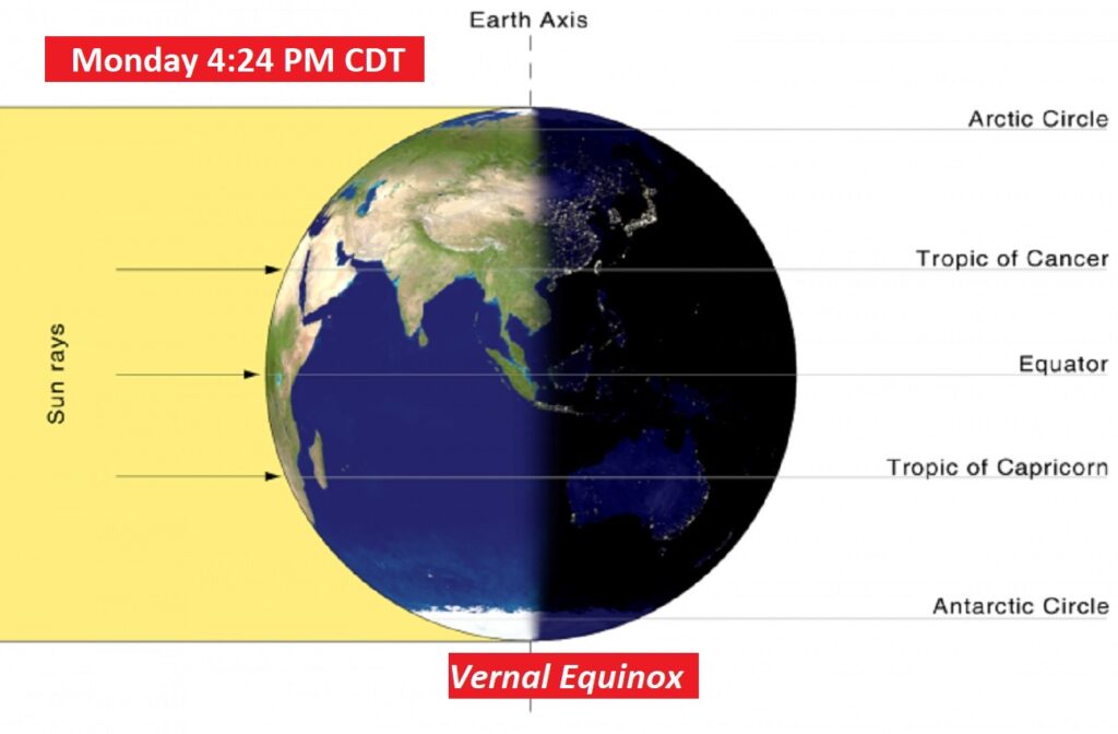
SPRING BEGINS MONDAY: Monday is the Vernal Equinox. Spring officially begins at 4:24 PM CDT.
Thanks for reading this Blog this morning! I’ll have another update for you in the morning. Stay warm. Have a nice weekend!
–Rich