
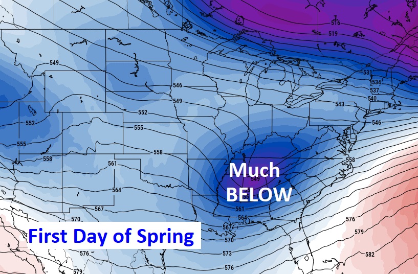
Good Morning! Spring begins later today, but most of us are going to start this day in the 20’s. Normal low 47. Once again we’ll only be in the 50’s. Normal high 73. And, guess what? We have another Freeze Warning for tonight. But, soon this craziness will be in our rear-view mirror. A warm-up starts Tuesday afternoon. By Wednesday we’ll be well inti the 70’s and the 80’s by Thursday. The next storm system will affect the state by late Friday. Another Severe Weather threat. SPC has much of the state in a Severe Risk. Here’s my brief forecast discussion.
TODAY: FREEZE WARNING this morning. We’ll be in the 20’s at Dawn. (Today’s record is 25 from 1923) Mostly sunny and very cool. High near 57. Northwest wind 6 to 12 mph. FROST WARNING tonight. Clear and quite cold. Low near 33 by Dawn. Widespread frost (The Record of 25 from 1965 is safe)
The COLD will fade this week as an upper Ridge of High pressure builds by mid to late week.
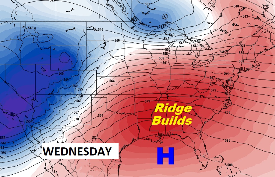
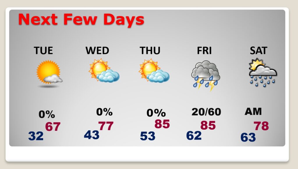
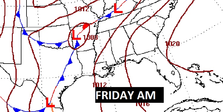
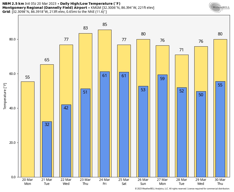
NEXT FEW DAYS: After a cold frosty start and another late season freeze, we’ll rebound to the 60’s Tuesday, 70’s Wednesday and 80’s Thursday. The next storm system arrives by late Friday. Strong to Severe storms.
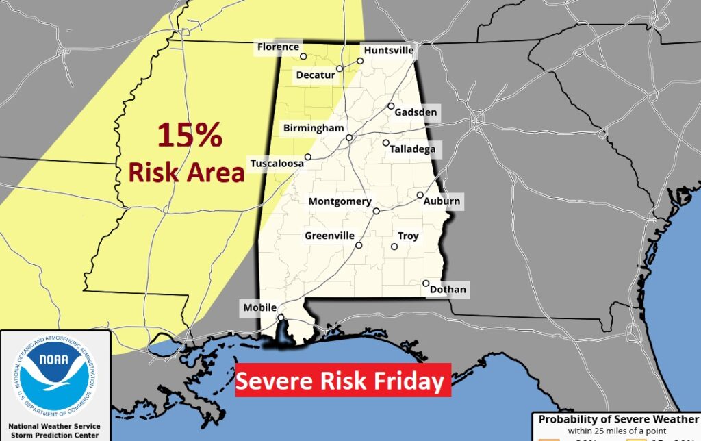
Confidence is building for a potential Severe Weather Event by late Friday & Friday night.
Here’s the 10 Day Model Temperature Blend. A very nice warm-up is finally on the way. PERHAPS no more freezes.
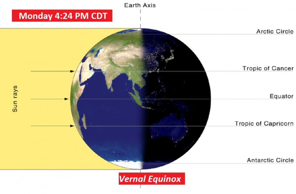
SPRING BEGINS: Today is the Vernal Equinox. Spring officially begins at 4:24 PM CDT. Sunrise 6:50 AM. Sunset 6:58.
Thanks for reading this Blog this morning! This morning we are LIVE on the radio from 6 to 9 on NewsTalk 93.1. Watch us on TV on CBS 8 and ABC 32. I’ll have another update for you in the morning. Have a nice day!
–Rich