
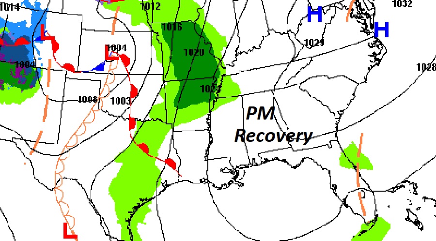
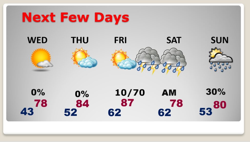
Good Morning! It’s a cold frosty start to the day…again. This morning should be the final freeze in this series. A big temperature recovery begins this afternoon. Today’s high of 67 is 10 degrees warmer than yesterday, but still a little below the normal high of 73. But, stand-by. We’ll be well into the 70’s on Wednesday, and expect highs in the 80’s on Thursday and Friday. The next storm system will bring a round of thunderstorms, some possibly strong/severe by Friday. Much of Alabama is in a severe weather risk. After this morning we’re done with chilly air for at least the next 10 days. Here’s my brief forecast discussion.
TODAY: A cold frosty start with a Freeze Warning and Frost Advisory. Good but of sunshine today. Nice afternoon warm-up. High 67. (normal 73/47) Southeast wind 5 to 10 mph. Partly cloudy, not as cold tonight. Low 43.
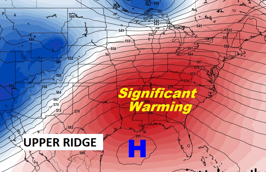
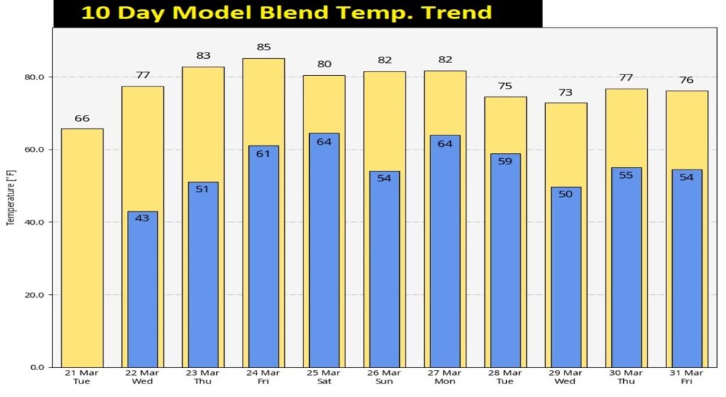
NEXT FEW DAYS: Get ready for a major warming trend. We’ll be well into the 70’s on Wednesday, and expect highs in the 80’s on Thursday and Friday. A huge Upper Ridge of high pressure will be responsible for the Major Warming Trend.
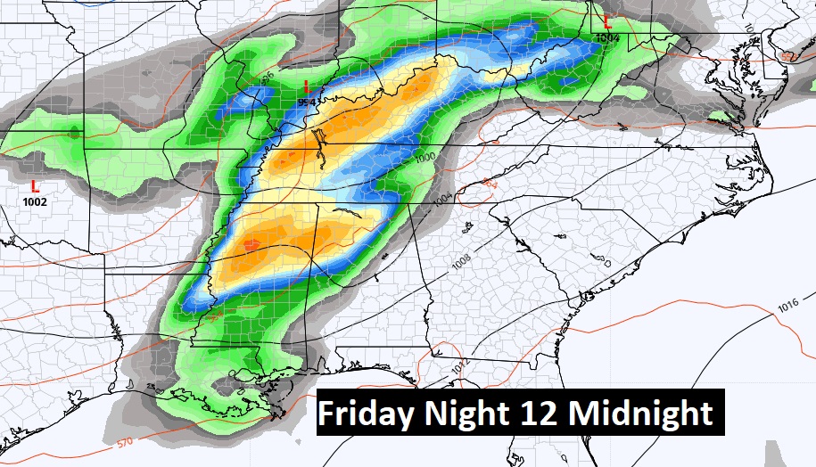
The next storm system will bring a round of thunderstorms, some possibly strong/severe by Friday. Much of Alabama is in a severe weather risk. Another round of showers arrives Sunday as the next storm system approaches.
Looks like a potential Severe Weather Event is shaping up for Friday night.
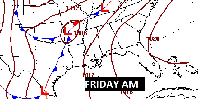
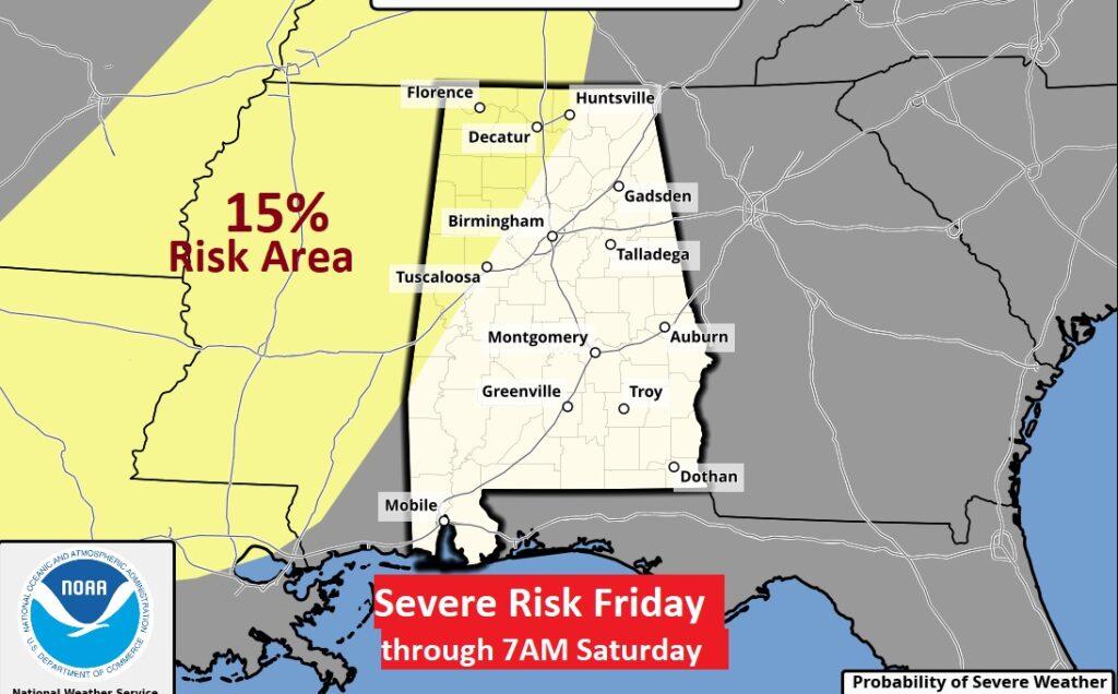
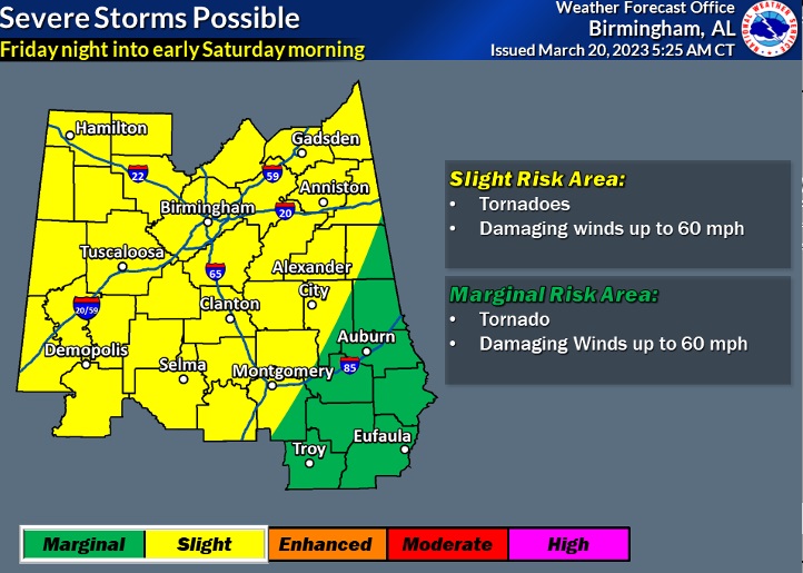
SPC Has outlined a Severe Risk which reaches into West Alabama by late Friday night. However the Birmingham NWS office is little more bullish and they have included much of the state in a potential Severe Risk. Damaging wind gusts and tornadoes are possible. We’ll continue to monitor future outlooks.
Here’s the 10 Day Model Temperature Blend. A very nice warm-up is finally on the way. Could this morning be the final freeze of this season? We hope so. This is the 45th freeze of the season. Normal freezes in a season is 40.
Thanks for reading this Blog this morning! This morning we are LIVE on the radio from 6 to 9 on NewsTalk 93.1. Watch us on TV on CBS 8 and ABC 32. I’ll have another update for you in the morning. Have a nice day!
–Rich