
Good Morning! After several chilly/cold days and nights, finally the news is getting better. The major warming trend continues. We’ll be into the mid 80’s on Thursday and mid to upper 80’s by Friday. Summer-like. The next storm system will bring a round of thunderstorms, some possibly strong/severe by late Friday night. Here’s my brief forecast discussion.
TODAY: The big warm-up continues. Mostly sunny. High 78-80. (Yesterday’s low/hi 30/68. Normal 73/47) South wind 5 to 10 mph. Partly cloudy, not as cool tonight. Low 51.

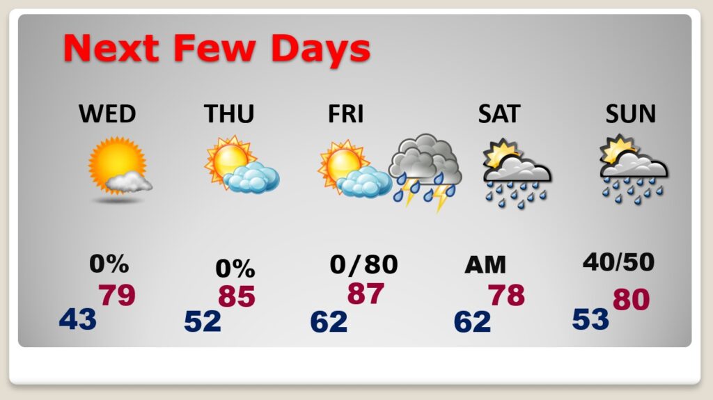
NEXT FEW DAYS: The major warming trend continues.
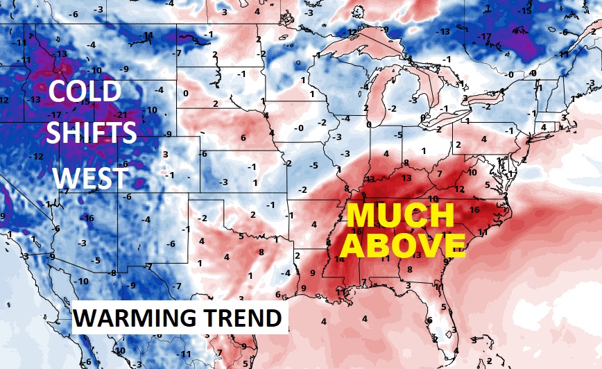
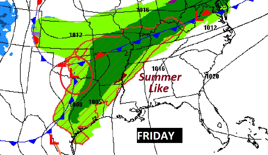
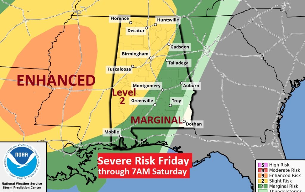
We’ll be into the mid 80’s on Thursday and mid to upper 80’s by Friday. Summer-like. The next storm system will bring a round of thunderstorms, some possibly strong/severe by late Friday night. Much of Alabama is in a severe weather risk. In fact, much of west Alabama is in a Level 2. Damaging wind gusts and a few tornadoes area possible Saturday looks dry. Another round of showers arrives Sunday as the next storm system approaches.
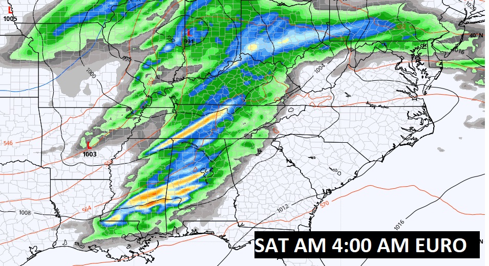
Still looks like a potential Severe Weather Event is shaping up for late Friday night. (wee hours of Saturday AM)
SPC Much of Alabama is in a severe weather risk. In fact, much of west Alabama is in a Level 2. Damaging wind gusts and a few tornadoes area possible We’ll continue to monitor future outlooks.
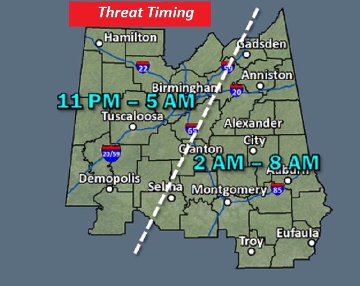
Here’s an update on potential timing.
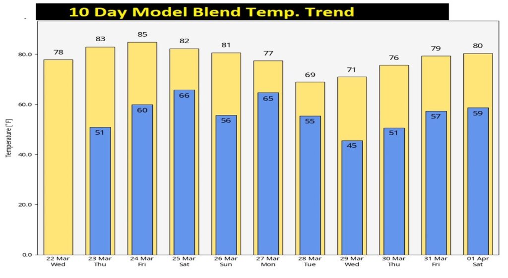
Here’s the 10 Day Model Temperature Blend. Finally a ten day span with NO COLD AIR. Welcome to Spring.
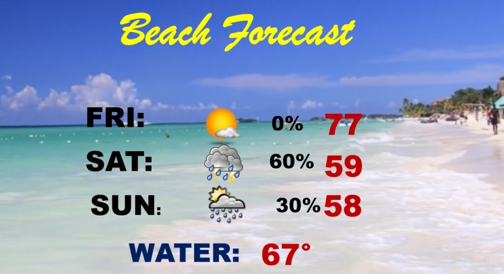
Beach Outlook: The news is certainly better this week. Very nice today through Friday. Scattered showers and storms on Saturday, Temperatures will be comfortably warm.
Thanks for reading this Blog this morning! This morning we are LIVE on the radio from 6 to 9 on NewsTalk 93.1. Watch us on TV on CBS 8 and ABC 32. I’ll have another update for you in the morning. Have a nice day!
–Rich