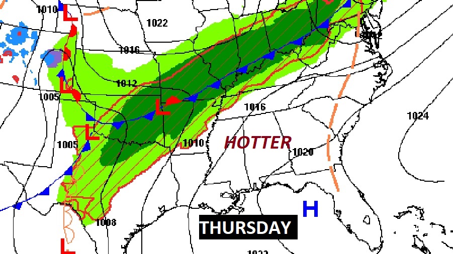
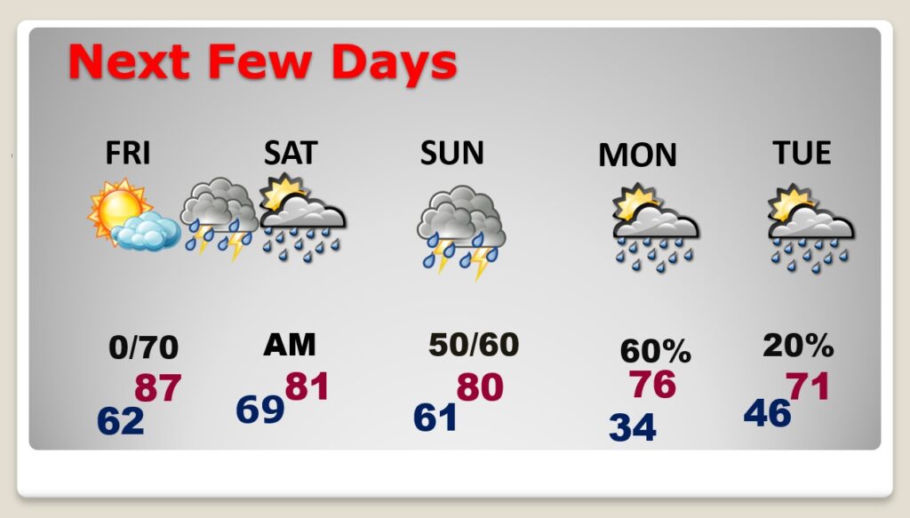
Good Morning! The major warming trend continues. We’ll be into the mid 80’s today, and the mid to upper 80’s on Friday. More like May. The next storm system will bring a round of thunderstorms, some possibly strong/severe by late Friday night, including a severe weather risk. We get a brief break in the action Saturday, before another storm system brings in a round of strong storms Sunday. Here’s my brief forecast discussion.
TODAY: Dense fog Advisory till 9AM. Patchy Dense Fog early. Then, Mostly sunny. High mid 80’s. (Yesterday’s low/hi 42/79. Normal 73/47) South wind 5 to 10 mph. Partly cloudy, very mild tonight. Low 61.
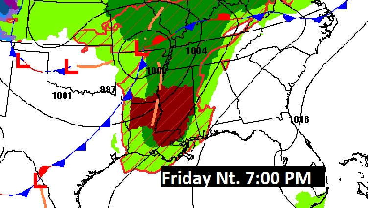
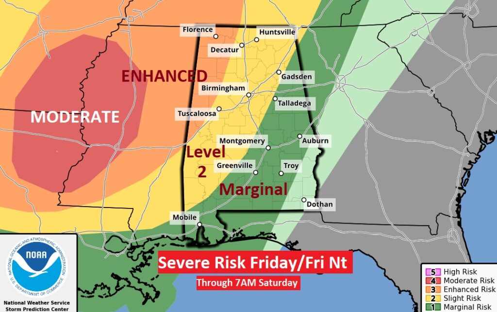
NEXT FEW DAYS: The major warming trend continues. We’ll be into the mid to upper 80’s by Friday. Summer-like. The next storm system will bring a round of thunderstorms, some possibly strong/severe by late Friday night (early Saturday morning). Much of Alabama is in a severe weather risk. In fact, much of west Alabama is in a Level 2 Part of NW Alabama is in a Level 3 Enhanced risk. Damaging wind gusts and tornadoes area possible. Saturday storms clear out early. Much of the day looks dry. Another round of showers arrives Sunday as the next storm system approaches. A few strong storms are possible. We are getting into an active pattern for much of next week.
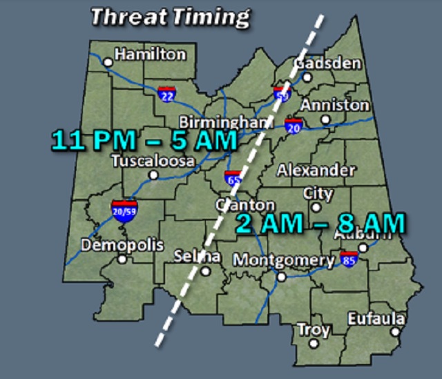
Confidence is growing for a severe weather event late Friday night in through the wee hours of Saturday morning,
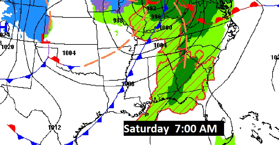
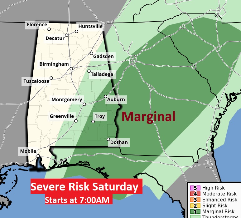
Much of Alabama is in a severe weather risk. In fact, much of west Alabama is in a Level 2 Part of NW Alabama is in a Level 3 Enhanced risk. Damaging wind gusts and tornadoes area possible. Saturday the severe threat shifts into southeast Alabama.
Here’s an update on Threat Timing.
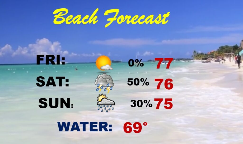
Beach Outlook: Very nice today through Friday. Scattered showers and storms on Saturday. Temperatures will be comfortably warm.
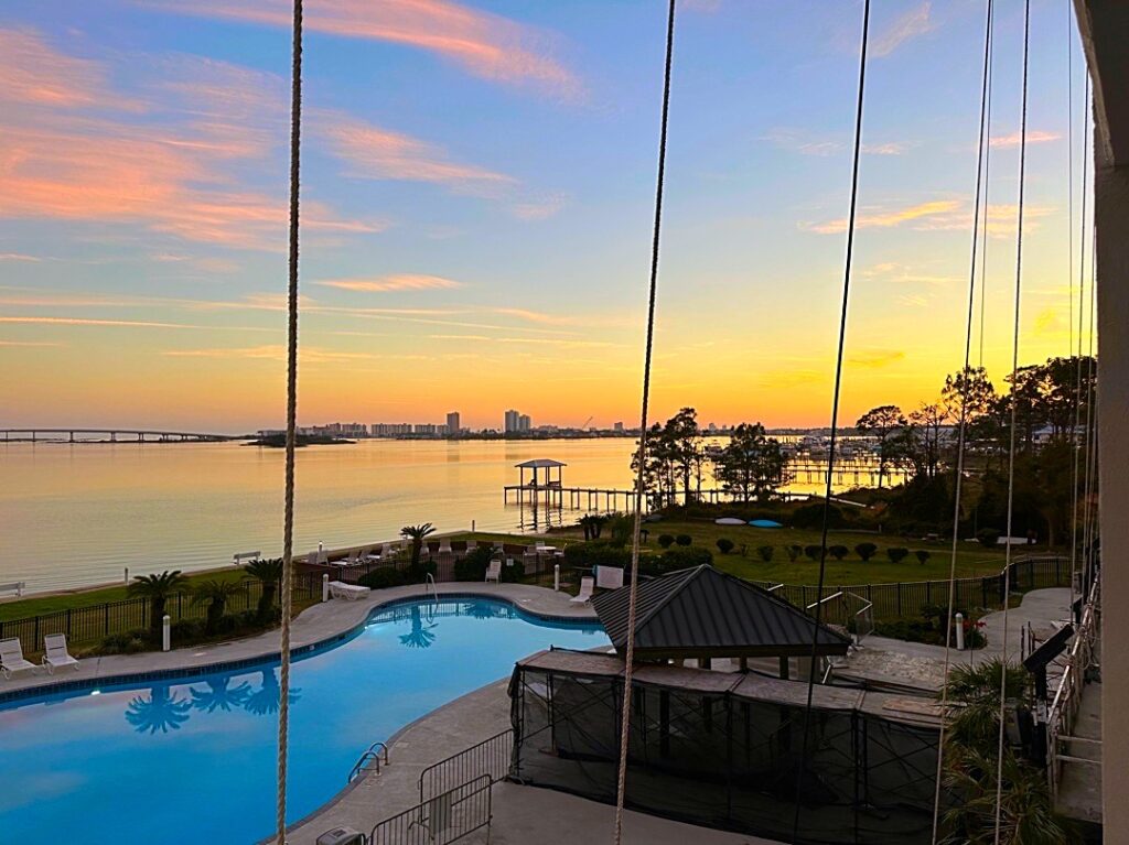
Good morning from Orange Beach. Sunset yesterday evening,
Thanks for reading this Blog this morning! I’ll have another update for you in the morning. Have a nice day!
–Rich
