
Good Morning! It’s hard to believe we had 27 degrees early Monday morning, because this afternoon we’ll be closer to 87. Everything comes with a cost. A potent storm system will produce a potential tornado outbreak across the lower Mississippi valley today. The Severe Risk will edge eastward into Alabama overnight tonight. Most of the state is in various levels of Severe Weather Risk. The risk is highest in the west. Storms clear out rather early Saturday. Much of the day will be dry. But, another round of showers and potentially strong storms are expected Sunday and Monday. Here’s my brief forecast discussion.
TODAY: Patchy Dense Fog early. Mostly cloudy this morning. Gradually, sunshine later, High 87. (Yesterday’s low/hi 52/82. Normal 48/74) South wind 5 to 15 mph.
TONIGHT: Dry through the evening. Cloudy. Very mild. Breezy. Showers and storms become likely in the overnight hours. (The wee hours of Saturday morning) Especially closer to morning, some storms could be strong/severe. Overnight low 65.
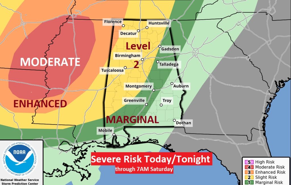
The Storm Prediction Center Outlook for today/tonight shows a potentially dangerous tornado risk for ArkLaMiss, with a Level 4 Moderate Severe Risk. The level 3 Enhanced risk extends eastward and even edges into extreme west Alabama. Closer to I-65, the risk decreases to a Level 1 Marginal Risk. All modes of Severe Weather are possible including Damaging wind gusts and Tornadoes. This Risk Map runs through 7AM Saturday.
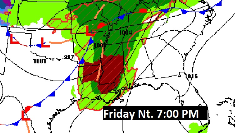
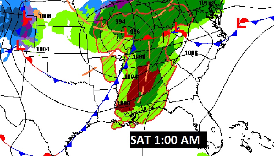
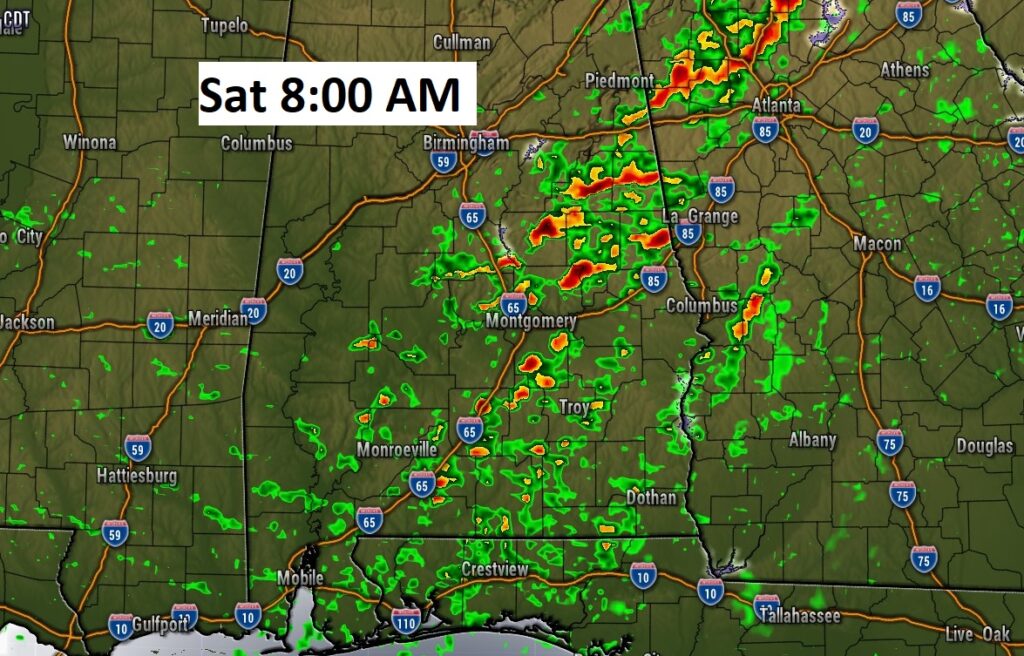
Here’s some Future Radar (NAM) snapshots showing the eastward progression of the system early Saturday morning. The greatest risk of stronger storm will be across the western half of the state.
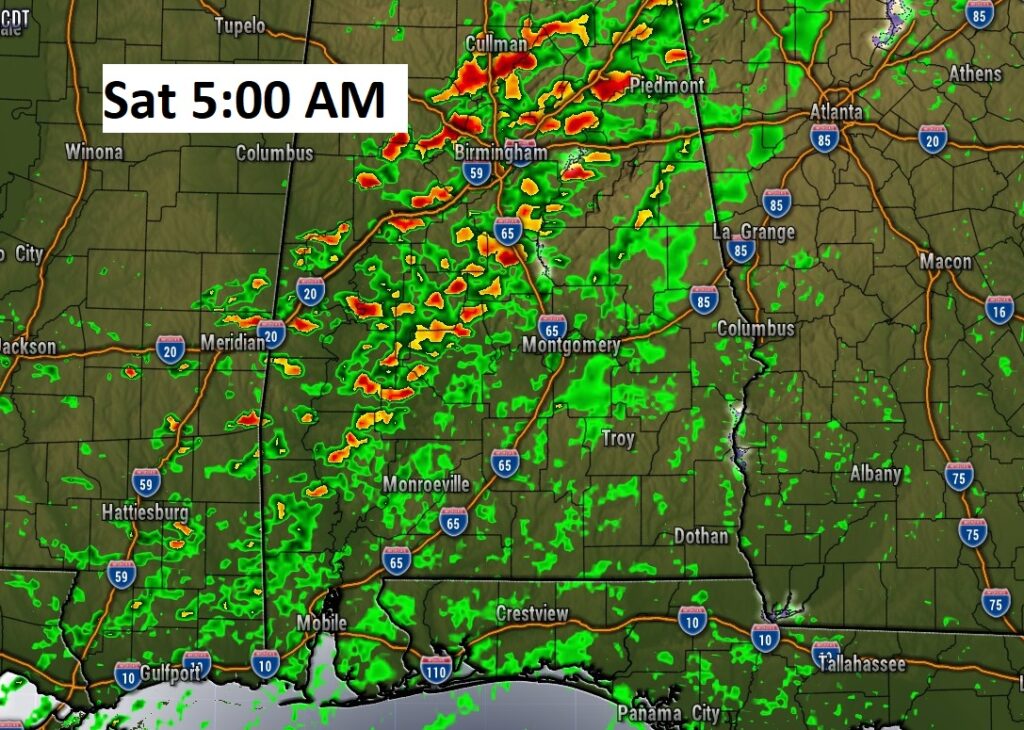
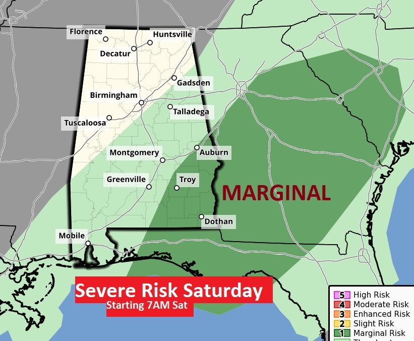
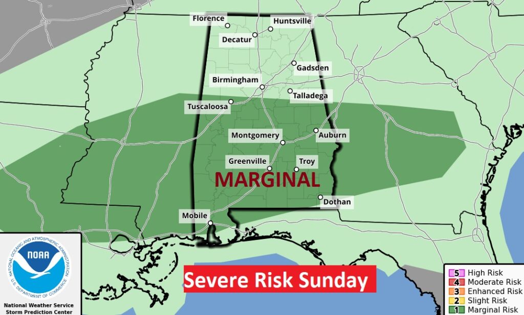
After 7AM Saturday, the risk shifts to southeast Alabama. Marginal Risk.
By Saturday afternoon, we’ll see some improvement. Perhaps even some sun.
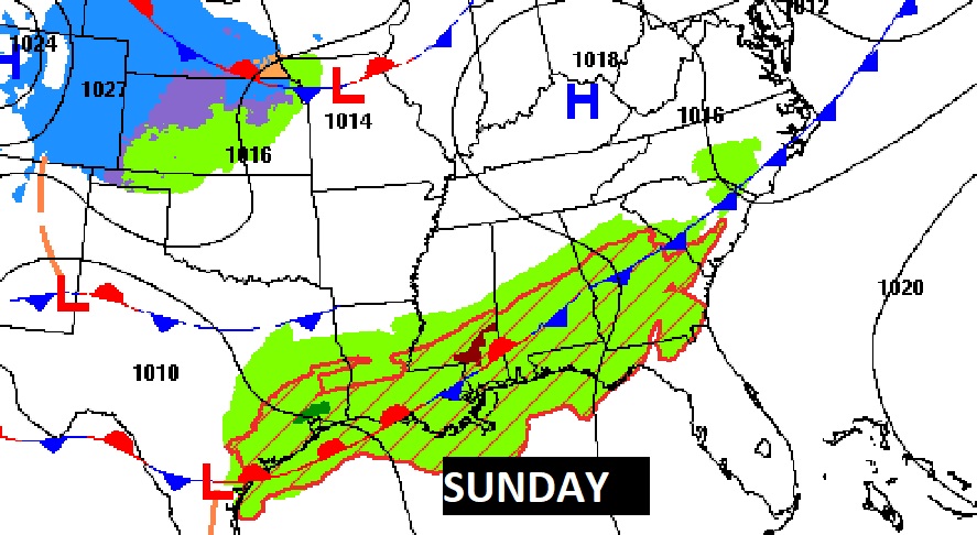
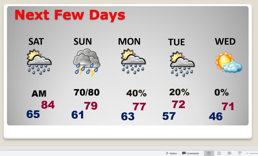
NEXT FEW DAYS: Saturday…storms clear out early. Much of the day looks dry. Cloudy, through mid-day Saturday. Then, gradually sunshine. Another round of showers/storms arrives Sunday as the front stalls. Much of south Alabama is in a Level 1 Marginal Risk Sunday. Damaging wind gusts and hail would be the main risk in this situation.
We’ll be back to the 70’s Monday & Tuesday. Scattered showers and storms. Cooler Wednesday.
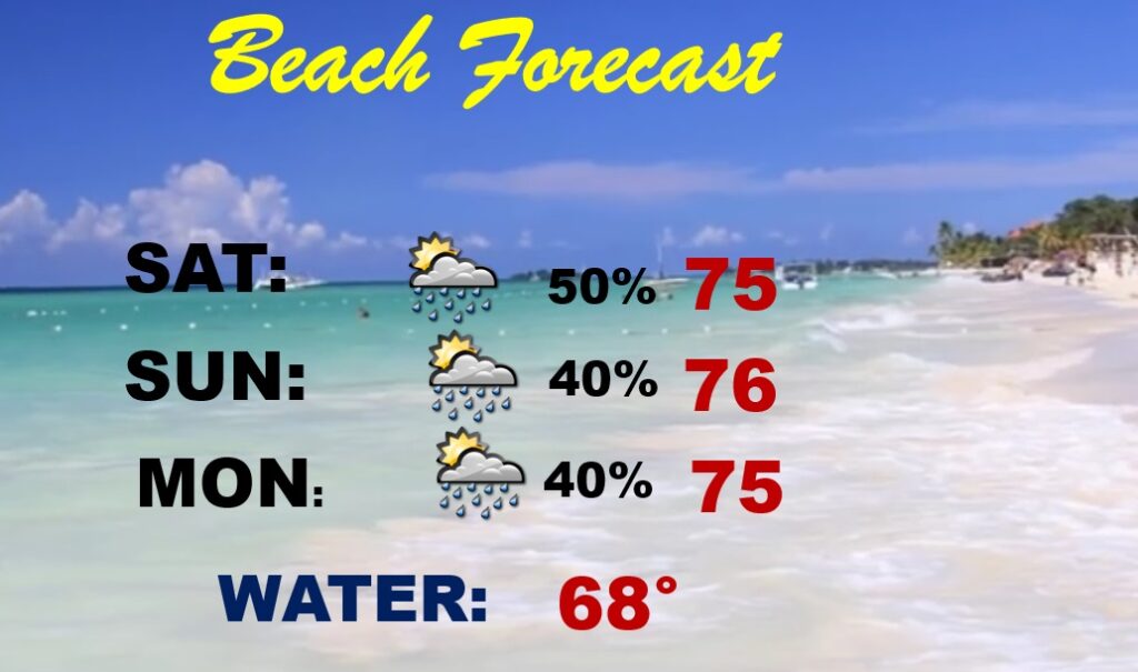
Beach Outlook: Continued warm. Scattered thunderstorms each day. Highs in the 70’s. Gulf water temperature 68.
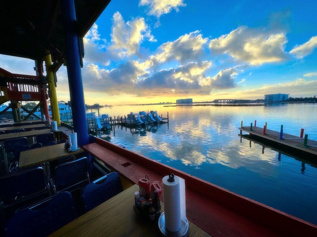
Good morning from Orange Beach. Here’s my view at Breakfast Thursday morning.
Thanks for reading this Blog this morning! I’ll have another update for you in the morning. Have a nice day!
–Rich