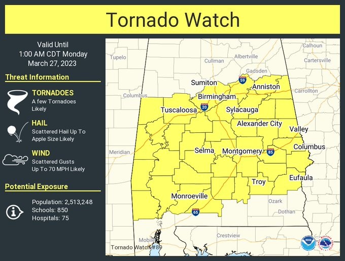
A Tornado Watch is in effect for much of central and south Alabama. Tornadoes are likely. Severe thunderstorms, with a potential wind gusts to 70 mph, hail as large as apple size are possible. A couple of tornadoes are also possible. Stay weather aware. This is part of a complicated Severe Weather threat through the night tonight hours.
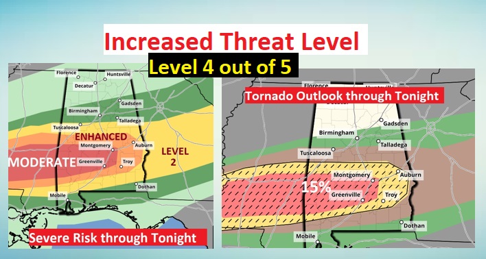
SPC has increased today’s threat level to a Level 4 Moderate Risk across SW and central Alabama. Not only that, the tornado risk is now 15% in that hatched orange area. #alwx
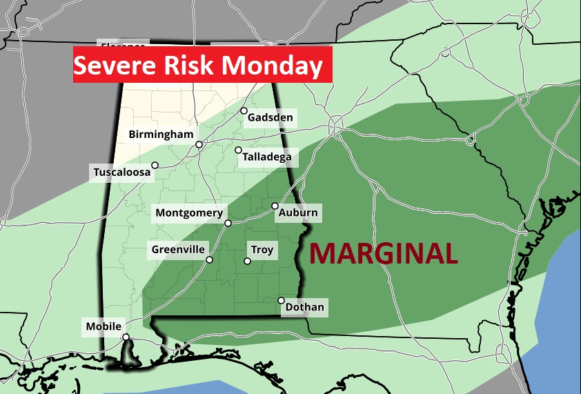
The risk of Strong/Severe storms continues on Monday. Damaging wind gusts. Large hail. Tornadoes possible. For most of us the threat will end during the morning hours.
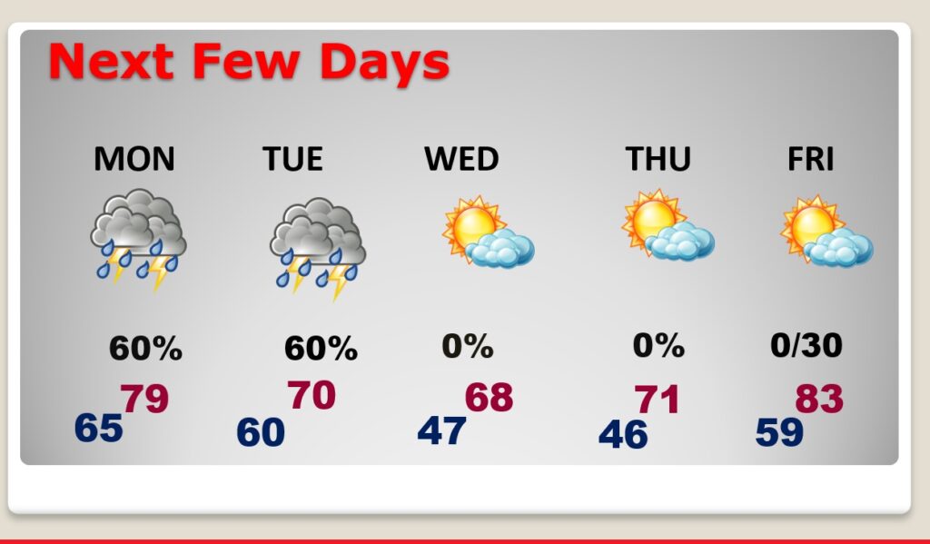
NEXT FEW DAYS: Wet and stormy at times through Tuesday. Cooler Wednesday. Warmer late week