
Good Morning! It was a wild night in Alabama. Some of you woke up to tornado sirens in the middle of the night. The Severe Risk is low this morning. The Tornado Watch ended early at 1AM. The risk of showers and storms will continue this morning, but should exit the state by lunchtime. We get a brief break this afternoon and this evening. Then, another round of showers and storms invade the area in the overnight hours tonight and it will be wet at times Tuesday. Cooler Tuesday & Wednesday. Warmer Thursday. Next chance of showers and storms by late Friday night into Saturday.
TODAY: Risk of showers and storms mainly morning. Cloudy, then Partly sunny by afternoon. High 81. Southwest wind 5 to 10 mph. Dry through the evening hours. Risk of more scattered showers and thunderstorms developing in the overnight hours. Low 57.
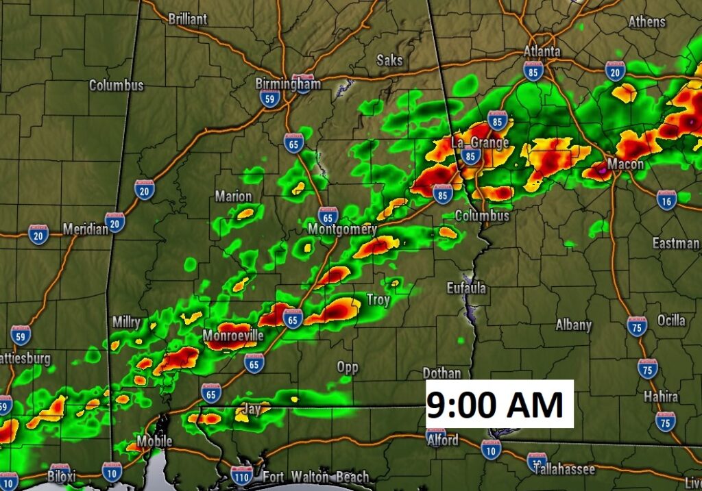
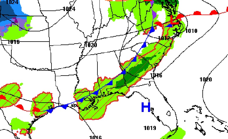
Here’s The SPC Severe Outlook for today, which begins at 7AM. Marginal Risk covers much of central and south Alabama early.

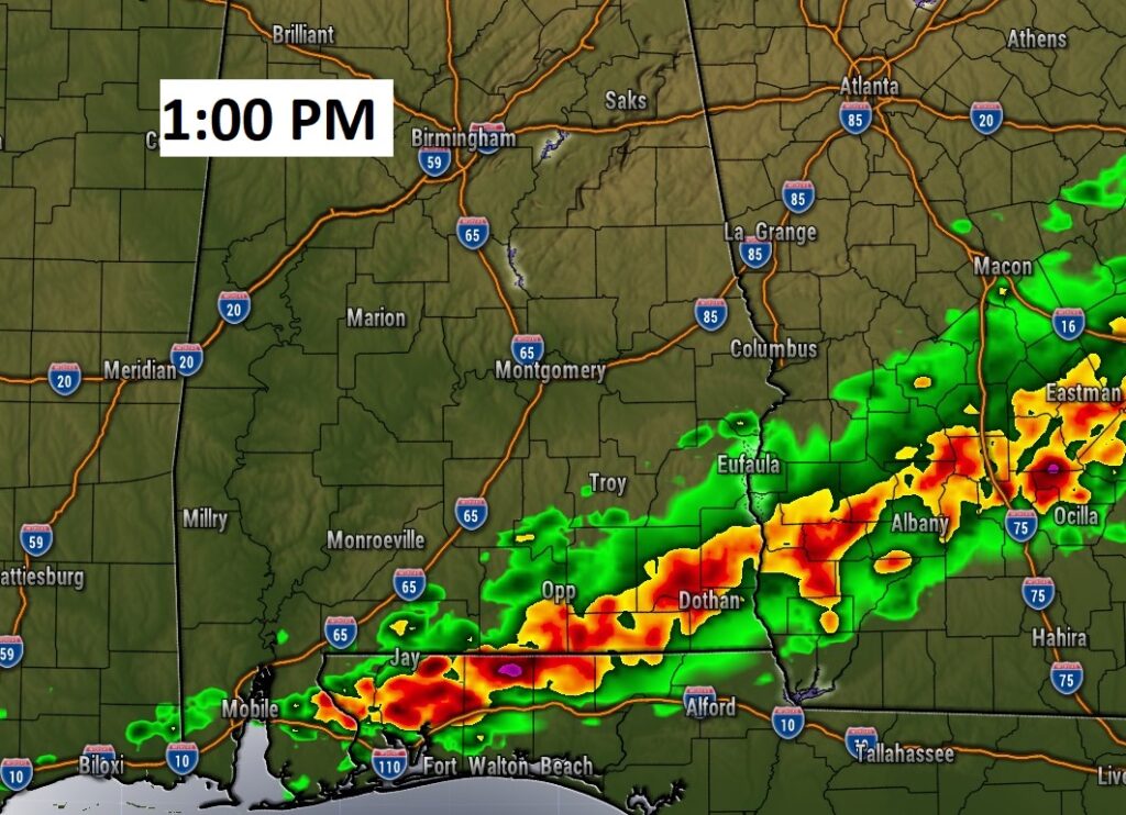
Future radar snapshots. Locally stormy morning. Storms exit shortly after lunchtime.
NEXT FEW DAYS: Showers and storms likely Tuesday. Mostly sunny Wednesday. Cooler Tuesday & Wednesday. Sunny and warmer Thursday. Back to the 80’s Friday. Showers and thunderstorms could move in overnight Friday night, and then become more likely on Saturday.
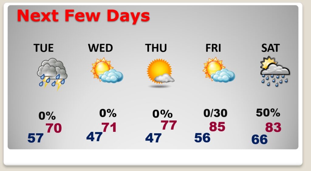
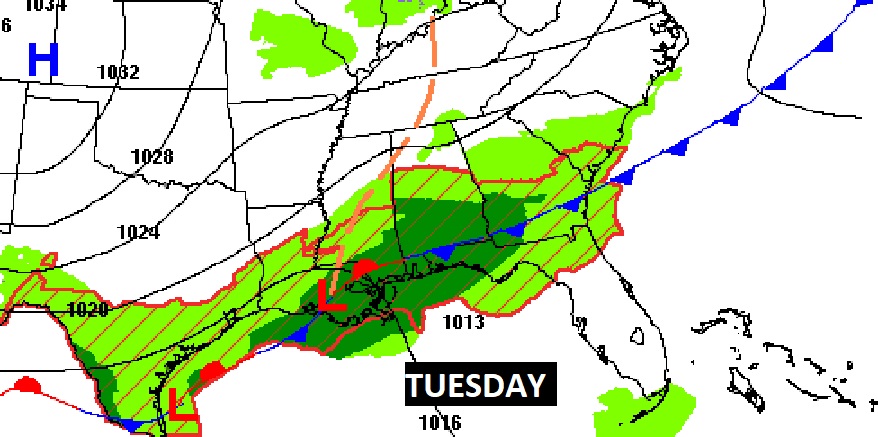
Locally wet Tuesday.
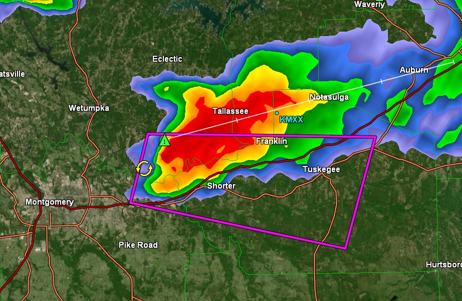
EARLY MORNING TORNADO WARNING: 2:53 AM. One rouge cell prompted a Tornado Warning for extremes NE Montgomery country, Elmore and Macon. Apparent touchdown near Millstead.

Thanks for reading this Blog this morning! This morning we are LIVE on the radio from 6 to 9 on NewsTalk 93.1. Watch us on TV on CBS 8 and ABC 32. I’ll have another update for you in the morning. Have a nice day!
–Rich