
Good Morning! After a wild series of days that included tornadoes, hail and flooding rainfall, there is a risk for more showers and storms today, especially south of US 80/I-85. But, nicer days are on the menu. Wednesday will be cool, but dry. We’ll see sun by afternoon. Thursday is the nicest day of the week and warmer. We’re back to the 80’s Friday. But, showers and storms could arrive overnight Friday and into Saturday. Some of those storms, again, could be quite strong. (again) Here’s my brief forecast discussion.
TODAY: DENSE FOG ADVISORYuntil 9AM. Risk of scattered showers/thunderstorms today. High 75. Northeast wind 5 to10 mph. Partly cloudy cooler tonight. Low 45.
A wave of low pressure moving along that old front near the coast will be the culprit for today’s rain threat.
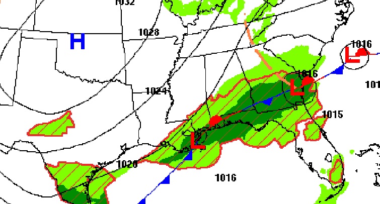
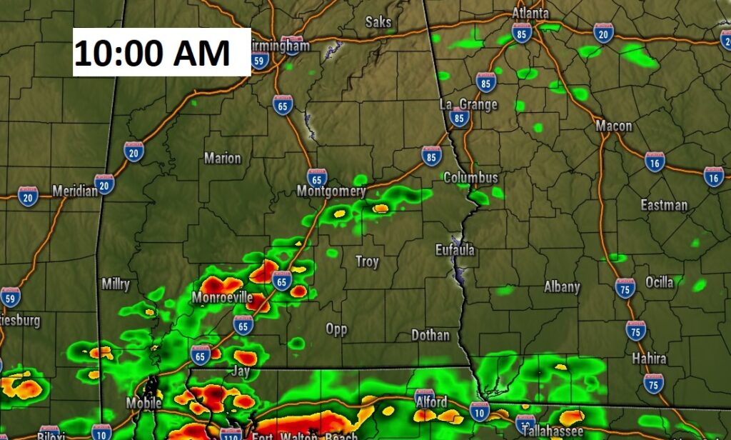
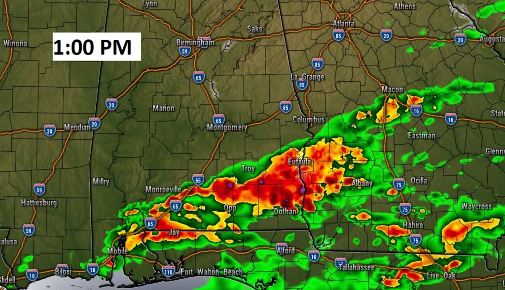
Here’s a couple of Future Radar snapshots. Notice most of action will be along and south of US80/I-85.
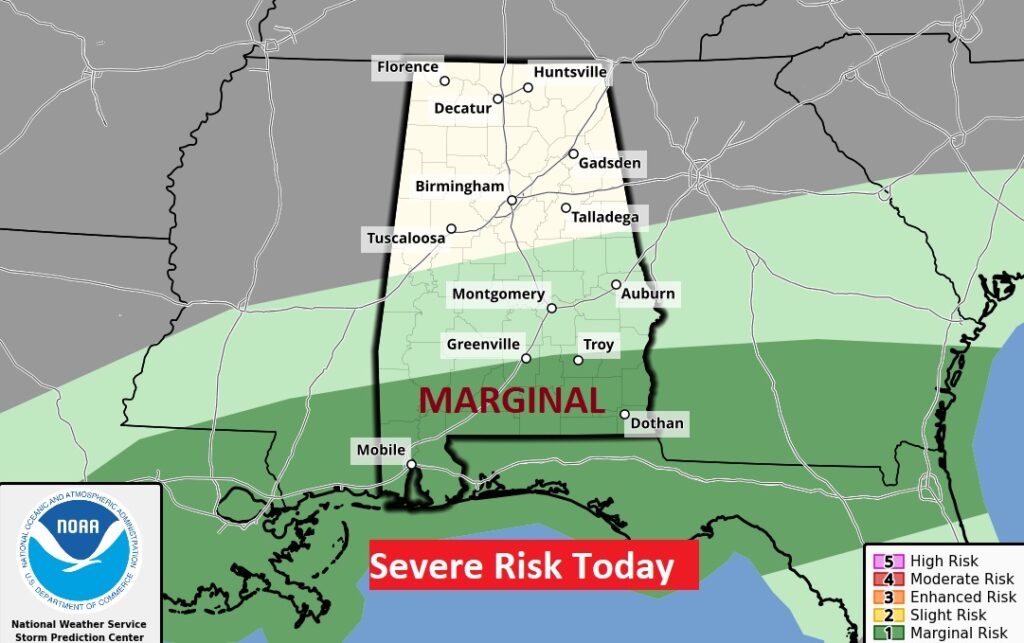
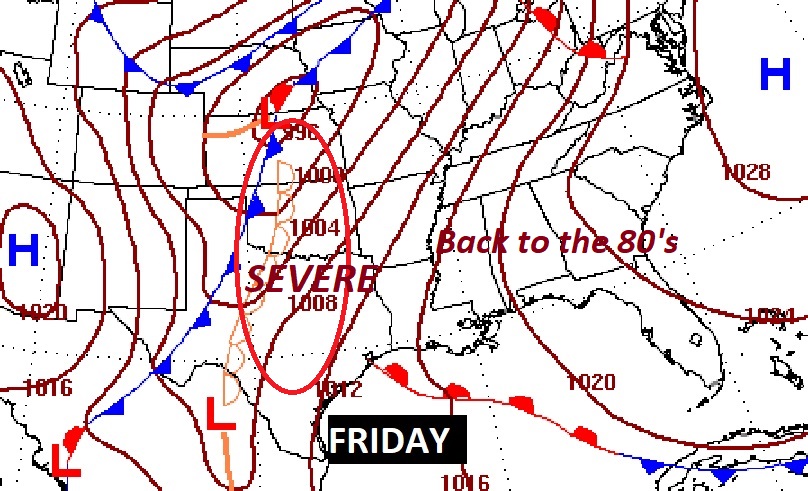
Marginal Severe weather risk for South Alabama today.
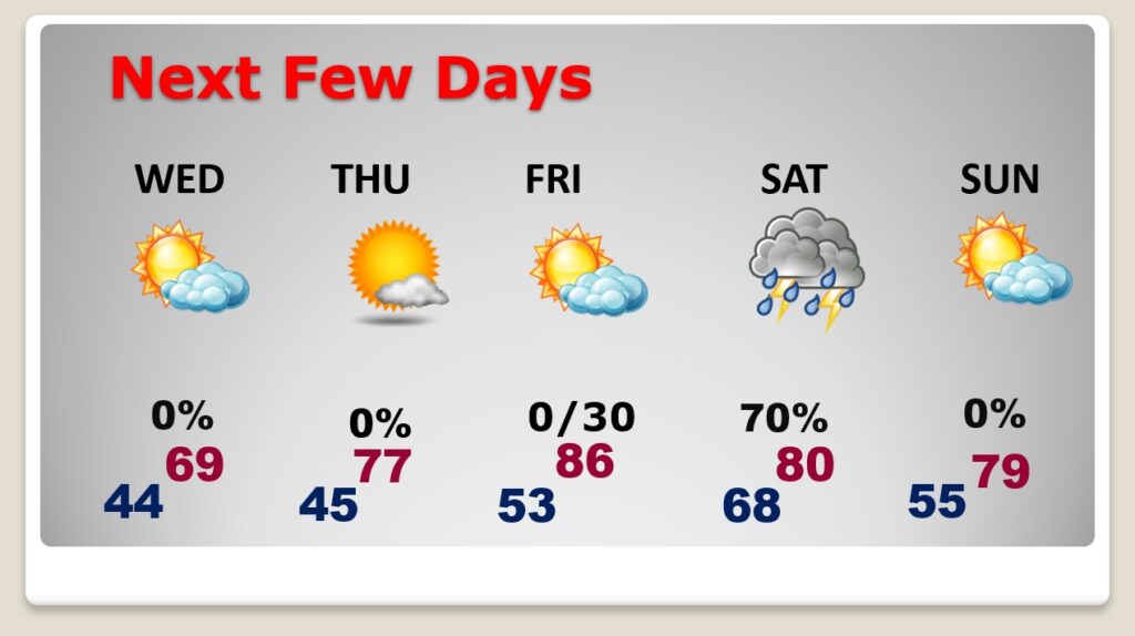
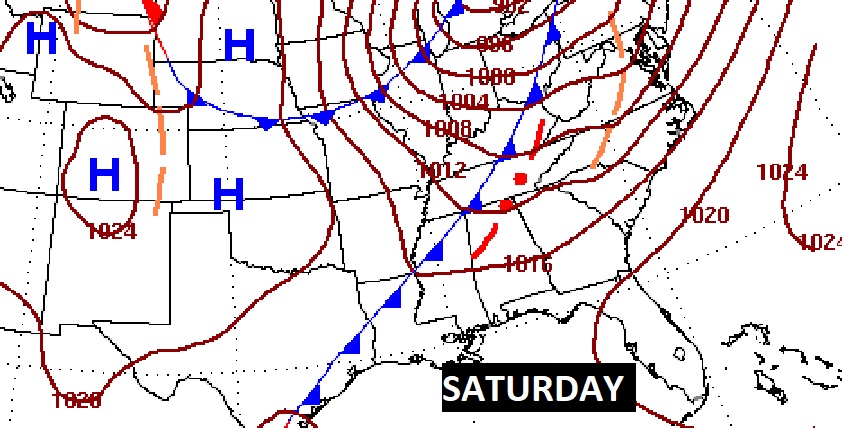
NEXT FEW DAYS: Improvement Wednesday. Cloudy early, then Mostly sunny. Cooler Wednesday. Sunny and warmer Thursday. Back to the 80’s Friday. Showers and thunderstorms could move in overnight Friday night, and then become more likely on Saturday. (Strong to severe?)
We’ll be watching closely the evolution of that late week storm system. Will there be another Severe Threat?
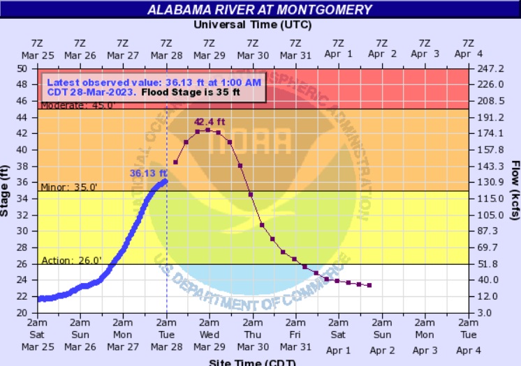
RIVER FLOODING: Due to excessive rain, some rivers are above flood stage. Most notably the Tallapoosa and Alabama rivers.

The Alabama river at Montgomery will peak at 42.4 feet tonight. Flood stage is 35 feet. The toll bridge to Emarald Mountain is closed.
TORNADO SURVEYS: So far NWS has completed three tornado surveys. EF-0 near Prattville 9:39 PM, EF-1 near Lake Martin 10:22PM, and a significant EF-2 in Macon county at 2:41 AM. Surveys will continue today.
TORNADO #1
Local Storm Report by NWS BMX: 1 ENE Autauga County Ai [Autauga Co, AL] nws storm survey reports TORNADO at 26 Mar, 09:39 PM CDT — an ef-0 tornado was confirmed with a path length of 1.03 miles.
TORNADO #2
Local Storm Report by NWS BMX: 2 S Martin Lake At Kowa [Elmore Co, AL] nws storm survey reports TORNADO at 26 Mar, 10:22 PM CDT — an ef-1 tornado was confirmed with a path length of 7.46 miles.
TORNADO #3
Local Storm Report by NWS BMX: 2 ENE Brassell [Macon Co, AL] nws storm survey reports TORNADO at 27 Mar, 02:41 AM CDT — an ef-2 tornado was confirmed with a path length of 15.41 miles as it tracked between interstate 85 and the tallapoosa river.
Thanks for reading this Blog this morning! This morning we are LIVE on the radio from 6 to 9 on NewsTalk 93.1. Watch us on TV on CBS 8 and ABC 32. I’ll have another update for you in the morning. Have a nice day!
–Rich