UPDATE:
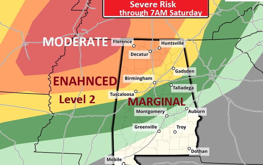
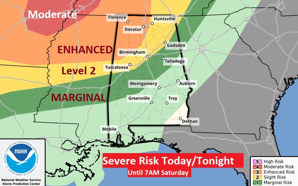
Expanded Real Estate: SPC’s updated Day 1 outlook (through 7AM SAT) shows the severe threat has expended southward to near the US 80/I-85 corridor. The Enhanced Level 3 risk in NW AL is larger. Ominous Moderate risk now nicks extreme NW AL, overnight hours tonight #alwx
Good Morning! On this last day of March, we’re back to the 80’s. Meanwhile, a powerful storm system will assault several states with Severe Weather today, as March goes out like a lion. But, it looks like, by the time the line of storms reaches us, it will have lost much of it’s Severe Potential. Much of the action will be in the wee hours of Saturday AM. Expect improvement by Saturday afternoon. Much of the weekend looks good. Another storm in the middle of next week needs to be watched. We’ll soar way into the 80’s by the middle of next week. Here’s my brief forecast discussion.
TODAY: Limited sunshine. Clouds will dominate. Breezy and warmer. High 84. Southeast wind 10-15+.
Today will be a big Severe Weather Day for much of the central part of or country as a massive storm system marches eastward. A significant tornado outbreak is possible.
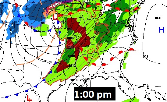
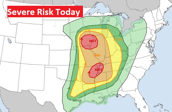
TONIGHT: Dry through the evening hours. A Line of showers and thunderstorms arrive in the overnight, particularly closer to morning. Some storms could be strong, possibly severe. By far the greatest Severe Threat is in the northwest half of the state. In fact, far northwest Alabama has an Enhanced Level 3 Risk. The line of storms will weaken some before reaching the I-85 corridor.
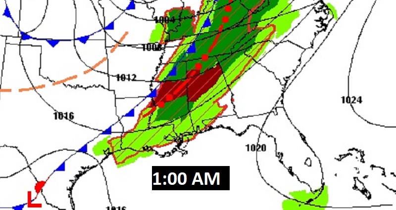
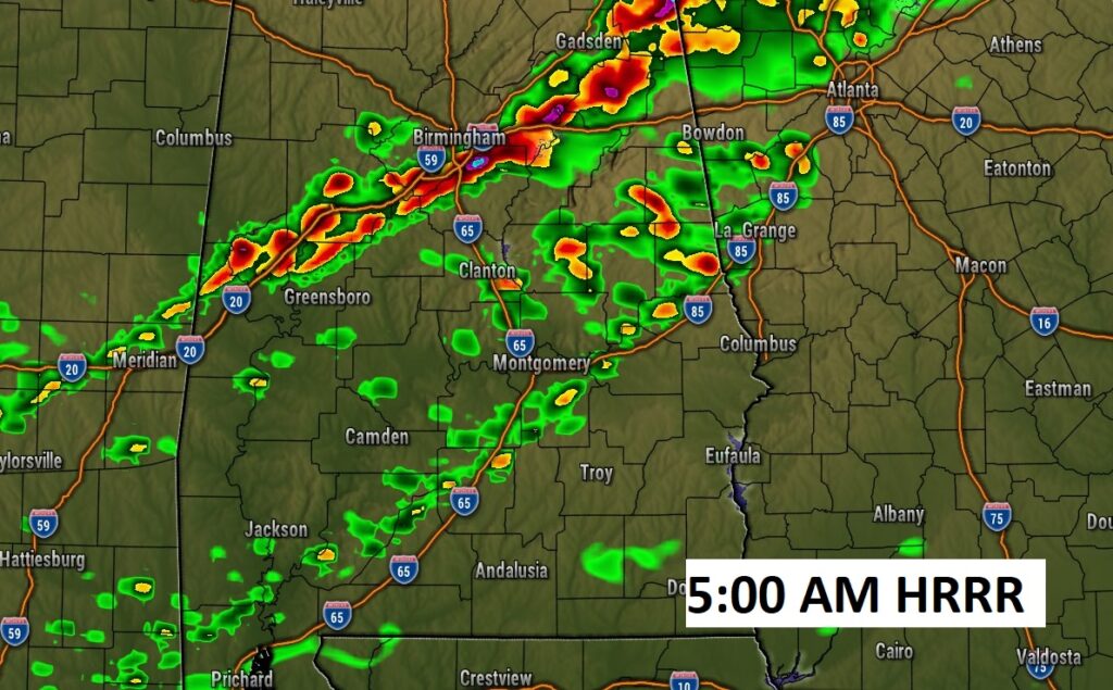
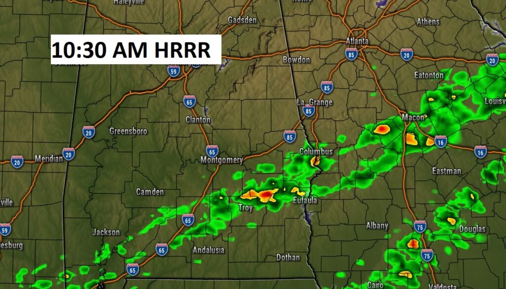
Here’s a couple of Future Radar (HRRR) snapshots, just as an example. By late morning, the line of storms will stretch across southeast Alabama.
After 7AM Saturday, the Severe Threat shifts into SE Alabama, Georgia and Florida. Marginal Risk.
CLIMATE DATE YESTREDAY: AM low 42. PM High 77. (Normal 75/49)
NEXT FEW DAYS: Warmer Friday. Partly sunny. High in the mid 80’s. Risk of Showers and thunderstorms will continue through the first half of the day Saturday. Sunday looks really nice with a sun/cloud mix and temperatures in the 70’s. By late Sunday night into Monday, a northward moving warm front could bring in more scattered showers & thunderstorms. We’re well into the 80’s by Tuesday & Wednesday.
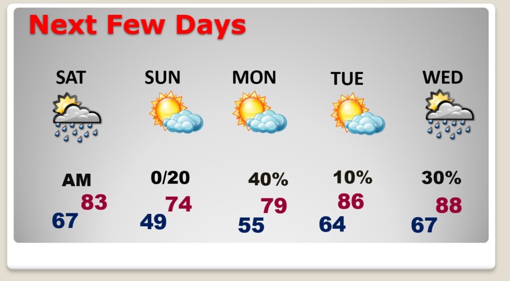
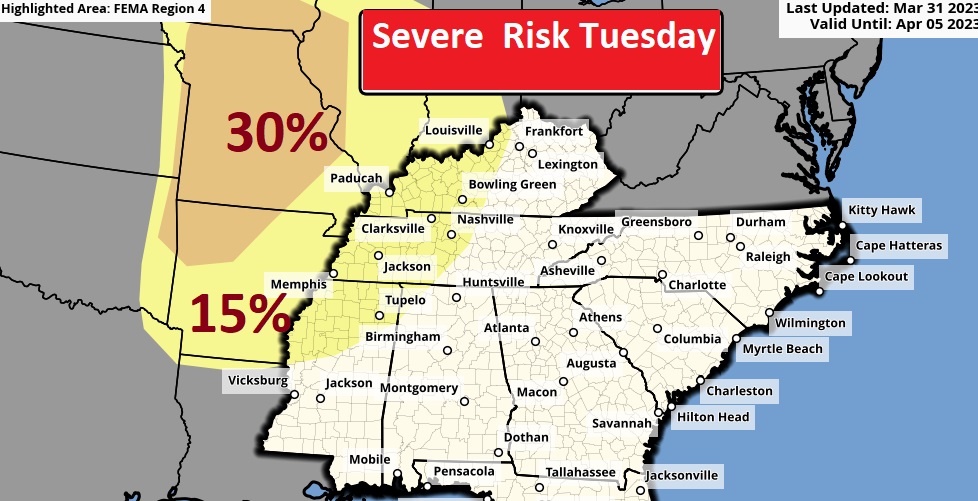
Could we see some strong to severe storms with a mid week storm system?
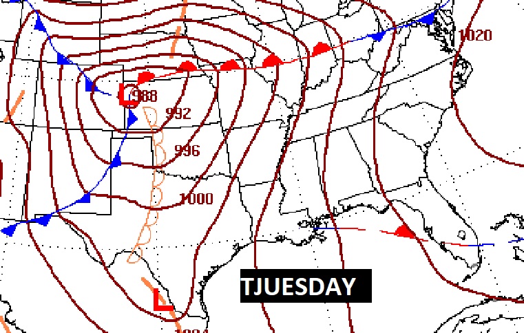
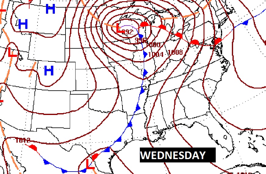
Right now, the BEST dynamics for severe weather stay well NW of us.
BEACH FORECAST: Nice day today. Scattered thunderstorms Saturday. Only a small chance of leftover showers Sunday. The Gulf water is still cool….72. HIGH Rip current risk Saturday and Sunday.
Thanks for reading this Blog this morning! This morning we are LIVE on the radio from 6 to 9 on NewsTalk 93.1. Watch us on TV on CBS 8 and ABC 32. I’ll have another update for you in the morning. Have a nice day!
–Rich
