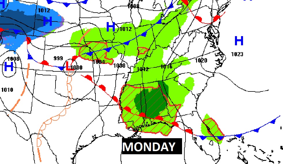
Good Morning! After a stormy Saturday morning, and a beautiful warm & sunny afternoon, today will be pretty nice. On this Palm Sunday, temperatures will be comfortable, and we’ll see the sun from time to time. Showers and storms will be back in our forecast in the late night hours and Monday (mostly in the morning), along a northward moving warm-front. Tuesday looks dry and warm. But expect yet another storm system to brig in another round of storms by Wednesday. Once again a few stronger storms can’t be ruled out. The cool front moves through Thursday AM ending the rain threat.
CLIMATE DATA: Yesterday’s low 60. High 84. (Normal 76/49) Rainfall: .76.
TODAY: Pretty nice day. Comfortable. High 75. Partial sunshine. North wind 6 to 12 mph. Dry through the evening hours. Risk of showers and storms arriving in the overnight hours. Low 56.
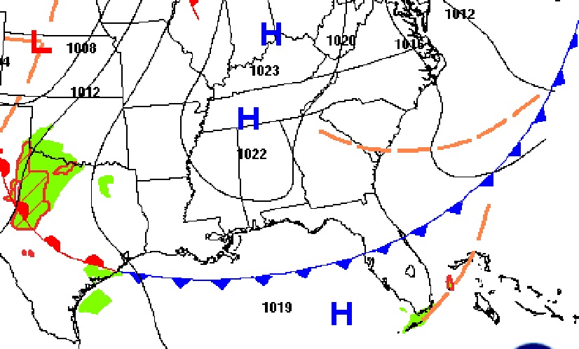
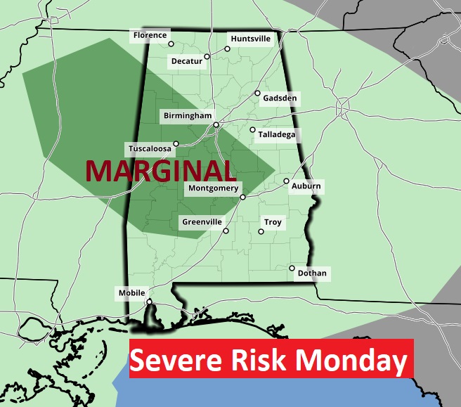
A few storms could be strong early in the day Monday as a warm front moves northward. Damaging wind and hail is the main threat.
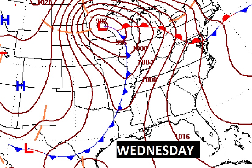
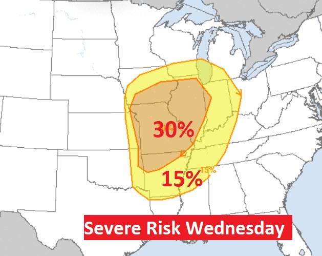
NEXT SEVERE WEATHER THREAT FOR THE U.S.: Looks like yet another significant severe weather threat Tuesday & Wednesday for the Nation’s heartland, including another potential significant tornado outbreak. This, following the deadly Friday tornado outbreak which killed at least 26.
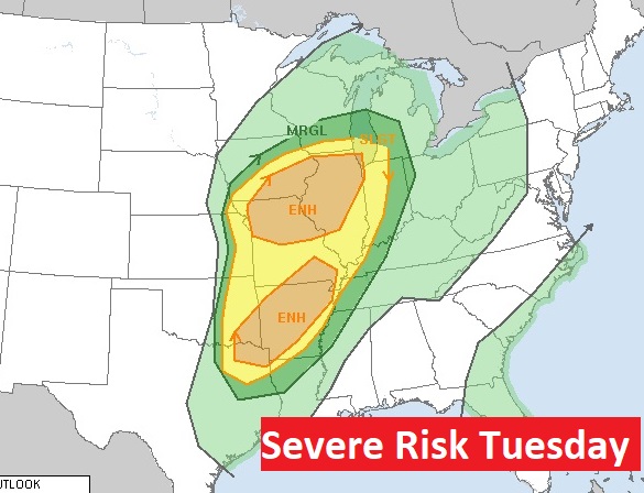
As this storm system gets closer to us, the severe weather will not be nearly as strong. The main Severe Threat will remain well to the northwest of us.
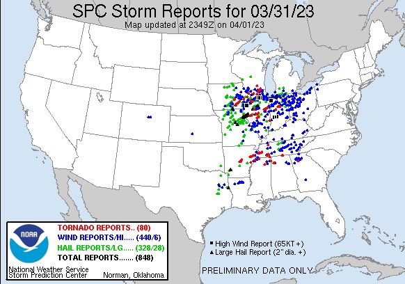
Here’s the updated Storm Reports Map from Friday until 7AM Saturday AM. Simply mind boggling.
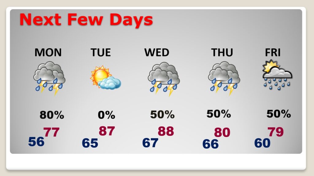
NEXT FEW DAYS: The Risk of showers and storms will mainly be during the first half of the day Monday along a warm front . Tuesday looks dry and warm. But expect yet another storm system to brig in another round of storms by Wednesday. Once again a few stronger storms can’t be ruled out. The cool front moves through Thursday AM ending the rain threat.
Thanks for reading this Blog this morning! I’ll have another update for you in the morning. Have a nice day!
–Rich
