
Good Morning! The calendar says April, but it will feel more like summertime today and Wednesday with upper 80’s both days. Like a summer day, there could be some isolated “heat of the day” pop up showers. Rain chance 20% at best. Looks like we will be easing into a Wet at Times pattern Thursday through Easter Sunday. It won’t be a washout, but be prepared to have a plan “B”. The weekend will be rather cool with highs in the 60’s. At the moment, there is no severe weather in our future. Here’s my brief forecast discussion.
TODAY: DENSE FOG ADVISORY until 9AM. Otherwise…A very warm day. High in the upper 80’s. Partial sunshine. Like a summer day, there could be some isolated “heat of the day” pop up showers. Rain chance 20% at best.
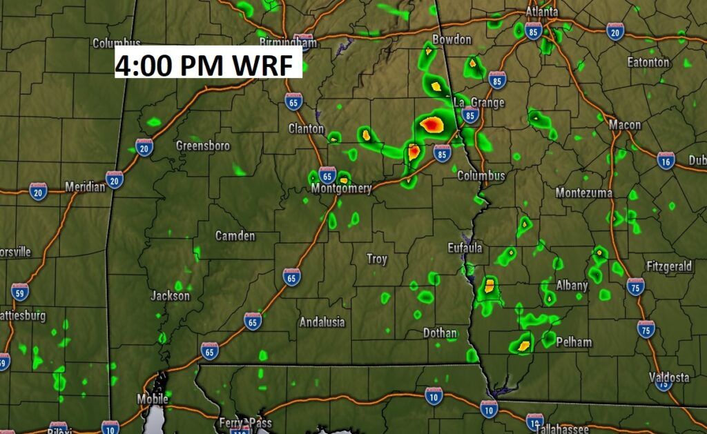
Future radar at 4:00PM. Small chance of pop up showers.
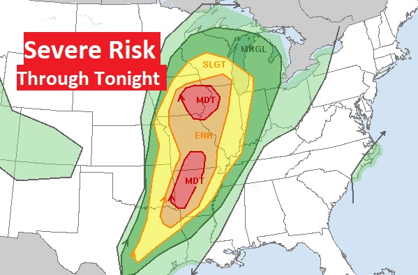
ANOTHER SIGNIFICANT SEVERE WEATHER OUTBREAK: Looks like yet another significant severe weather threat today & tonight for the Nation’s heartland, including another potential significant tornado outbreak. The main Severe Threat moves eastward to the Great Lakes region Wednesday.
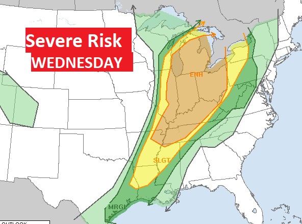
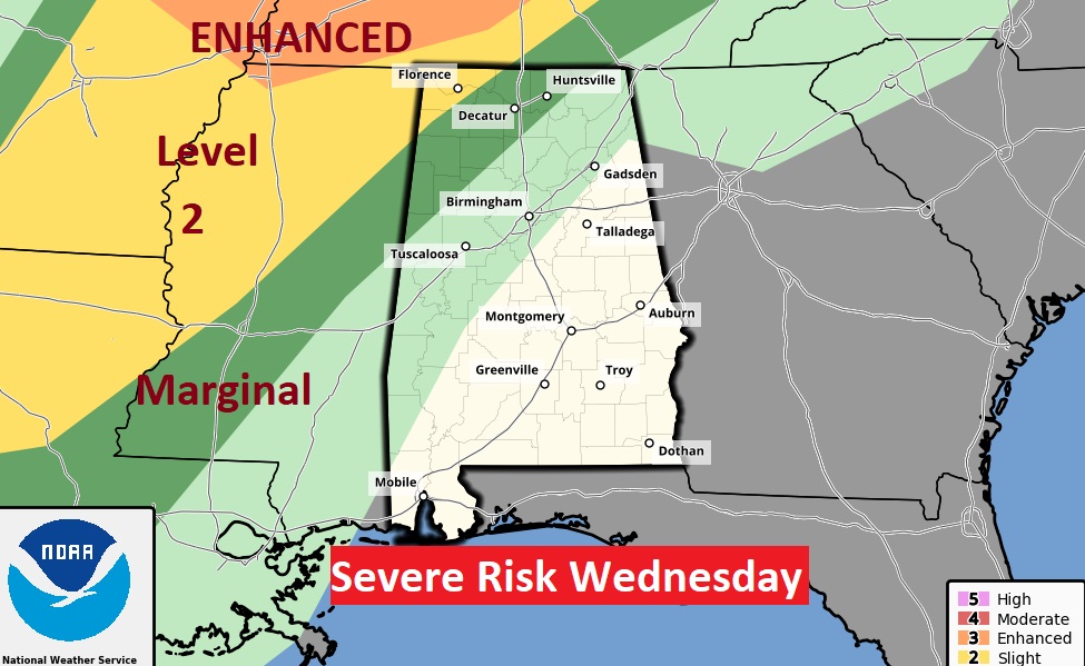
As this storm system gets closer to us, the severe weather will not be nearly as strong. The main Severe Threat will remain well to the north of us Wednesday & Wednesday Night. A marginal risk covers part of north Alabama.
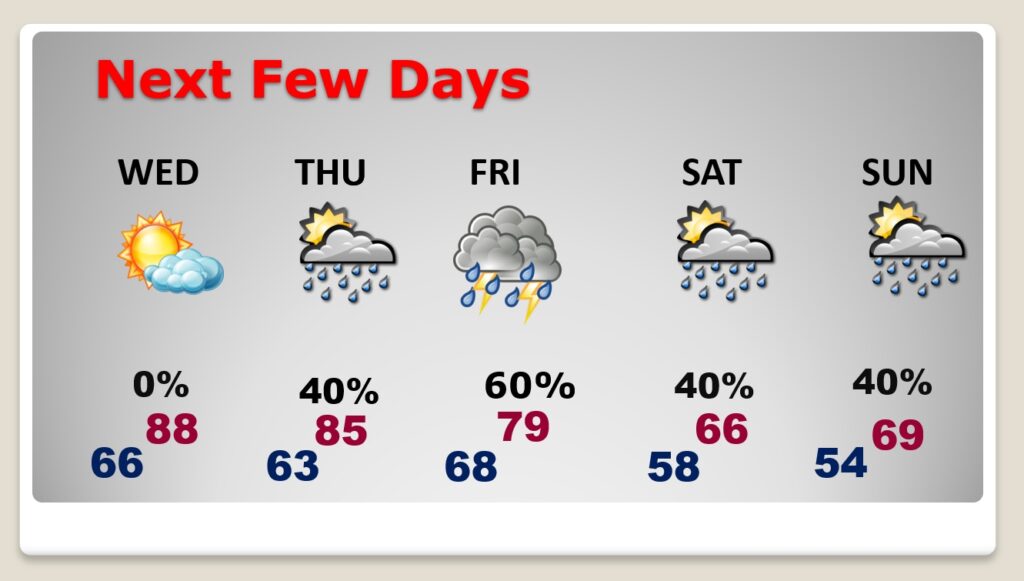
NEXT FEW DAYS: . Wednesday will be summer-like, like today, with highs in the upper 80’s. Expect showers and thunderstorms to return by early Thursday. It will be wet at times Thursday through Easter Sunday. Much cooler over the weekend with highs in the 60’s
The cool front moves through Thursday. But, the front will take residence along the Gulf Coast. Waves of low pressure will move along the front. That will keep us wet at times Friday through Easter Sunday.
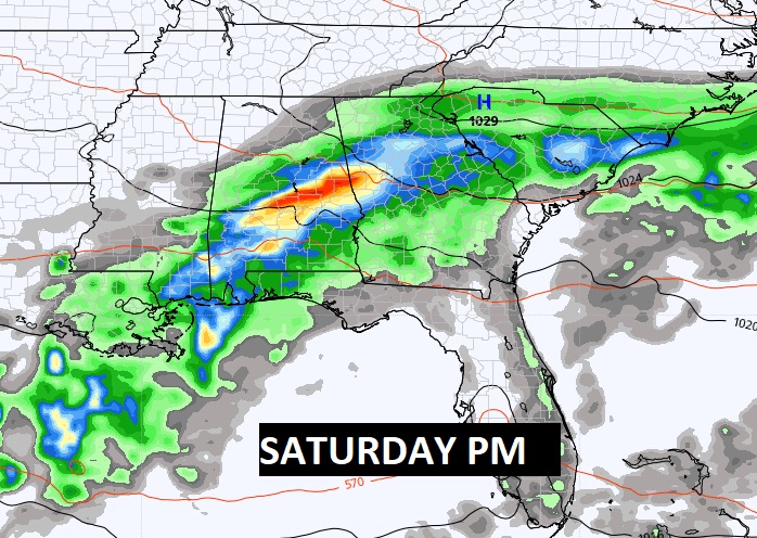
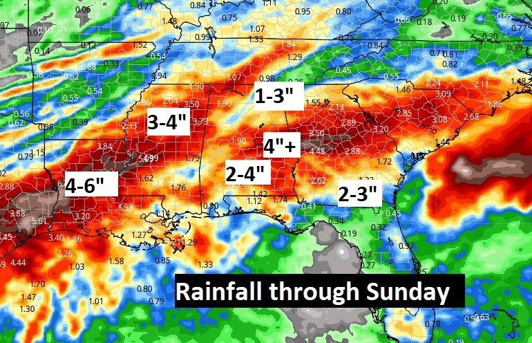
It will be wet at times Thursday through Easter Sunday. Here’s the expected rainfall.
Easter will be cool, compared to normal. Upper 60’s. Small chance of scattered showers.

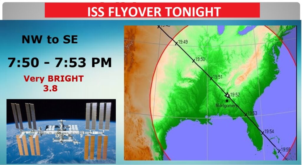
SPACE STATION FLYOVER: Hopefully the clouds will cooperate tonight. It’s a “maybe”. There will be a very bright Space Station flyover. 3.8 magnitude. Look in the northwest sky at 7:50 PM. It will be southeast bound. Fingers crossed.
Thanks for reading this Blog this morning! This morning we are LIVE on the radio from 6 to 9 on NewsTalk 93.1. Watch us on TV on CBS 8 and ABC 32. I’ll have another update for you in the morning. Have a nice day!
–Rich