
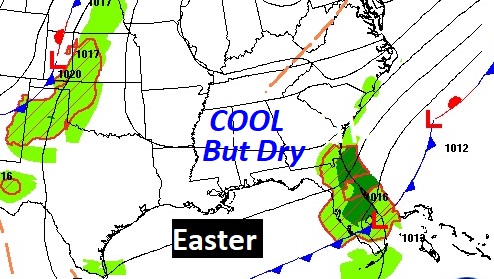
Good Morning! It’s a rather brisk and cool Easter morning. But, the good news is..the rain is gone. Expect a much improved, but cool holiday, Although clouds will dominate, I think there will be a few “sunbreaks” later. Monday and Tuesday will feature good bit of sunshine with highs in the 70’s. Risk of showers returns late Wednesday night. Scattered showers will increase on Thursday and Friday. No severe weather is expected.
TODAY: Breezy and cool early this morning. Easter sunrise at 6:25 AM. Temperature 47, wind chill factor 39. Today will be DRY and breezy. High 69. Northeast wind 10 to 15+. Gradual clearing overnight tonight. Low 49.
Much of the Southeast will be dry today, with the exception of Florida.
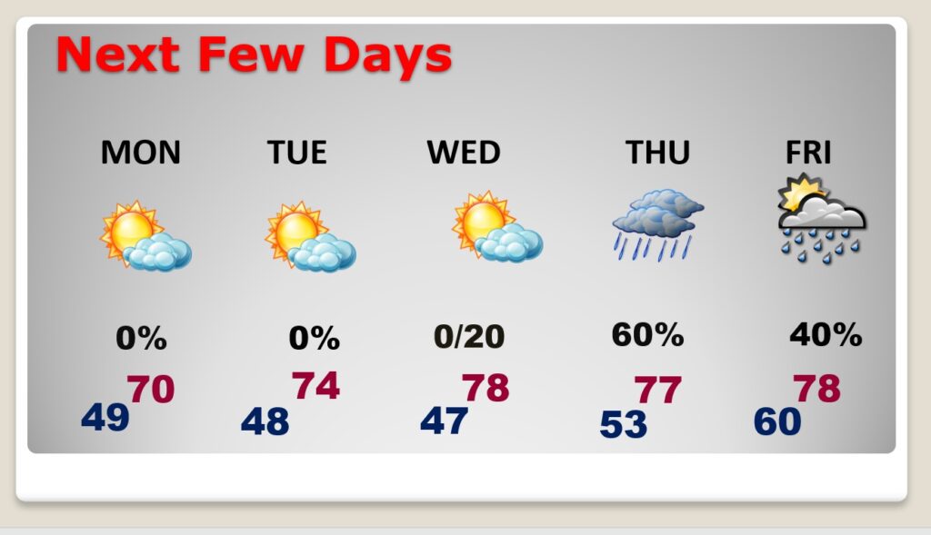
NEXT FEW DAYS: Dry Monday and Tuesday. Still below normal on the temperatures. (Normal 77/51). Warmer Wednesday. Risk of showers returns late Wednesday night. Scattered showers will increase on Thursday and Friday.
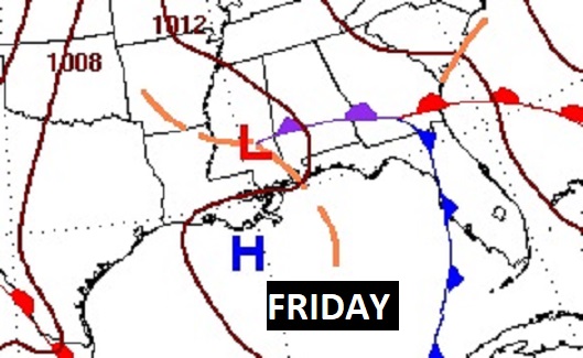
An interesting Gulf Low will be responsible for showers returning by Thursday and Friday.

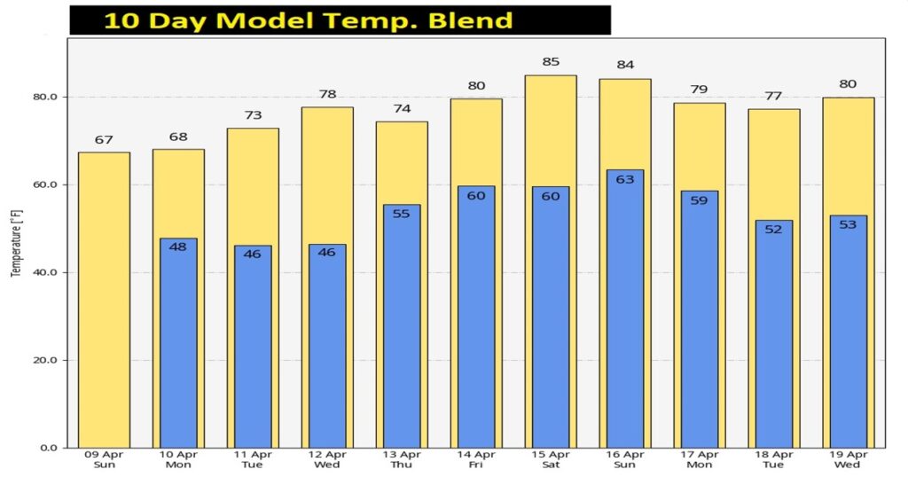
Here’s the 10 day Model Blend. The coolest days will be today and tomorrow. Temperatures will moderate especially by late week and into the weekend.
Thanks for reading this Blog this morning! I’ll have another update for you in the morning. Have a nice day!
–Rich