
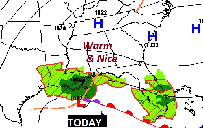
Good Morning! Our string of nice days continues. And, we have a nice warming trend underway. Today should be beautiful, and comfortable. Showers and thunderstorms become likely Thursday, as a Gulf low migrates northward. A Marginal Severe Weather Risk covers most of the state. Widely scattered showers, but warmer Friday & Saturday, as we return to the 80’s. Another storm system will being more scattered showers & storms by Sunday. Yesterday’s high was 77. Normal 78/51.
TODAY: Mostly sunny. A little warmer. High near 74. East wind 6 to 15 mph. Mostly clear, chilly tonight. Low 48.
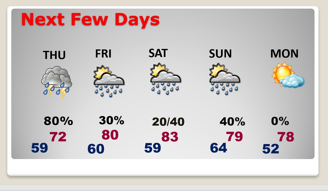
NEXT FEW DAYS: More sun Wednesday. High 78. Risk of showers by late Wednesday night. Rain and thunderstorms become likely Thursday. Marginal Severe Risk for much of Alabama. Warmer near the end of the week. Back to the 80’s Friday and Saturday. Another storm system will bring in more scattered showers and storms on Saturday night & Sunday.
A northward moving Gulf Low will bring the rain back to Alabama on Thursday. This is a non-tropical Low.
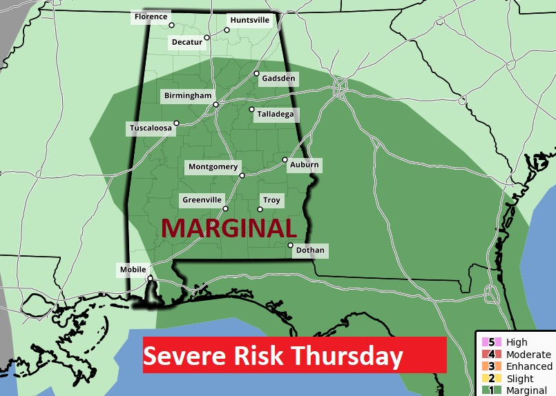
Marginal Severe Risk for much of Alabama. Damaging wind gusts are the main threat. Brief tornadoes can’t be ruled out. SPC says they may upgrade the threat level in future forecasts.
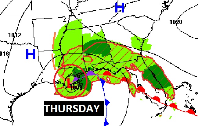
Interesting and active Future Radar, Thursday morning at 11:00 AM. (NAM)

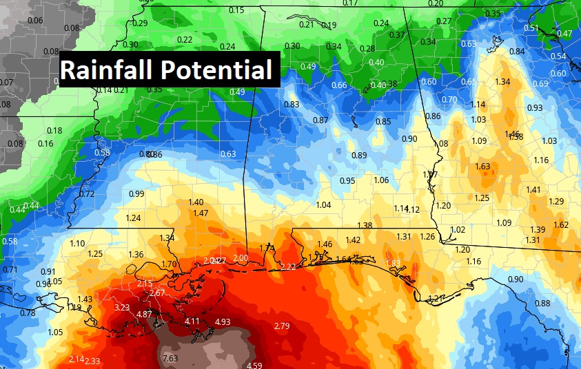
Locally Heavy rainfall amounts will mainly be confined to areas closer to the coast.
NATIONAL TROPICAL WEATHER CONFERENCE: My home for the next few days. Thrilled and honored to finally attend The National Tropical Weather Conference, South Padre Island, Texas. 110 attendees this year. Beautiful venue. Conference business starts at 8:50 AM in the morning. Awesome agenda. I’ll be listening and learning.
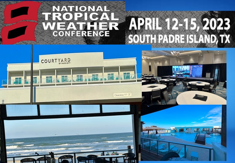
Thanks for reading this Blog this morning! I’ll have another update for you in the morning. I’m getting on an airplane this morning. I’ll be here at the National Tropical Weather Conference at South Padre Island, Texas through the end of the week. My updates from the road will be somewhat condensed and abbreviated. I’ll do my best to keep you up to date. Have a nice day!
–Rich