
Good Morning ! It should be a pretty nice Saturday. It’ll be dry and warm with a sun/cloud mix. We’re headed for the mid 80’s. Another approaching front will bring a round of showers and storms in the overnight hours tonight and through the first half of the day Sunday. A few stronger storms are not out of the question. After the front moves through tomorrow, much nicer air will follow. Get ready for an extended series of nice days and chilly nights for most of next week through Thursday.
TODAY: A pretty nice Saturday. Rain chances not zero, but 20% or less. Sun/cloud mix. Warm. High 85. South winds at 5 to 10 mph. Risk of scattered showers and thunderstorms Saturday night. A few stronger storms possible. Low 64.
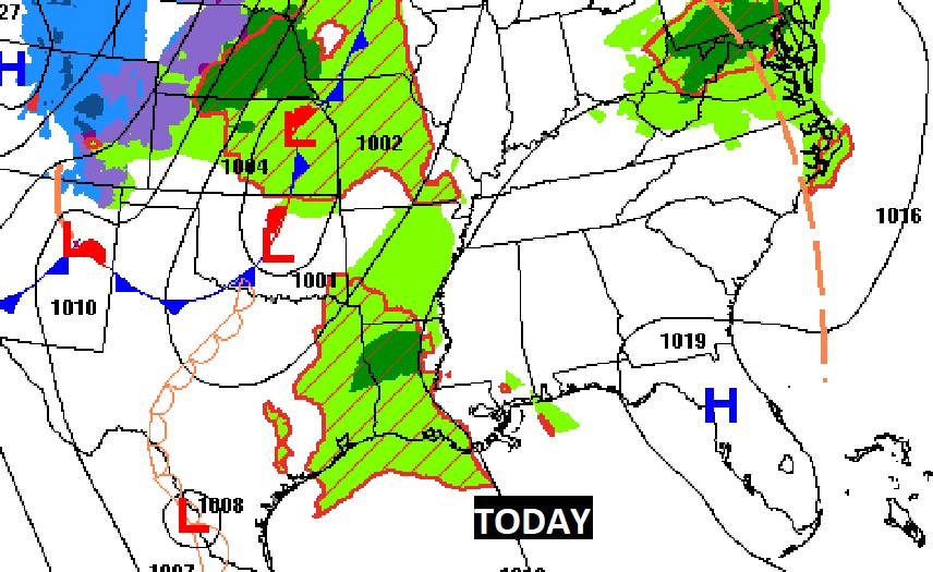
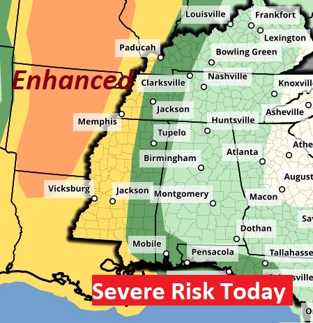
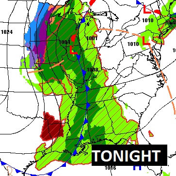
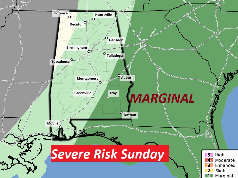
We’re dry through the evening. Showers and storms arrive in the overnight hours. Looks like a rather significant Severe Weather Risk especially for states west of us today & tonight.
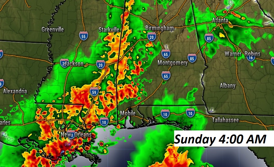
Early morning Future Radar.
Starting at 7AM Sunday, the risk shifts to southeast Alabama and points east.
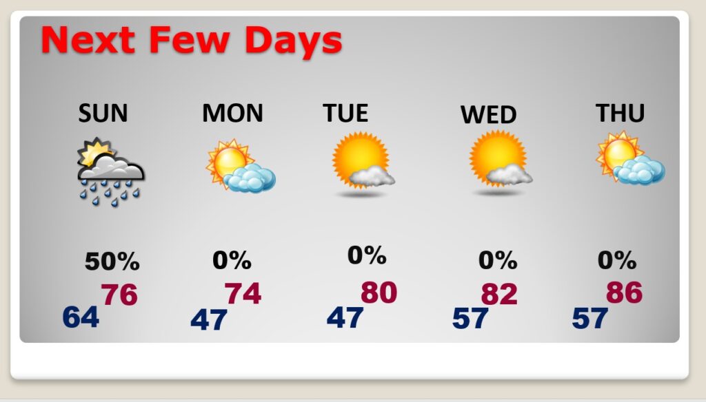
NEXT FEW DAYS: Scattered showers and thunderstorms mainly first half of the day Sunday. A few stronger storms possible It will be cooler Monday & Tuesday, with chilly nights but comfortable days. Back to the mid 80’s again on Wednesday. Storm free Monday through Thursday.
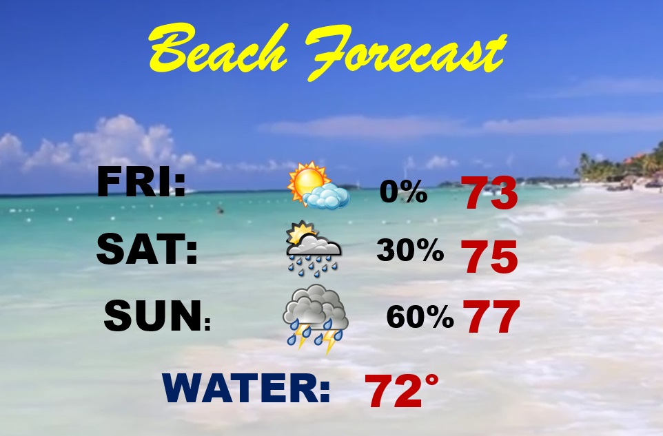
BEACH OUTLOOK: Showers & thunderstorms Saturday afternoon through Sunday. High Rip Current Risk Saturday & Monday. Moderate on Saturday.
Thanks for reading this Blog this morning! Today is a travel day for me, as I depart the National Tropical Weather Conference here on South Padre Island Texas. I’ll have another update for you in the morning, from Montgomery. Have a nice weekend!
–Rich