
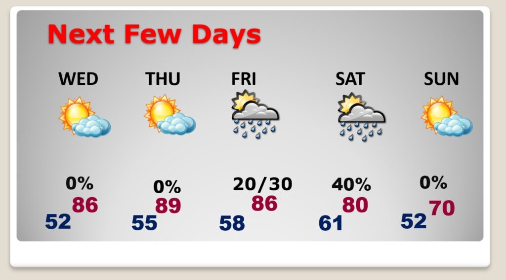
Good Morning! It’s chilly this morning, but, hang on. The Major Warming trend continues today through Thursday. Mid 80’s Wednesday. Upper 80s to near 90 Thursday. More sunshine. Friday will be warm, too. And approaching front will bring a widely scattered thunderstorms by Friday afternoon. The rain chances are a little better Friday night into Saturday, as a cold front sweeps into the area. It’ll turn much cooler Saturday night and Sunday. Here’s my brief forecast discussion.
CLIMATE DATA: Yesterday’s high was 75, after a morning low of 45. (Normal 79/53) Peak wind gust 28 mph.
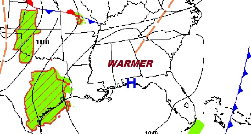
TODAY: Chilly start in the 40’s. Sunshine. Warmer. High 83. Southeast wind 6 to 12 gusting mph. Clear, not quite as chilly tonight. Low 41.
NEXT FEW DAYS: The Major Warming trend continues Wednesday and Thursday. Mid 80’s Wednesday. Upper 80s to near 90 Thursday. More sunshine. Friday will be warm, too. And approaching front will bring a widely scattered thunderstorms by Friday afternoon. The rain chances are a little better Friday night into Saturday, as a cold front sweeps into the area. It’ll turn much cooler Saturday night and Sunday.
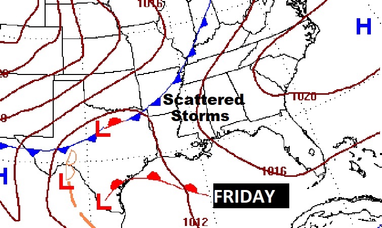
An approaching cold front will bring a risk of showers and thunderstorms by late Friday into Saturday.
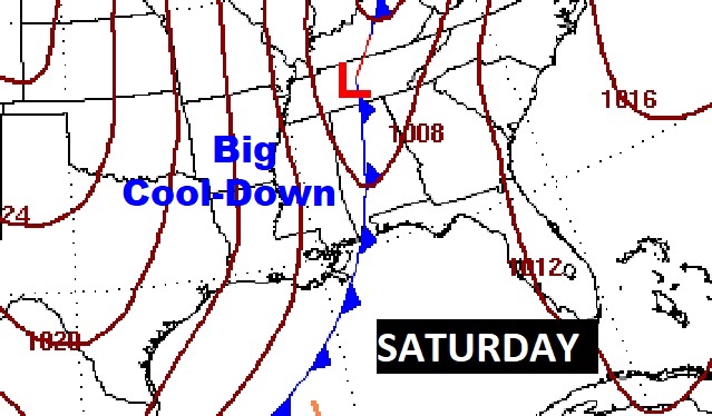
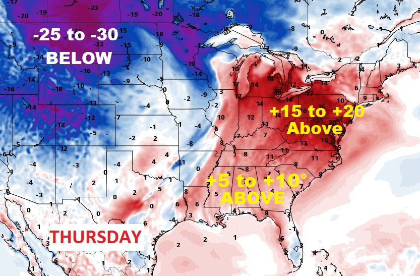
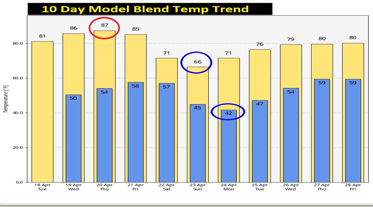
Our Warmest Day will be Thursday. But, notice that block of chilly air entering the north central U.S. We will turn much cooler by Sunday.
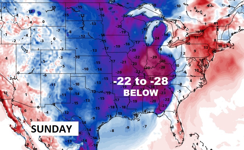
Take a look at this. Thursday is the warmest day with upper 80’s. But look at the huge Temperature crash Sunday. Highs in the 60’s Low 40’s by Monday morning. Wow.
Thanks for reading this Blog this morning! This morning we are LIVE on the radio from 6 to 9 on NewsTalk 93.1. Watch us on TV on CBS 8 and ABC 32. I’ll have another update for you in the morning. Have a nice day!
–Rich