
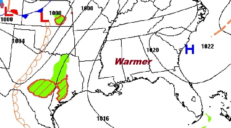
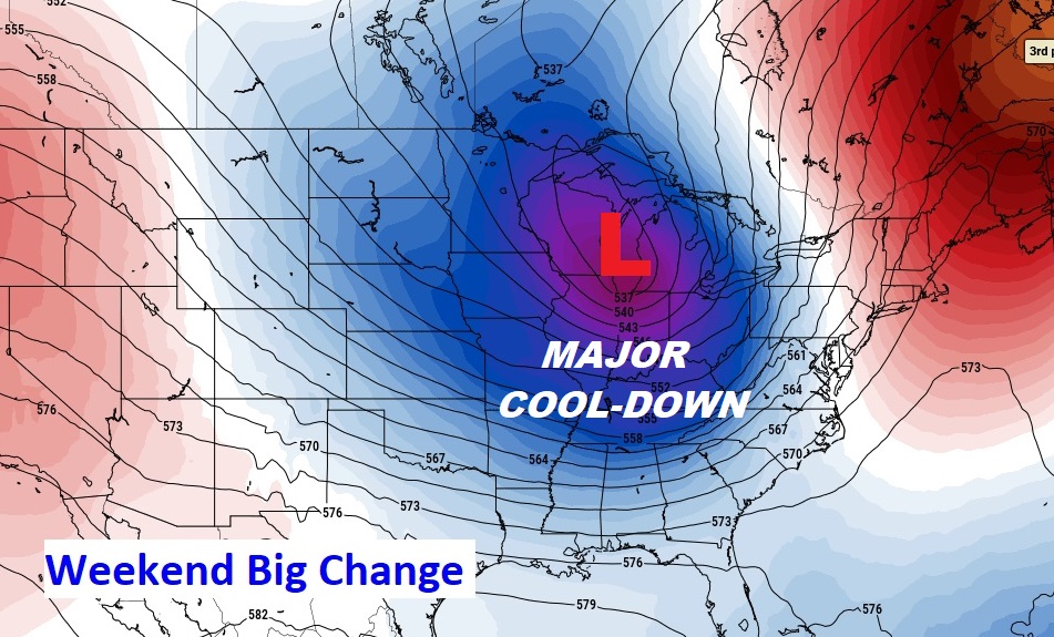
Good Morning! Our string of nice, storm-free days continues. Each day gets a little warmer. The warming trend continues today and Thursday. As a cold front approaches the risk of showers and thunderstorms will increase, especially by Friday evening, Friday night and Saturday. Much cooler air will sweep into the state behind the front by Saturday night and Sunday. Here’s my brief forecast discussion.
CLIMATE DATA: Yesterday we had a nearly 40 degree warm-up from a morning low of 43 to an afternoon high of 82. (Normal 79/53)
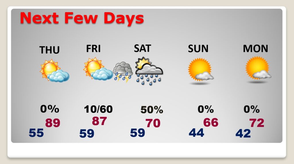
TODAY: Another very cool start. Abundant sunshine. High 87. East wind at 5 to 10, shifting to south in the afternoon. Clear and not quite as cool tonight….low 54.
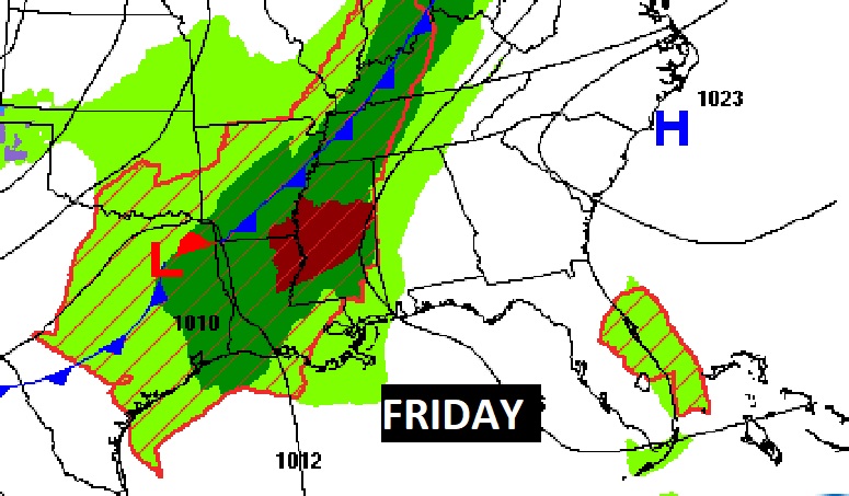
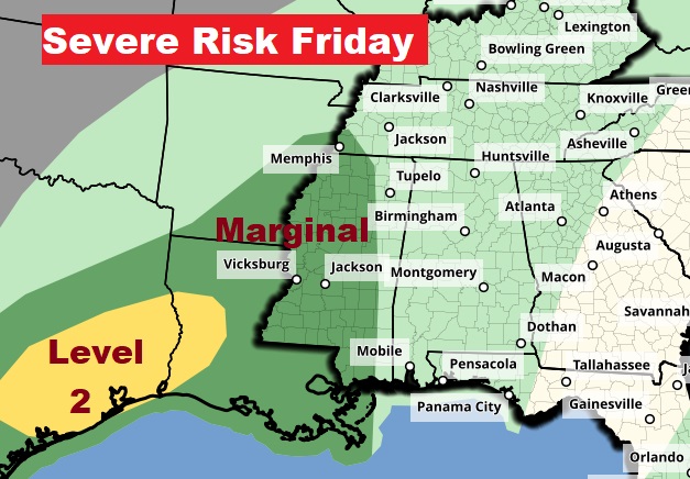
The approaching Cold front will bring a severe weather threat to states west of us Friday.
Expect a change of climate after the cold front passes. Significantly cooler…again.
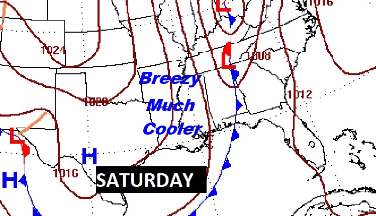
NEXT FEW DAYS: It’ll feel more like June Thursday with a high temperature teasing 90. Partly sunny Friday. High 86. Risk of widely scattered showers by Friday afternoon. Scattered showers and thunderstorms Friday night and early Saturday, before the cold front sweeps through. Then, much cooler. Back to the 40’s Saturday night. Sunday’s high only in the 60’s. Expect lower 40’s by Monday morning.
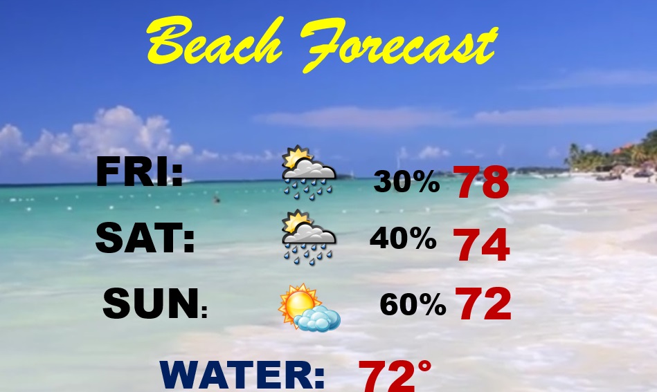
BEACH FORECAST: Risk of scattered thunderstorms by Friday/Friday night and especially Saturday. Cooler Saturday night and Sunday. Gulf water temperature 72. HIGH Rip Current Risk Friday & Saturday and moderate Sunday.
Thanks for reading this Blog this morning! This morning we are LIVE on the radio from 6 to 9 on NewsTalk 93.1. Watch us on TV on CBS 8 and ABC 32. I’ll have another update for you in the morning. Have a nice day!
–Rich