
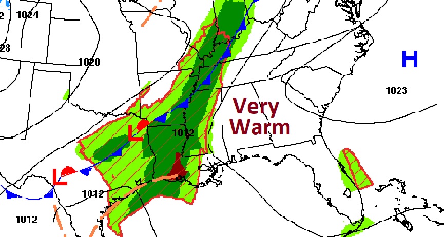
Happy Friday! Once again this morning, this blog update is short and sweet. Because, frankly, there’s not much to say. And, in a normally very turbulent month of April, that’s a good thing. Get ready for very warm Friday as we head for the upper 80’s again. A cold front is on the way. This is the front that has brought so much severe weather to America’s Heartland. But, as front approaches Alabama, it will be come rather meek and mild. Scattered showers and storms are possible overnight and early Saturday, but nothing severe. Cooler air will follow the front, but not cold. All in all the weekend forecast looks good. I don’t see any “big ticket” weather in the next few days. Here’s my brief forecast discussion.
CLIMATE DATA: Yesterday we had a cool morning low of 50, but a warm afternoon high of 87. (Normal 80/54)
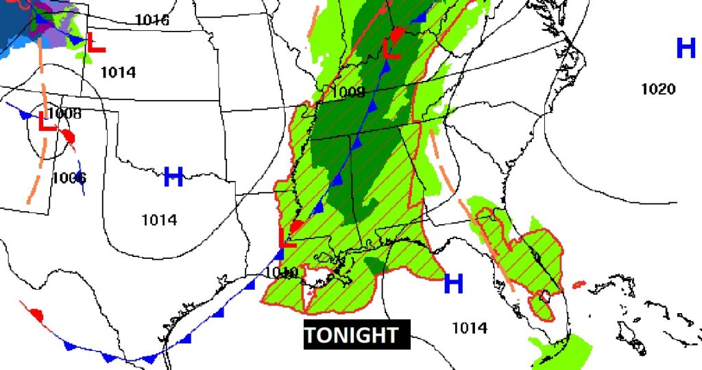
TODAY: Very warm. High 87. A sun/cloud mix. Afternoon rain chance, not zero, but generally 20% or less. Isolated. Scattered showers and thunderstorms tonight and early Saturday as the weakening cold front sweeps eastward. Southeast wind 6 to 12 mph. Low tonight 58.
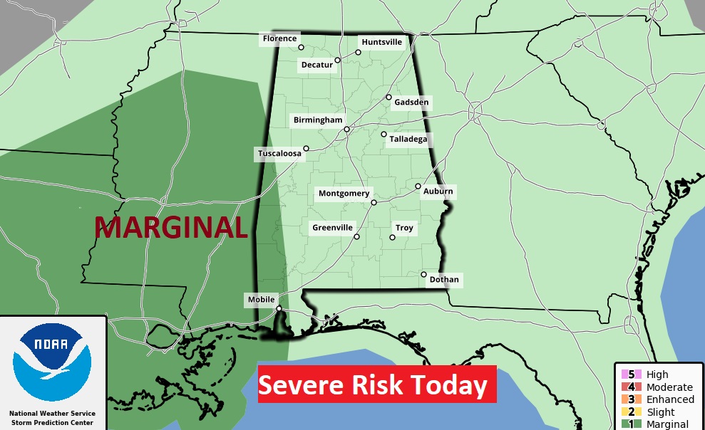
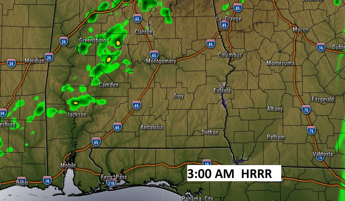
The approaching Cold front will bring a severe weather threat to states west of us Friday. But, the severe weather dynamics will quickly lift to the northeast before the front arrives on our door step.
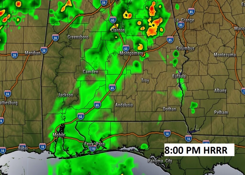
Here’s Future Radar. This model (HRRR) shows two lines of showers (tonight & early Saturday) which tend to fall apart on our doorstep.
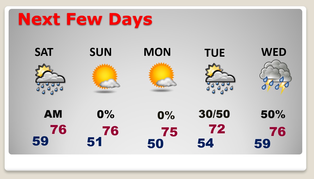
NEXT FEW DAYS: Risk of showers early Saturday, then improvement. Mid to upper 70’s Saturday. Much cooler Saturday night. Nice Sunday. Mid 70’s. Great day Monday. Comfortable. Risk of rain and maybe some thunderstorms returns by late Tuesday and Wednesday. It does not look Severe.
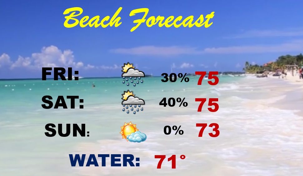
BEACH FORECAST: Risk of scattered thunderstorms by late today and tonight and Saturday. Comfortable weekend, even after the cold front moves through. Gulf water temperature 74. HIGH Rip Current Risk today through Sunday.
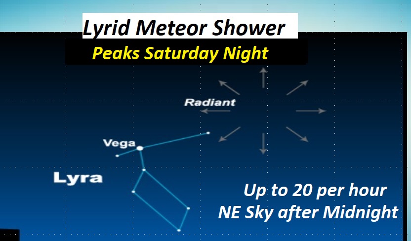
METEOR SHOWER: The Lyrid Meteor shower peaks late Saturday night. Looks like clouds won’t be a problem. It’s not one of the bigger meteor showers of the year, but there should be about 20 per hour. Check out the northeast sky after midnight, far away from city lights. Enjoy!
Thanks for reading this Blog this morning! This morning we are LIVE on the radio from 6 to 9 on NewsTalk 93.1. Watch us on TV on CBS 8 and ABC 32. I’ll have another update for you in the morning. Have a nice day!
–Rich