
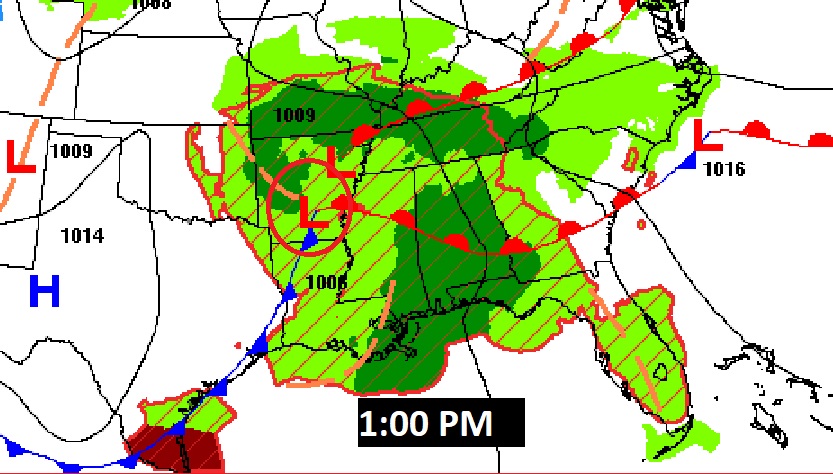
A severe thunderstorm watch continues in effect for much of southwest Alabama until Noon. This includes Butler and Crenshaw counties. Scattered Damaging wind gusts to 75 mph, hail up to 2” in diameter and a couple of tornadoes are possible. #alwx

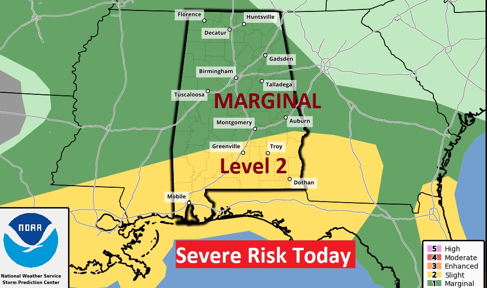
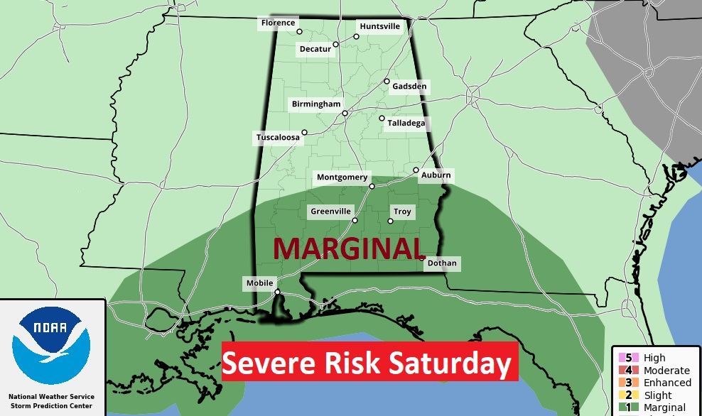
Good Morning! Expect an Active weather day, today. Showers and storms are not only likely, some storms could be strong to severe. There is a Marginal Severe Risk for most of us. There is a Level 2 Risk for much of south Alabama, mainly south of a Greenville/Troy line. While damaging winds are the main threat, tornadoes can’t be ruled out. More showers and storms are in the forecast for Friday and Saturday. There’s much to talk about on today’s Blog Update. Here’s my brief forecast discussion.
CLIMATE DATA: Yesterday we had morning low of 56, and a afternoon high of 83. (Normal 81/55) Airport Rainfall: .55” I had 1.42” in East Montgomery.
TODAY: Active weather day, today. Showers and storms are not only likely, some storms could be strong to severe. There is a Marginal Severe Risk for most of us. There is a Level 2 Risk for much of south Alabama, mainly south of a Greenville/Troy line. While damaging winds are the main threat, tornadoes can’t be ruled out. High today near 80. East wind 10 to 15 mph. Low tonight 63.

Here’s today’s outlook from the Storm Prediction Center. Much of the state is in a Marginal Severe Risk. There is a Level 2 Risk for much of south Alabama, mainly south of a Greenville/Troy line. While damaging winds are the main threat, tornadoes can’t be ruled out.
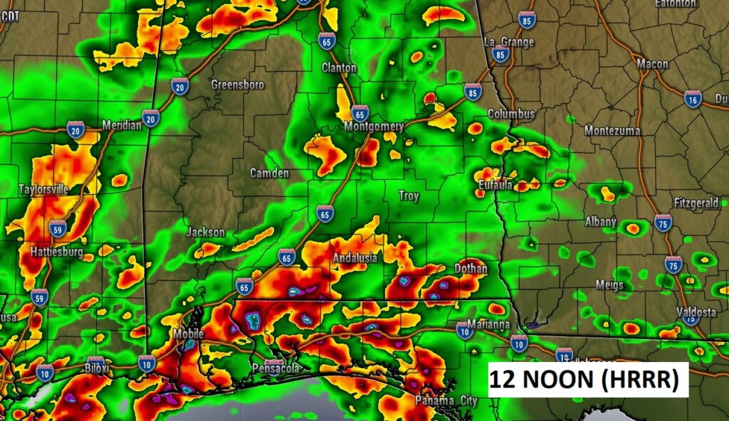
Future Radar suggests we could have a VERY active radar by lunchtime. Busy afternoon ahead.

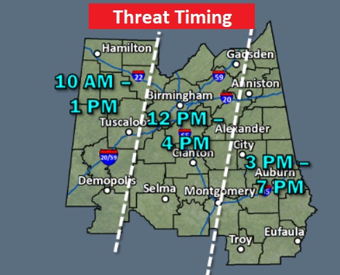
Don’t take this map literally, but here’s a NWS Threat Timing Map which may help you with your planning today.
NEXT FEW DAYS: The active and wet at times pattern will continue. Scattered showers and thunderstorms continue in the forecast Friday & Saturday. There could even be some lingering showers on Sunday. By Monday, we should begin a stretch of dry days.
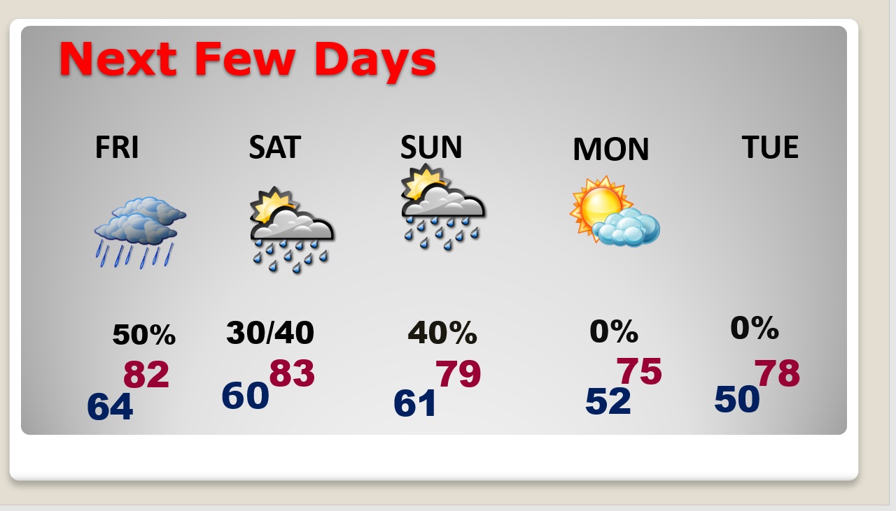
Even Saturday, there could be more strong to severe storms. Marginal Severe Risk.

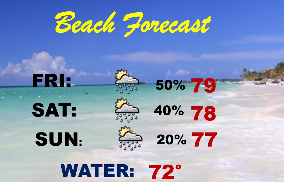
BEACH FORECAST: Wet at times today through Sunday. Showers and thunderstorms. Highs in the 70’s Gulf water temperature 72.
DEADLY TORNADO ANNIVERSITY: Few words area adequate to describe the enormity of what happened the United States on April 27, 2011. Not only the biggest tornado outbreak in US history, Alabama, unfortunately, was the epicenter, with 62 tornadoes and 252 deaths. There were four rare EF-5 tornadoes, 348 deaths in 9 states. Simply horrendous. Unprecedented in weather history. On THIS day, twelve years ago.
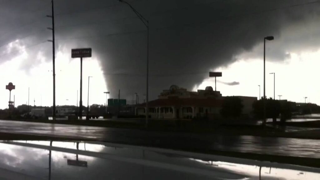

Close to home, here, — the Eclectic/Lake Martin EF-4 claimed 8 lives. We will NEVER forget April 27, 2011.


Thanks for reading this Blog this morning! This morning we are LIVE on the radio from 6 to 9 on NewsTalk 93.1. Watch us on TV on CBS 8 and ABC 32. I’ll have another update for you in the morning. Have a nice day!
–Rich