
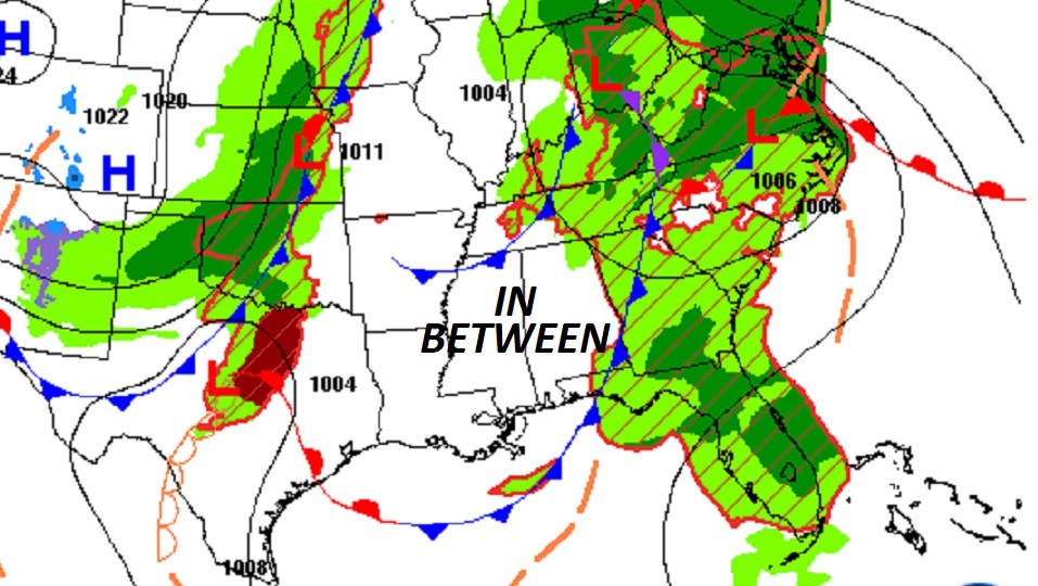
Good Morning! Today, Alabama gets a brief break in-between storm systems, but it won’t last long. If you have weekend plans, be flexible. Another storm system will bring in yet another round of showers and storms by Saturday afternoon and Saturday night. There may even be some lingering showers in the first half of the day on Sunday. After that, the news gets better. It looks like an extended string of dry, storm-free days for most of next week. I don’t see any “big ticket” weather in our future for the first several days of May. Here’s my brief forecast discussion.
CLIMATE DATA: Yesterday we had morning low of 62, and a afternoon high of 73. (Normal 81/56) Airport Rainfall: .02
TODAY: Patchy AM fog. Today will start off mostly cloudy. Gradually we’ll start to see some sunshine. Rain chance today 20% or less. We are briefly in between storm systems. High today 82. West wind 5 to 10. Low tonight near 60.
Alabama gets a brief break between storm systems today. Florida gets wet & stormy,
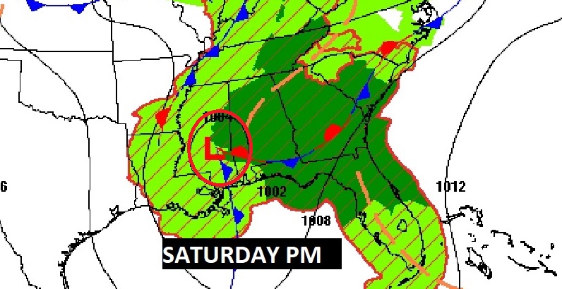
NEXT FEW DAYS: The active and wet at times pattern will continue. Scattered showers and thunderstorms continue in the forecast Saturday & Saturday Night. There could even be some lingering showers first half of the day on Sunday. By Monday, we should begin a long stretch of dry days.
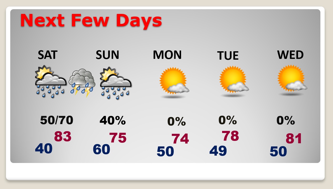
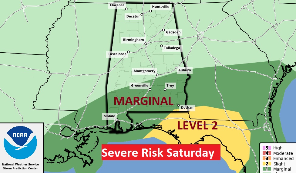
Again on Saturday, there could be more strong storms. Marginal Severe Risk for most of South Alabama.
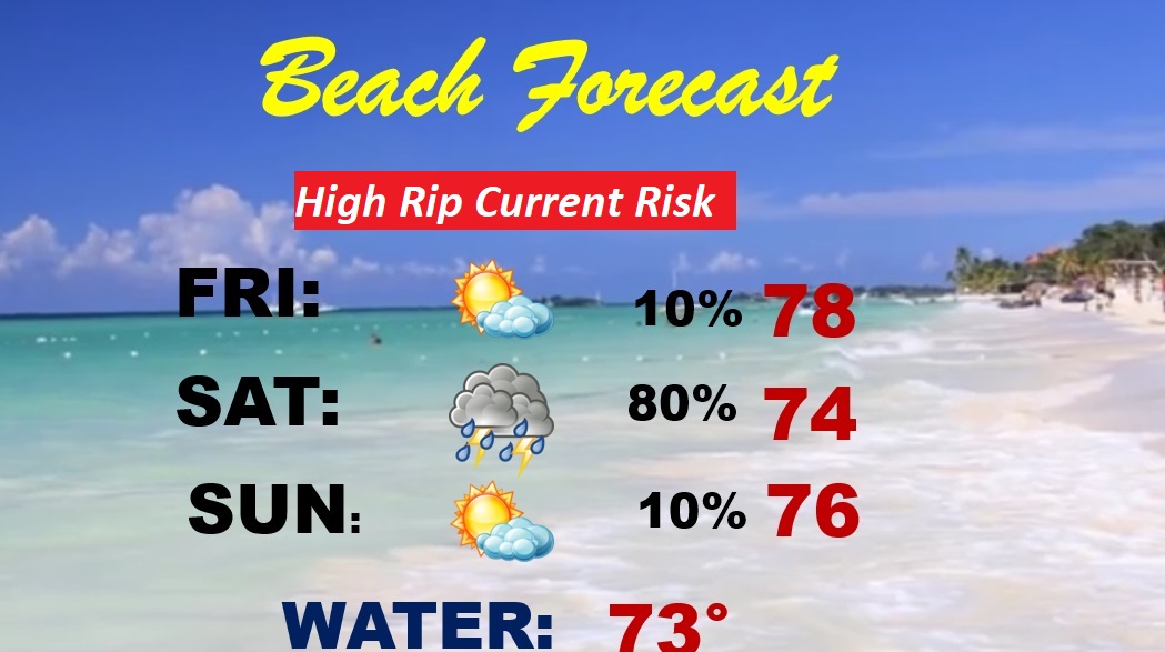
BEACH FORECAST: Wet Saturday and Saturday night. The rest of the weekend looks fine at the moment. Windy Sunday. Highs in the 70’s Gulf water temperature 73. High Rip Current Risk today through the weekend.
Thanks for reading this Blog this morning! This morning we are LIVE on the radio from 6 to 9 on NewsTalk 93.1. Watch us on TV on CBS 8 and ABC 32. I’ll have another update for you in the morning. Have a nice day!
–Rich