
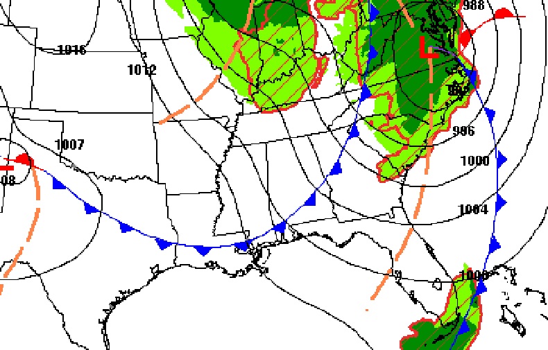
Good Morning! The storm system which brought drenching rains overnight will exit very early today. Cloudy skies will gradually give way to sunshine by mid to late morning. It will be breezy today and chilly tonight. The news is very good for the next several days. All things considered, we are in for a very nice first week of May. Abundant sunshine. Comfortable days. Chilly jacket weather nights. Several storm-free days. It’s a dry forecast until a small rain chance arrives Friday night. It’s a very brief Blog Update this morning, because there’s not much to say, and that’s always a good thing.
CLIMATE DATA: Yesterday we had morning low of 56, and an afternoon high of 75. (Normal 82/56) 24 Hour Airport Rainfall: .97” (East Montgomery 1.48”)
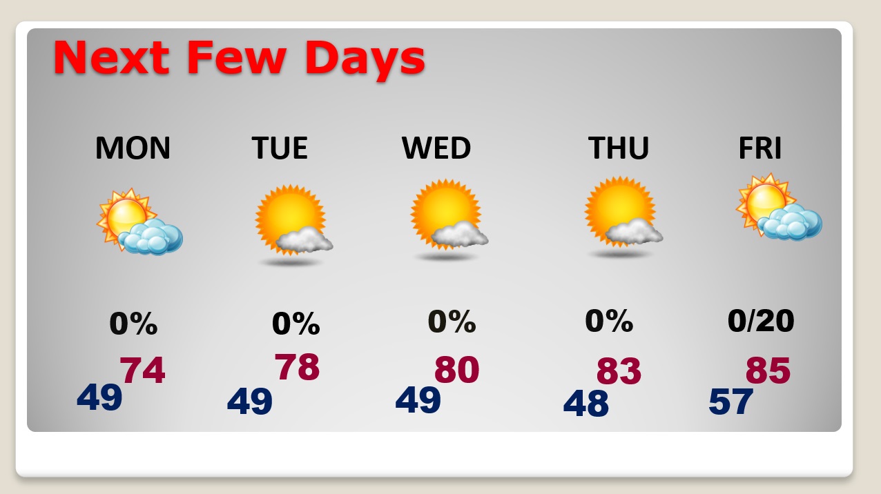
TODAY: Risk of leftover showers early. Cloudy through mid-morning. Then, gradual clearing. Windy. West wind 10 to 15 gusting to 25 mph. High 77. Partly Cloudy, breezy and colder tonight. Low 49.
Our storm system departs early. Awful day in the northeast. Another Severe weather threat in Florida.
NEXT FEW DAYS: All things considered, we are in for a very nice first week of May. Abundant sunshine. Comfortable days. Chilly jacket weather nights. Several storm-free days. 70’s Monday and Tuesday. Near 80 Wednesday. 80’s Thursday and Friday. Small rain chance by Friday night.
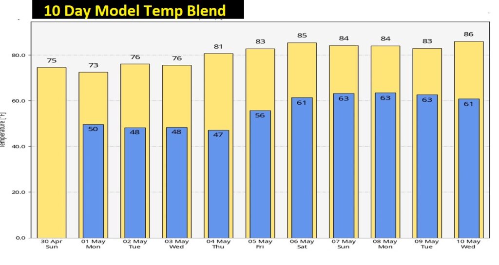
Here’s the Ten Day Model Temperature Blend.
.
Thanks for reading this Blog this morning! I’ll have another update for you in the morning. Have a nice weekend!
–Rich