
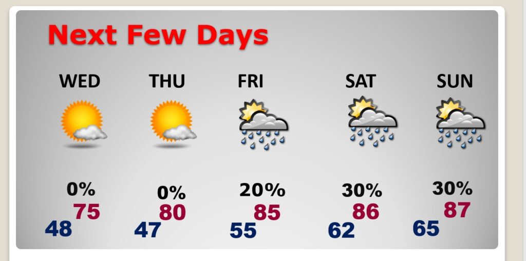
Good Morning! All things considered, it’s a pretty nice start to the month of May! Daily high temperatures are a bit below normal. Nights are chilly. Jacket weather. Your only complaint might be the gusty winds. Once again today, like yesterday, we could see wind gusts up to 30 mph. Temperatures will slowly moderate. We’ll be near 80 Thursday, and well into the 80’s Friday and Saturday. Spotty random showers will start to tease us by Friday and over the weekend, but there’s no “big ticket” weather to worry about for the next several days. What a great first week of May. In this Blog update, you’ll see that we’re in for much warmer days next week. Here’s my brief forecast discussion.
CLIMATE DATA: Yesterday we had morning low of 48, and an afternoon high of 75. (Normal 82/57) Peak wind gust 32 mph. No Rain.
TODAY: Sunshine, windy. High 77. West wind 12 to 20 mph, gusting to 30 mph. Clear, breezy, chilly tonight. Low 48.
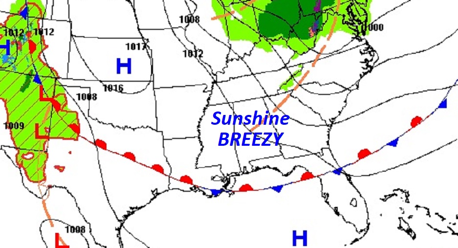
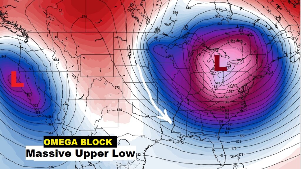
A HUGE Upper Level Low continues to dominates the entire eastern half of the nation. If you are student of Meteorology this coast to coast set-up is called an Omega Block.
NEXT FEW DAYS: All things considered, we are in for a very nice first week of May. Abundant sunshine. Comfortable days. Chilly, jacket weather nights. Several storm-free days. Upper 70’s Tuesday & Wednesday. 80’s Thursday and Friday. Small rain chance by Friday. Scattered showers Saturday.
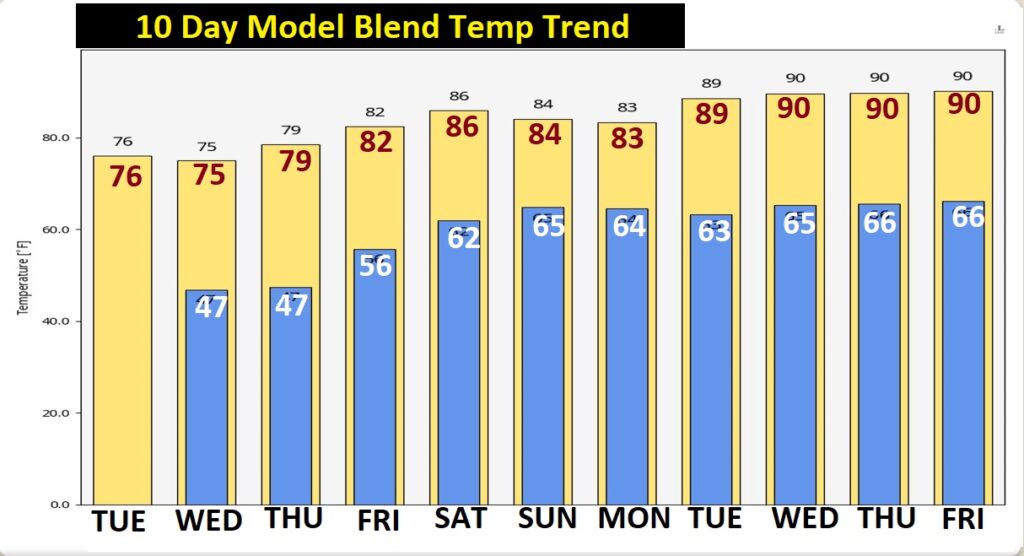
Here’s the Ten Day Model Temperature Blend. Below normal this week, with some rather chilly nights. But Much Warmer Next Week.
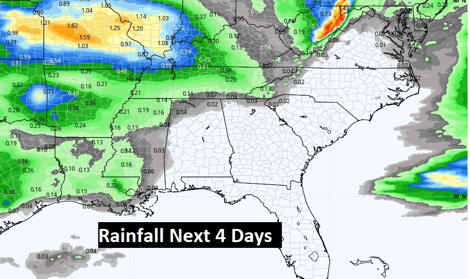
Expected rainfall through Friday.
.
Thanks for reading this Blog this morning! This morning we are LIVE on the radio from 6 to 9 on NewsTalk 93.1. Watch us on TV on CBS 8 and ABC 32. I’ll have another update for you in the morning. Have a nice day!
–Rich