
Good Morning! Radar was busy overnight. There were some strong storms in spots. The atmosphere is primed for more scattered storms today, tonight and Friday. A few storms could be strong. Meanwhile, our early Summer preview continues. It will be another warm & humid day. As we look ahead to the weekend, storms will “thin out” in coverage. The rain probability will comer down to 20% or less Saturday and Sunday. As an upper high builds over us, there will be increased sunshine and hotter days. By Mother’s day, temperatures will soar into the low to mid 90’s. The heat and humidity will persist into early next week. Here’s my brief forecast discussion.
CLIMATE DATA: Yesterday morning’s low was 67. Yesterday’s high was 84°. (Normal hi/lo 85/60) Airport rainfall: Trace.
TODAY: Warm & humid again today. Limited sunshine. Scattered “hit or miss” storms especially this afternoon & this evening, and into tonight. Some storms could be strong. Marginal Severe Risk through tonight. High 88. Low tonight 67.
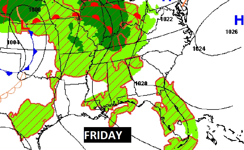
Looks like another active thunderstorm day across the Deep South.
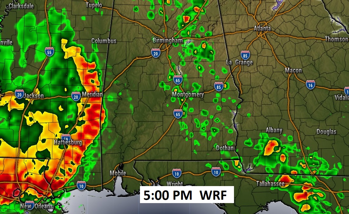
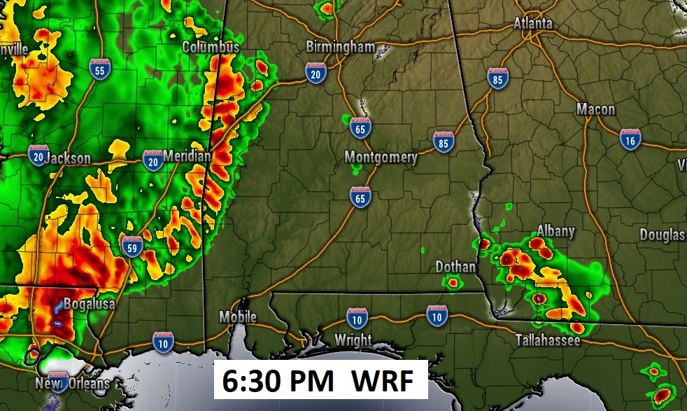
Future Radar shows a complex of storms, called an MCS, approaching the western counties by early evening. Some of the models are faster with the movement. Sone of the storms with this storm complex could be strong/severe.
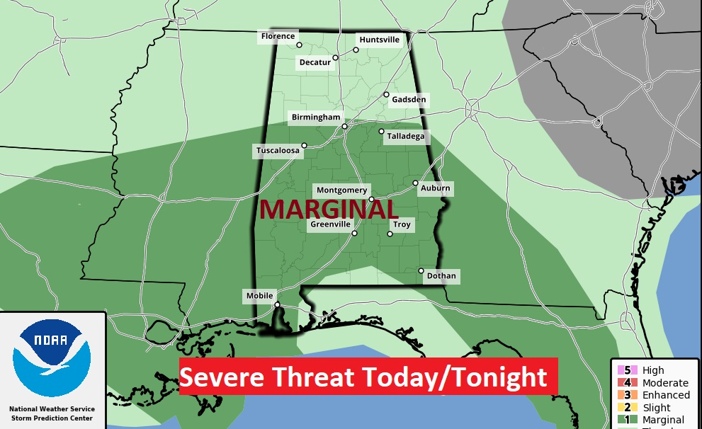
The Storm Prediction Center has much of the state in a Marginal Severe Risk. Damaging wind gusts are the main threat. This is not a tornado situation.
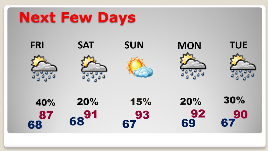
NEXT FEW DAYS: Our summer preview will continue. Warm & humid. Expect scattered, random hit or miss storms through Friday. By Saturday the number of storms will start to thin out. It’s hot now, but, it should be hotter over the Mother’s Day weekend. I’ve got us near 93 on Sunday. The record is 96 from 1881. The heat and humidity will persist into early next week, with more scattered storms.
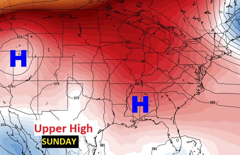
The big upper ridge of high pressure over us is promoting this Summer-like pattern. The upper high only gets stronger by the weekend. Looks like a hot and humid Mother’s Day Weekend.
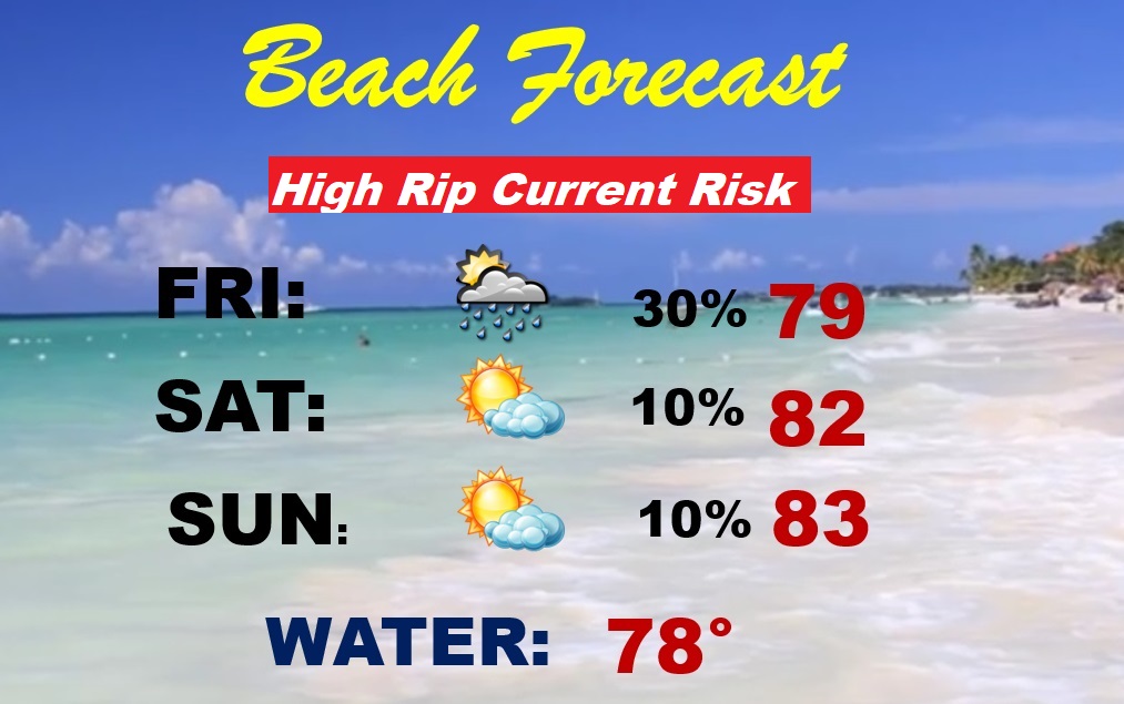
BEACH FORECAST: Looks like a pretty favorable weekend beach forecast. Scattered storms perhaps Friday. Mainly dry and warm Saturday and Sunday. Finally, the Gulf water is starting to warm up. Gulf water temperature 78. HIGH rip current risk Friday through Sunday.
Thanks for reading this Blog this morning! This morning we are LIVE on the radio from 6 to 9 on NewsTalk 93.1. Watch us on TV on CBS 8 and ABC 32. I’ll have another update for you in the morning. Have a nice day!
–Rich