
Good morning! Sunday was the hottest day of the year so far with 94 degrees. Today, we’ll be hot again. The radar will be much more active this week. Expect scattered, random hit or miss storms each day through Friday. Highs will be mostly in the mid to upper 80’s with very little day to day change. Here’s my brief forecast discussion.
CLIMATE DATA: Yesterday was the hottest day of the year so far. Yesterday morning’s low was 68. Yesterday’s high was 94°. (Normal hi/lo 86/61) Record High 96 in 1881. Airport rainfall: 0.00” East Montgomery: .06”
TODAY: Today will be quite hot again. Mostly sunny. High today: 93. (Today’s RECORD High is 94 from 1899) Scattered Random PM showers and storms. North wind at 5 to 10 mph.
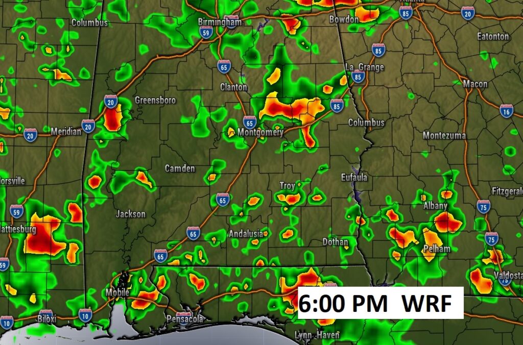
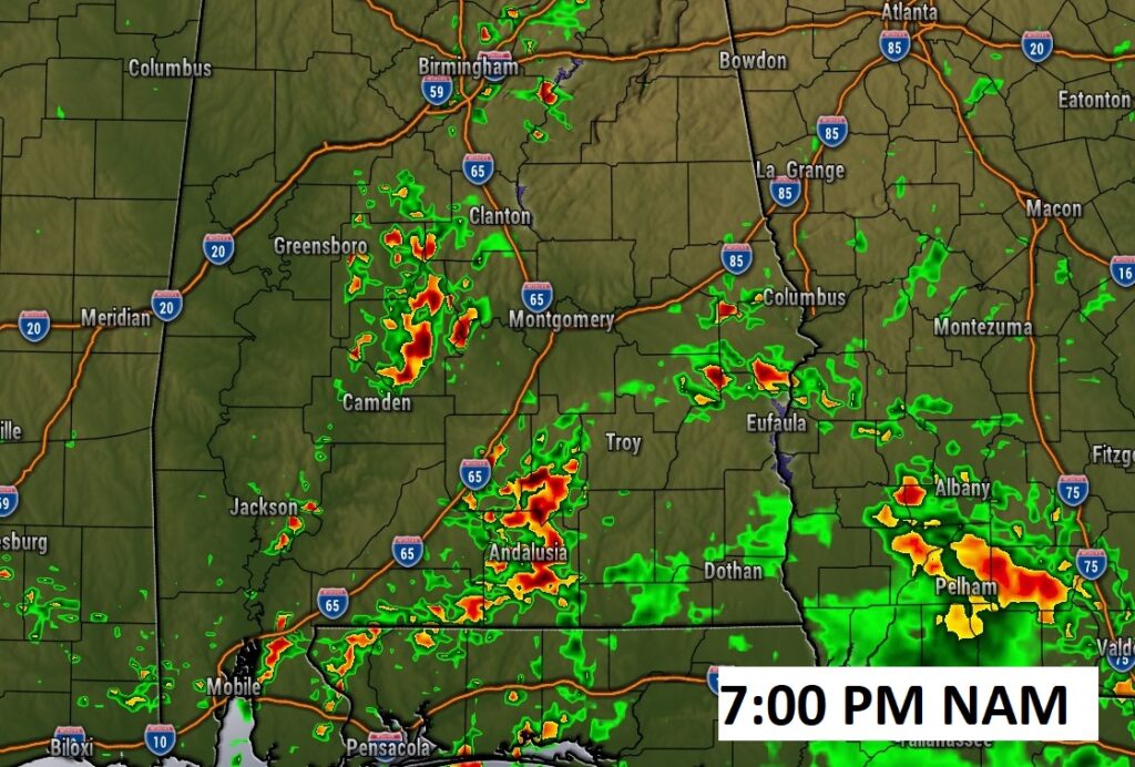
Future Radar suggests that the storms may get a late start today. The hi-res models are favoring the early evening hours for random storms.
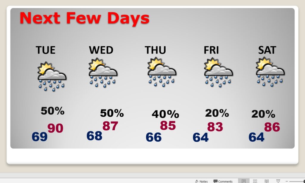
NEXT FEW DAYS: The radar will be much more active this week. Expect scattered, random hit or miss storms through Friday. Showers and storms will be random, but the chances of encountering one will be about 40-50% each day this week, through Thursday. We may get a little break Friday. Highs will be in the mid to upper 80’s each day.
Thanks for reading this Blog this morning! This morning we are LIVE on the radio from 6 to 9 on NewsTalk 93.1. Watch us on TV on CBS 8 and ABC 32. I’ll have another update for you in the morning. Have a nice day!
–Rich