
Good morning! Get ready for another 90+ degree day in May. Sunday we had 94, yesterday we had 93. After today, temperatures will back off a bit. The radar will be very active this week. Expect scattered, random hit or miss storms each day. We may get a little break in the number of storms Friday. Another frontal system will approach Saturday. Here’s my brief forecast discussion.
CLIMATE DATA: Yesterday morning’s low was 69. Yesterday’s high was 93°. Maximum Heat Index 99. (Normal hi/lo 86/61) Record High 94 in 1889. Airport rainfall: 0.00” .
TODAY: Today will be quite hot & humid again. Mostly sunny. High today: 91 Scattered Random PM showers and storms. SE wind at 5 to 10 mph.
Showers & storms becoming likely this evening and into tonight. Low tonight 68
Future Radar suggests there will be more storms on the radar today, then yesterday. Each day the radar will become more active.
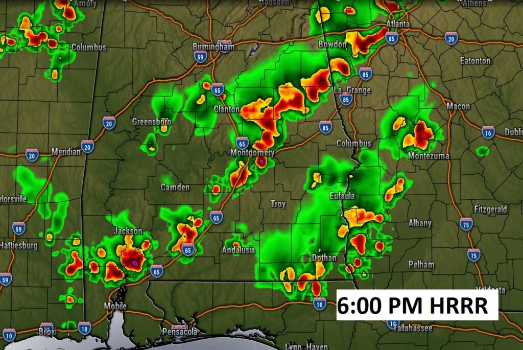
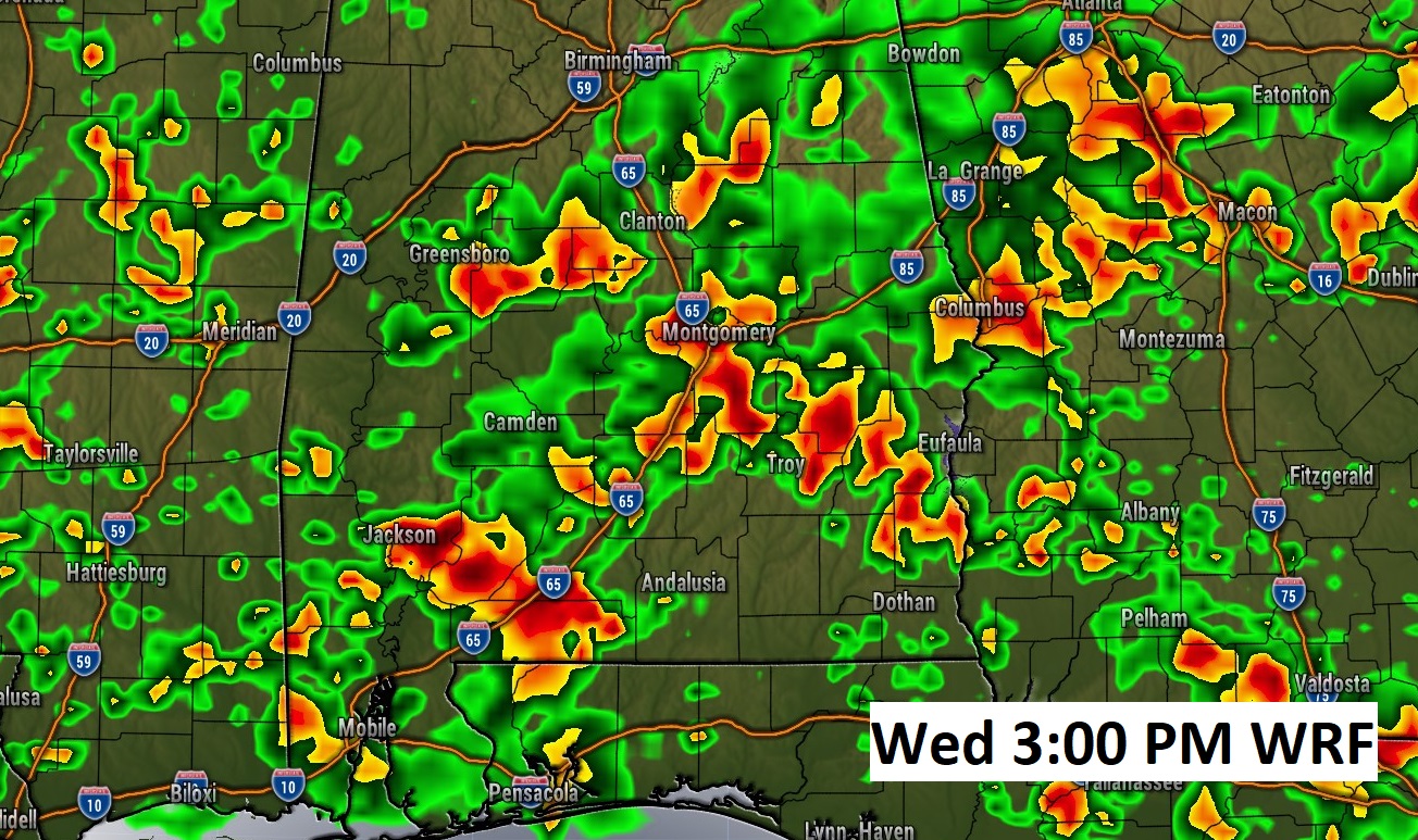
WEDNESDAY: Wednesday appears to be the highest rain chance of the week. Showers and storms become likely as a frontal system moves through the Gulf South. Here’s a Future radar example.
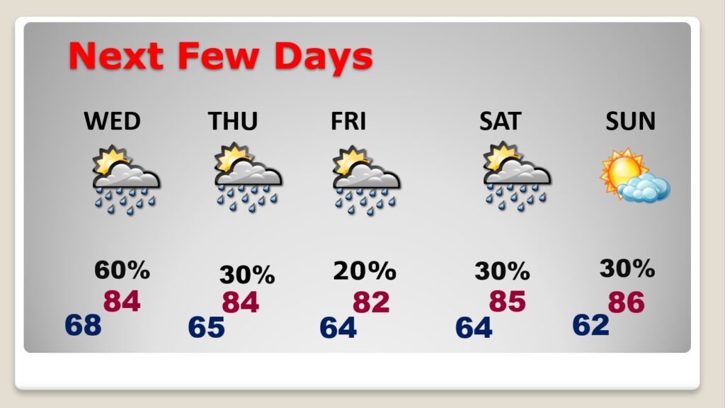
NEXT FEW DAYS: The radar will be very active this week. Expect scattered, random hit or miss storms each day. We may get a little break in the number of storms Friday. Another frontal system will approach Saturday. Highs will fall back to the low to mid 80’s Wednesday through Saturday.
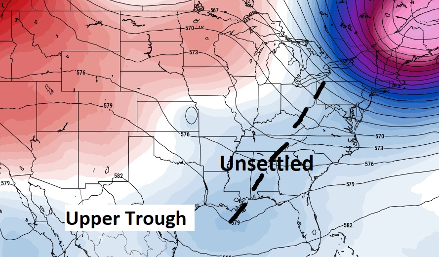
A large scale Upper Trough will be responsible for the better rain chances, and a decline in high temperatures in the week ahead.
Thanks for reading this Blog this morning! This morning we are LIVE on the radio from 6 to 9 on NewsTalk 93.1. Watch us on TV on CBS 8 and ABC 32. I’ll have another update for you in the morning. Have a nice day!
–Rich