
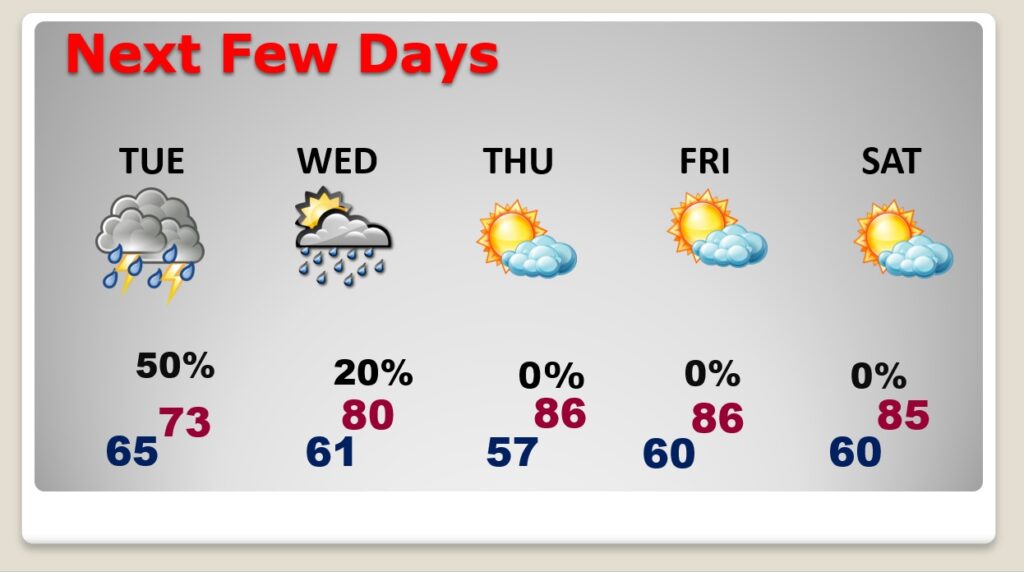
Good morning! Take the rain gear today. The risk of showers and storms are running high as a Low pressure storm system moves along the Gulf Coast. In fact, the better than normal rain chance will continue tomorrow. Things start to get a lot better by Wednesday and Thursday. We’ll be in the lower 80’s today. But, Tuesday will be different, as a “wedge” of much cooler air slides down the Appalachians into Alabama. Temperatures will be much cooler. Perhaps lower 70’s in central Alabama and even cooler toward the Georgia border. In the business we call this Cold Air Damming (CAD.) Thursday gets my vote as the best day of the week. Sunshine. Mid 80’s. Here’s my brief forecast discussion.
TODAY: Showers and storms are likely today and tonight. Count on it. Most towns will get wet. High today 83. Low tonight 65.
Here’s a couple of Future Radar examples. Radar will be colorful.
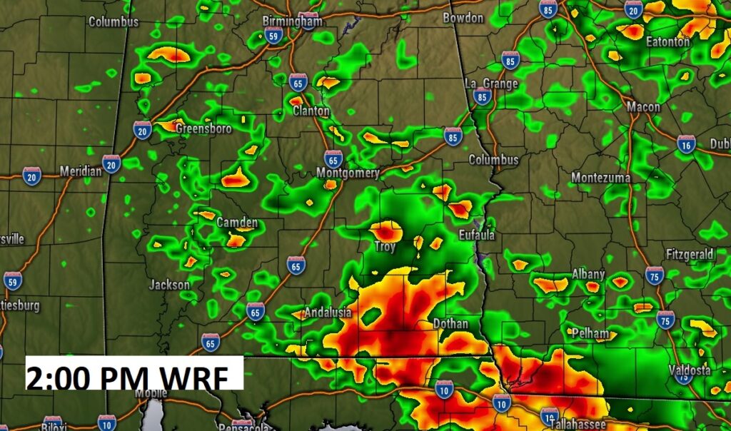
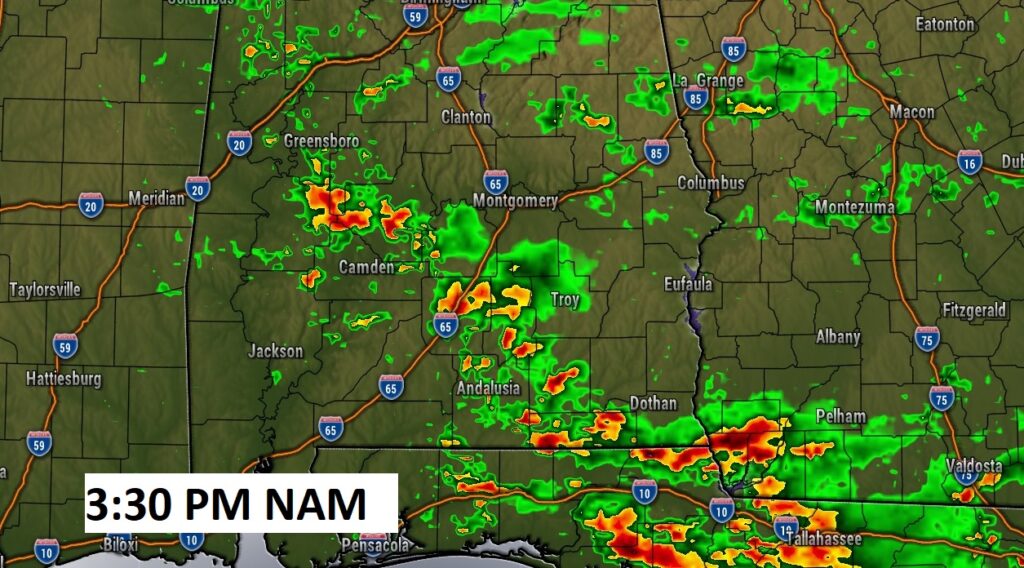
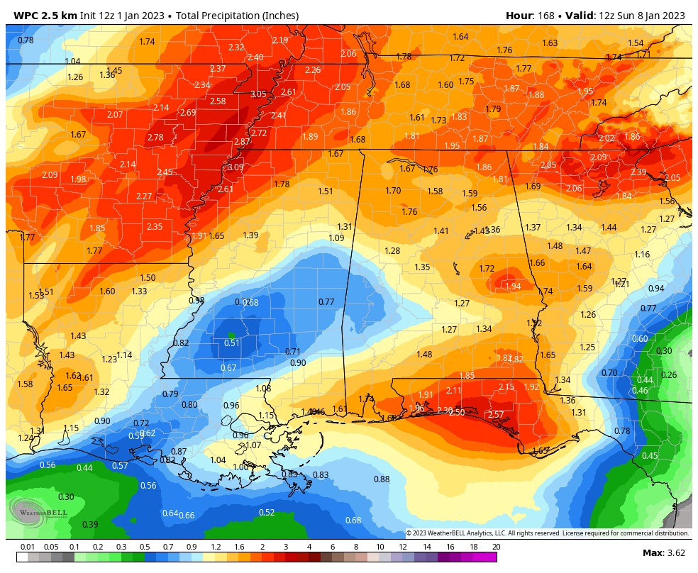
Rainfall amounts will be highest in the southeast counties.
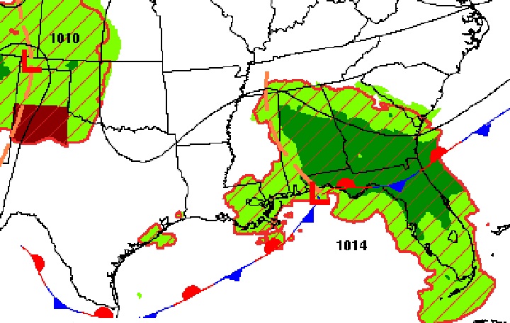
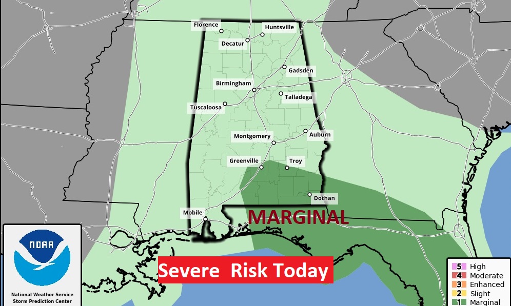
Some storms could be strong to severe especially in Southeast Alabama where there is a Marginal Severe Risk.
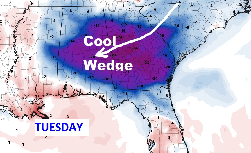
TUESDAY’S COOL WEDGE: We’ll be in the lower 80’s today. But, Tuesday will be different, as a “wedge” of much cooler air slides down the Appalachians into Alabama. Temperatures will be much cooler. Perhaps lower 70’s in central Alabama and even cooler toward the Georgia border. In the business we call this Cold Air Damming (CAD.)
NEXT FEW DAYS: Things start to get a lot better by Wednesday and Thursday. Thursday gets my vote as the best day of the week. Sunshine. Mid 80’s. Tuesday will be unusually cool. Scroll up and read about Tuesday’s Cool Wedge.
Thanks for reading this Blog this morning! This morning we are LIVE on the radio from 6 to 9 on NewsTalk 93.1. Watch us on TV on CBS 8 and ABC 32. I’ll have another update for you in the morning. Have a nice day!
–Rich