
12:30 PM UPDATE:
BREAKING NEWS:
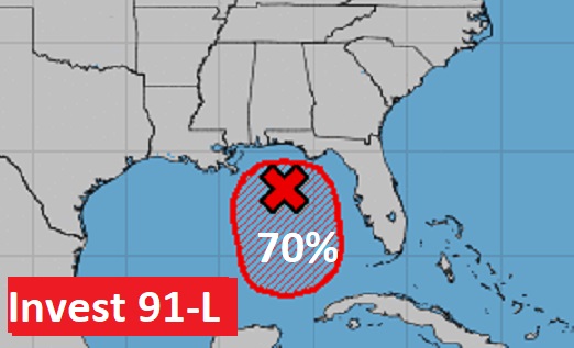
Drama builds on this first day of Hurricane Season. NHC now says Invest 91-L has a 70% chance of development. Meanwhile, Air Force Recon is poised on the runway at Keesler AFB, Biloxi to take off (12:45 PM CDT, Teal 71) for the short flight to the northern Gulf. #alwx #Invest91L
EARLY MORNING UPDATE:
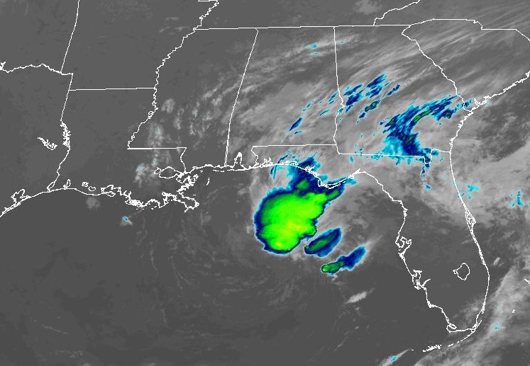
Good morning! Welcome to June! Meteorological Summer starts today, and we are settling into a very typical summertime pattern. Hot and humid days, mostly in the low 90’s. Fairly isolated, random pop-up showers and storms each day, mostly in the afternoon & evening hours. It’s ironic, on this first day of Hurricane Season and the National Hurricane Center is tracking INVEST 91-L in the Gulf. The system has gotten a little more prominent with a cluster of storms near the center of low pressure in the central Gulf. But, it should drift to the south and SE and it’ll have little or no effect on us. Here’s my brief forecast discussion.
CLIMATE DATA: Wednesday’s morning low was a cool 63 at MGM. Afternoon high was 86. Normal hi/lo: 89 and 66. Trace of rain at the airport.
TODAY: Sun/Cloud mix. A little more humid. High 88. Spotty, random showers & storms, especially afternoon & evening, fading out at night. East wind 5 to 10 mph. Partly cloudy tonight. Low 67.
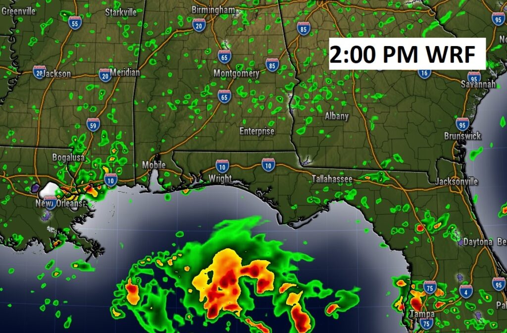
Here’s Future Radar at 2:00PM (WRF). Spotty pop up showers in central & south Alabama. But, look in the Gulf. A concentrated are of showers and storms associated with Invest 91-L. (scroll down for more)
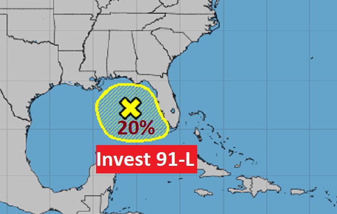
INVEST 91-L IN THE GULF: It’s ironic. First day of Hurricane Season and the National Hurricane Center is tracking INVEST 91-L in the Gulf. The system has gotten a little more prominent with a cluster of storms near the center of low pressure in the central Gulf. It has a tiny window of possible tropical development in the next 48 hours. 20% chance. It will start to drift south and southeastward. Air Force Recon and NWS recon is standing by to visit the system today if necessary.
Is your name on this list? Here’s the list of names for the 2023 hurricane season.

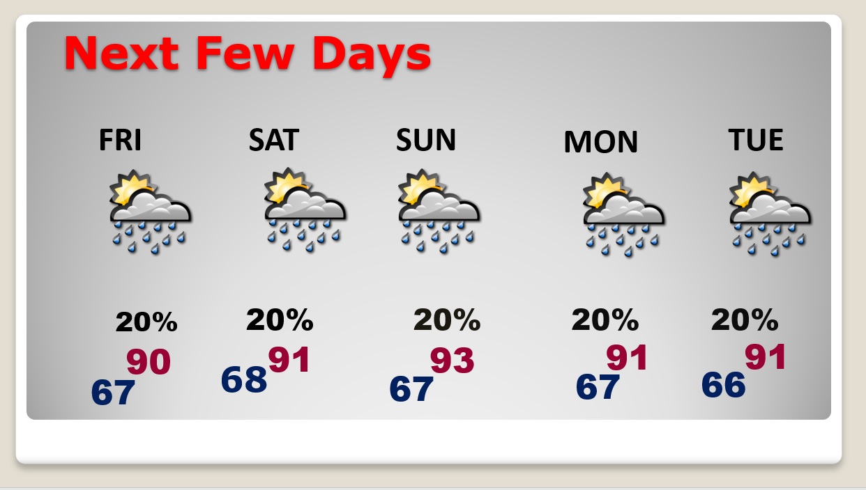
NEXT FEW DAYS: It’s June now, and we are settling into a very typical summertime pattern. Hit and humid days, mostly in the low 90’s. Fairly isolated, random pop-up showers and storms each day, mostly in the afternoon & evening hours,
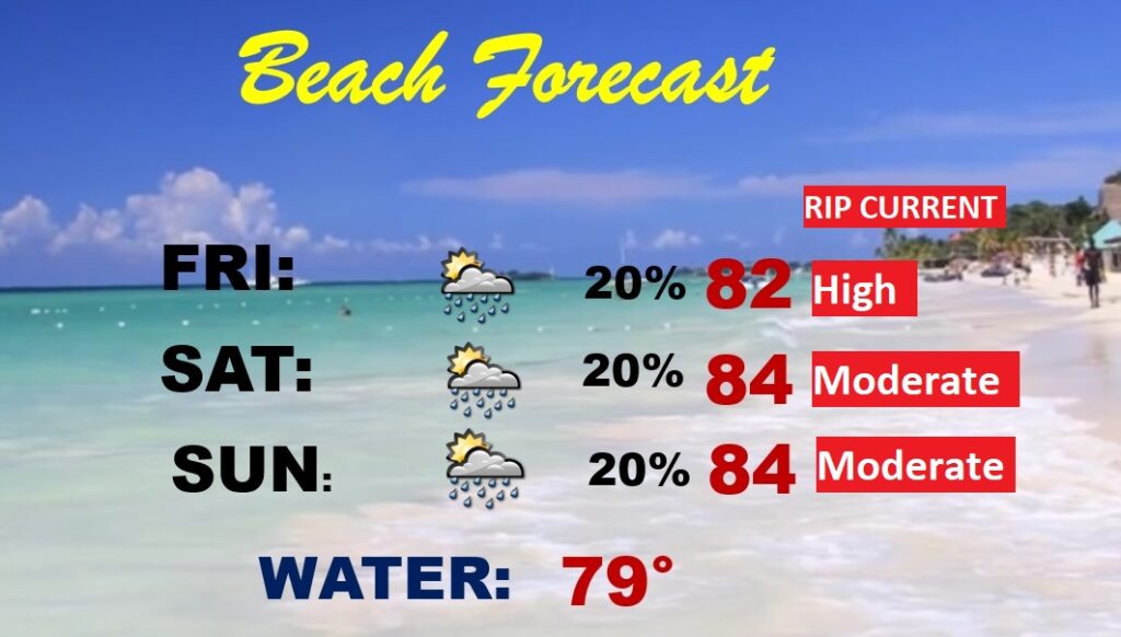
BEACH FORECAST: That Gulf disturbance will probably have no effect on the forecast. Pretty routine. Highs in the low to mid 80’s. Widely scattered thundershowers. Gulf water at 79 degrees. High rip current risk today through Friday, and moderate Saturday & Sunday.
Thanks for reading this Blog this morning! This morning we are LIVE on the radio from 6 to 9 on NewsTalk 93.1. Watch us on TV on CBS 8 and ABC 32. I’ll have another update for you in the morning. Have a nice day!
–Rich