
Good morning! It was a stormy Sunday and a very stormy early Monday morning, as expected. Looks like an active weather week ahead. A stubborn frontal system will take up residence in Alabama, oscillating north and south. That will be the focus for better than normal rain chances for several days through Saturday. Here’s my brief forecast discussion.
CLIMATE DATA: Yesterday’s morning low was 72 at MGM. Afternoon high was 91. Normal hi/lo: 91 and 68. Airport rainfall: .34” past 24 hours. .74” for the weekend. East Montgomery weekend rainfall: .93″
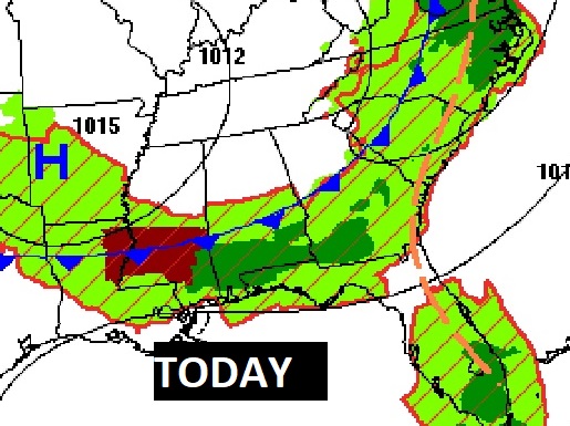
TODAY: Mostly cloudy in the morning, Gradually more sunshine later. Risk of spotty storms mainly in the morning. By afternoon, most of the activity will be confined to south Alabama. High today upper 80’s to near 90. Low tonight 68.
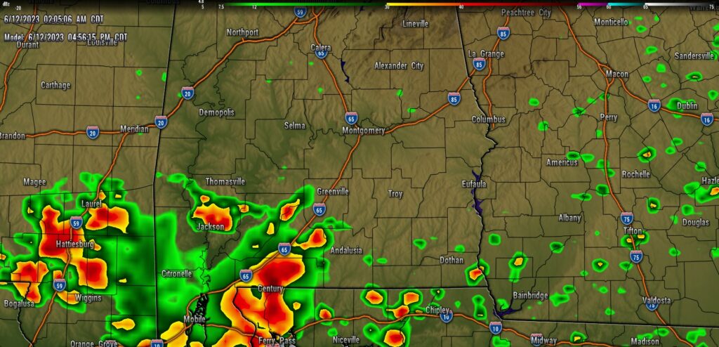
FUTURE RADAR: Today, as the frontal system edges southward the best chance of showers and storms will be across the southern third of the state.
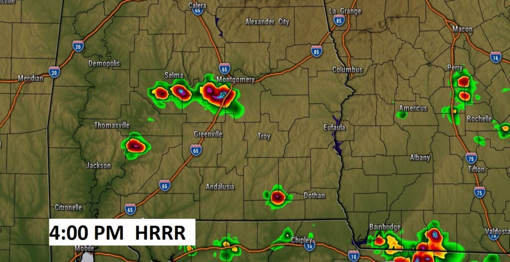
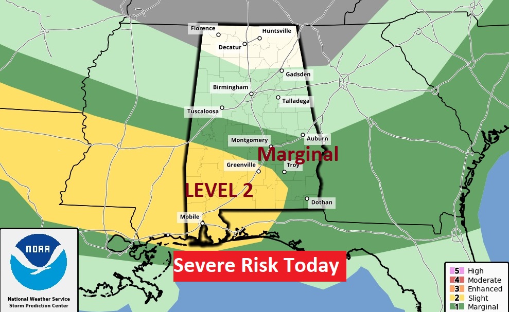
Some storms in South Alabama could be strong to severe.
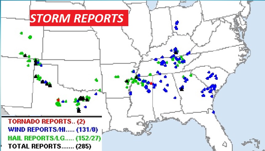
Over 200 storm reports yesterday, across the South…mostly wind damage, and mainly ahead of that frontal system from Texas to the Carolinas.
.
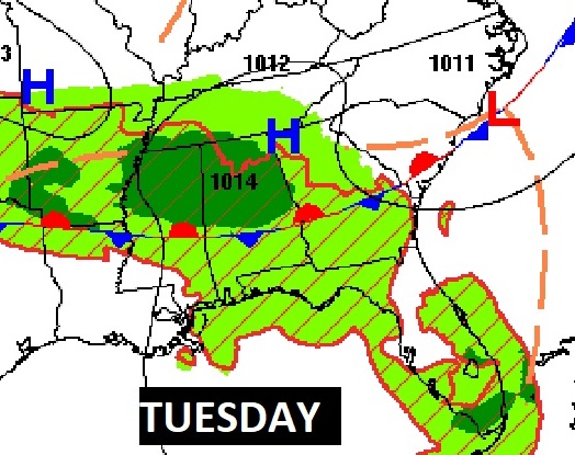
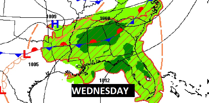
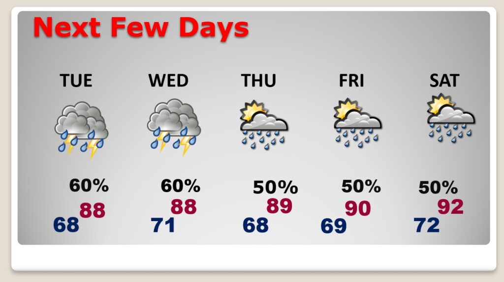
NEXT FEW DAYS: Looks like an active weather week ahead. A stubborn frontal system will take up residence in Alabama, oscillating north and south. That will be the focus for better than normal rain chances for several days through Saturday.
Highs will be mostly in the upper 80’s. Lows at night around 70.
Thanks for reading this Blog this morning! This morning we are LIVE on the radio from 6 to 9 on NewsTalk 93.1. Watch us on TV on CBS 8 and ABC 32. I’ll have another update for you in the morning. Have a nice day!
–Rich