
SEVERE THUNDERSTORM WATCH
(12:30 PM June 13/2023)
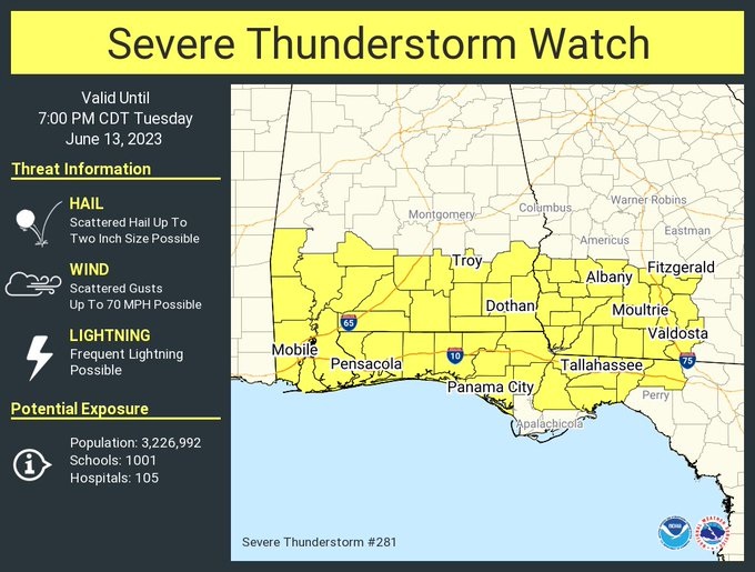
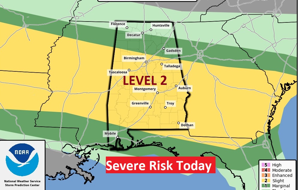
A severe thunderstorm watch covers all of south Alabama until 7:00 PM. This watch is along and south of Demopolis/Camden/Eufaula line. Damaging wind gusts to 70 MPH, and hail is large as hen eggs (2” in diameter) is possible. This is part of a multi-round, multi-day severe weather event today through Thursday. Level 3 Enhanced Risk Wednesday. #alwx
Good morning! Get ready for a very active, potentially stormy series of days. The Storm Prediction Center has us in at least a Level 2 risk today, Enhanced level 3 risk Wednesday, and Level 2 Thursday. Damaging wind gusts and large hail are the main risk. The tornado threat is small but not zero. Storms will be most numerous in the afternoon & evening. The number of storms will start to thin out Friday. Here’s my brief forecast discussion.
A stalled front will be the focus for storms next three days.
TODAY: Scattered to numerous showers and storms especially this afternoon and this evening. Some storms strong, possibly severe. Damaging wind gusts and large hail are the main risk. Locally heavy downpours & intense lightning.
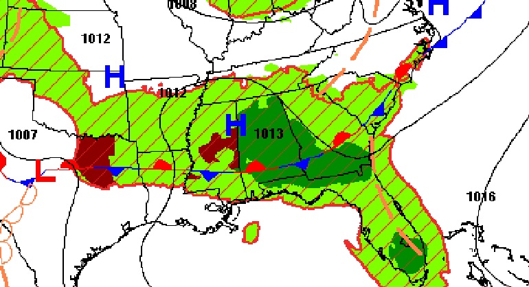
FUTURE RADAR: Here’s two hi-res model examples at mid afternoon. Both suggest we’ll be dealing with a strong complex of storms (MCS). Don’t take the 2:00 hour literally.
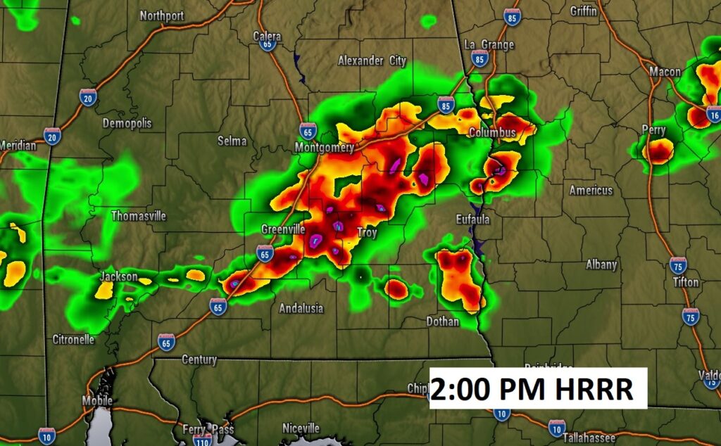
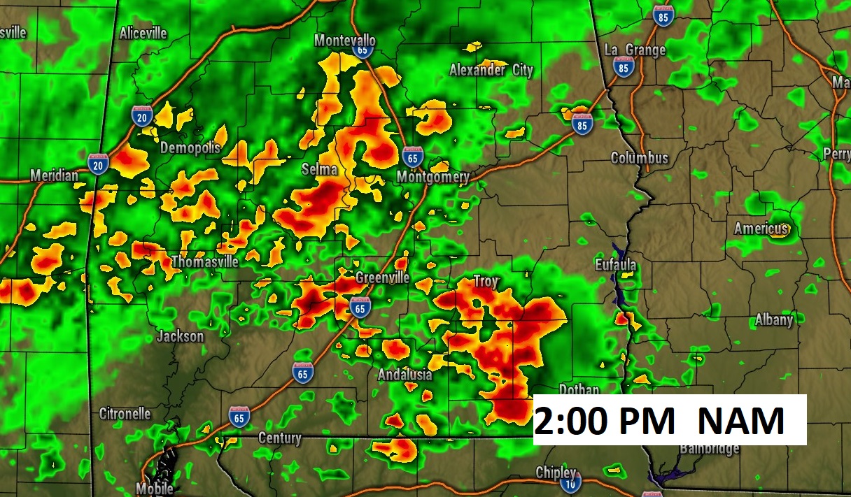
SPC has us in a Level2 out of 5 Severe Risk today and this evening. Damaging wind gusts and large hail are the main risk. The tornado risk is very small but not zero. Warnings and perhaps a Severe Thunderstorm Watch is a good bet.
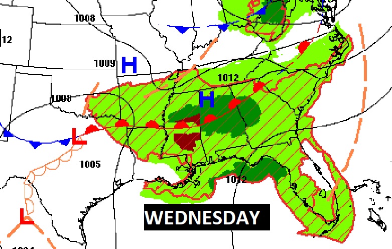
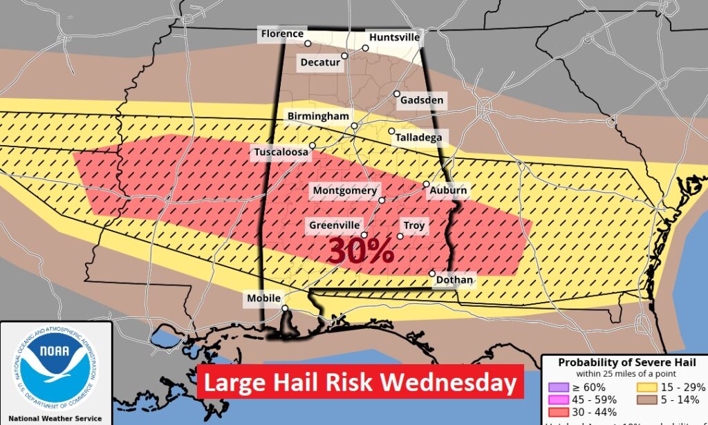
WEDNESDAY SEVERE RISK: The risk of severe storms is even stronger Wednesday and Wednesday night. SPC has us in a Level 3 Enhanced risk. Again, Damaging wind gusts and large hail are the main risk.
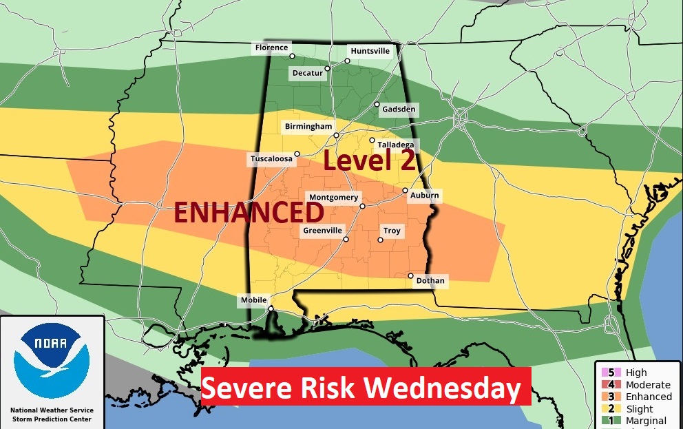
The Large Hail risk is particularly high. The hatched area covering much of central Alabama includes a 30-44% chance of hail .75″ in diameter or perhaps much larger within 25 miles of any given point. That’s strong.
Here’s a Future Radar example Wednesday evening, showing yet another cluster of storms. (MCS) Don’t take the time stamp literally.

.
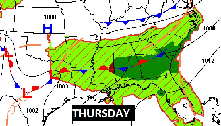
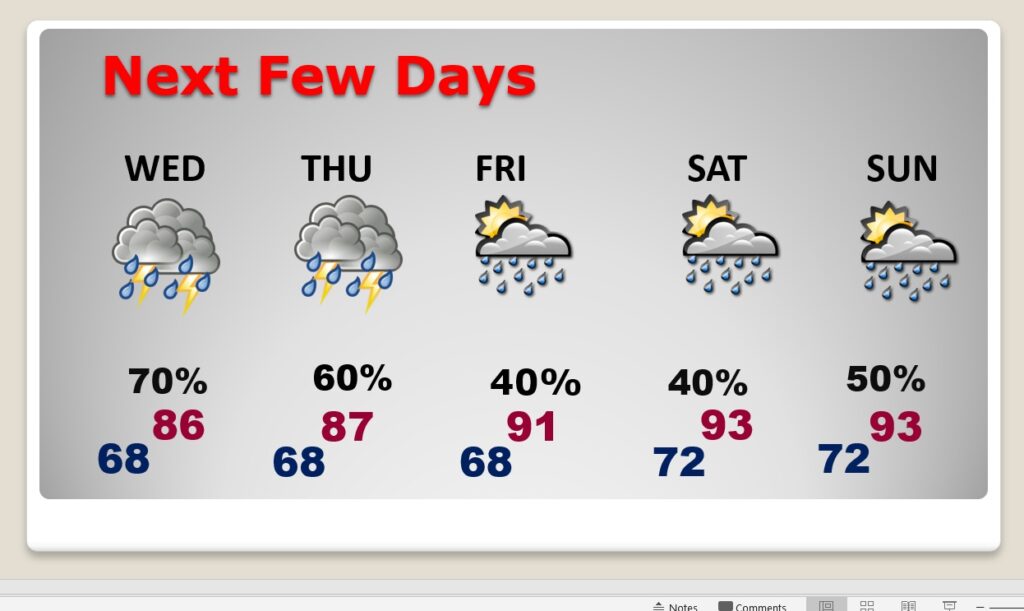
NEXT FEW DAYS: Scattered to numerous showers and strong storms through Thursday. Highs will be mostly in the upper 80’s. Lows at night around 70. Storms start to thin out in number by about Friday and Saturday. Highs will return to the 90’s over the weekend.
Thanks for reading this Blog this morning! This morning we are LIVE on the radio from 6 to 9 on NewsTalk 93.1. Watch us on TV on CBS 8 and ABC 32. I’ll have another update for you in the morning. Stay weather aware..
–Rich