
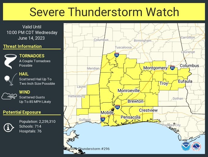
A severe thunderstorm watch now covers much of central and south Alabama until 10PM. Scattered wind gusts to 85 mph, egg size hail (2″ in diameter). A couple of tornadoes are possible. Stay weather aware. Our weather App will keep you on top of the action with instant push notifications. Go to the App store and search Rich Thomas Weather.
EARLY MORNING UPDATE:
WEDNESDAY Update: Multiple Round Severe Weather Threat – Rare June Moderate Risk
Good morning! Our multi-round, multi-day severe weather threat continues. Damaging wind gusts and large hail are the main risk. However, in a situation like this, the tornado threat is increasing. This is a dangerous June set-up because of the available energy. Storms will be most numerous this morning, and again this evening and tonight. The potential hail size could be epic. Locally heavy rainfall, and prolific lightning. This evening’s and tonight’s severe outbreak could be the strongest. Stay weather aware. The number of storms will start to thin out Friday, Saturday & Sunday. Highs return to the lower 90’s. Here’s my brief forecast discussion.
TODAY: There will be multiple rounds of strong to severe storms. Some storms likely severe. Damaging wind gusts and large hail are the main risk. But the tornado risk is increasing. It’s an extremely rare June set-up because of the available energy. Locally heavy downpours & intense lightning. The two most prominent rounds of storms are likely to be this morning and then again this evening and overnight tonight. High today mid 80’s Low tonight near 70.
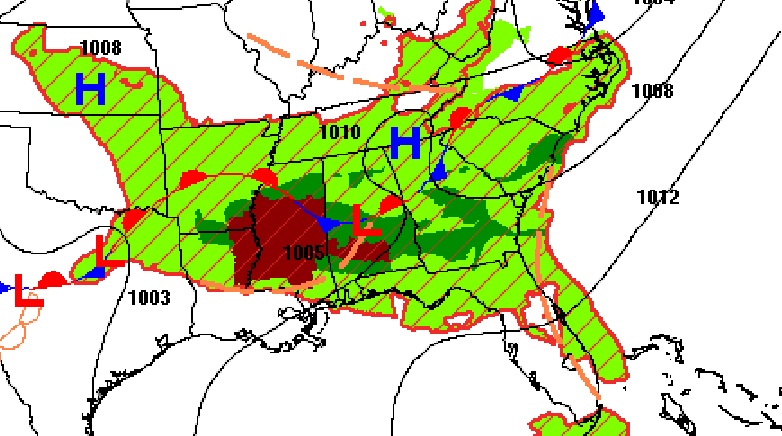

SPC has us in a Level 4 out of 5 MODERATE Severe Risk today and through tonight. I have never seen that here in the month of June.

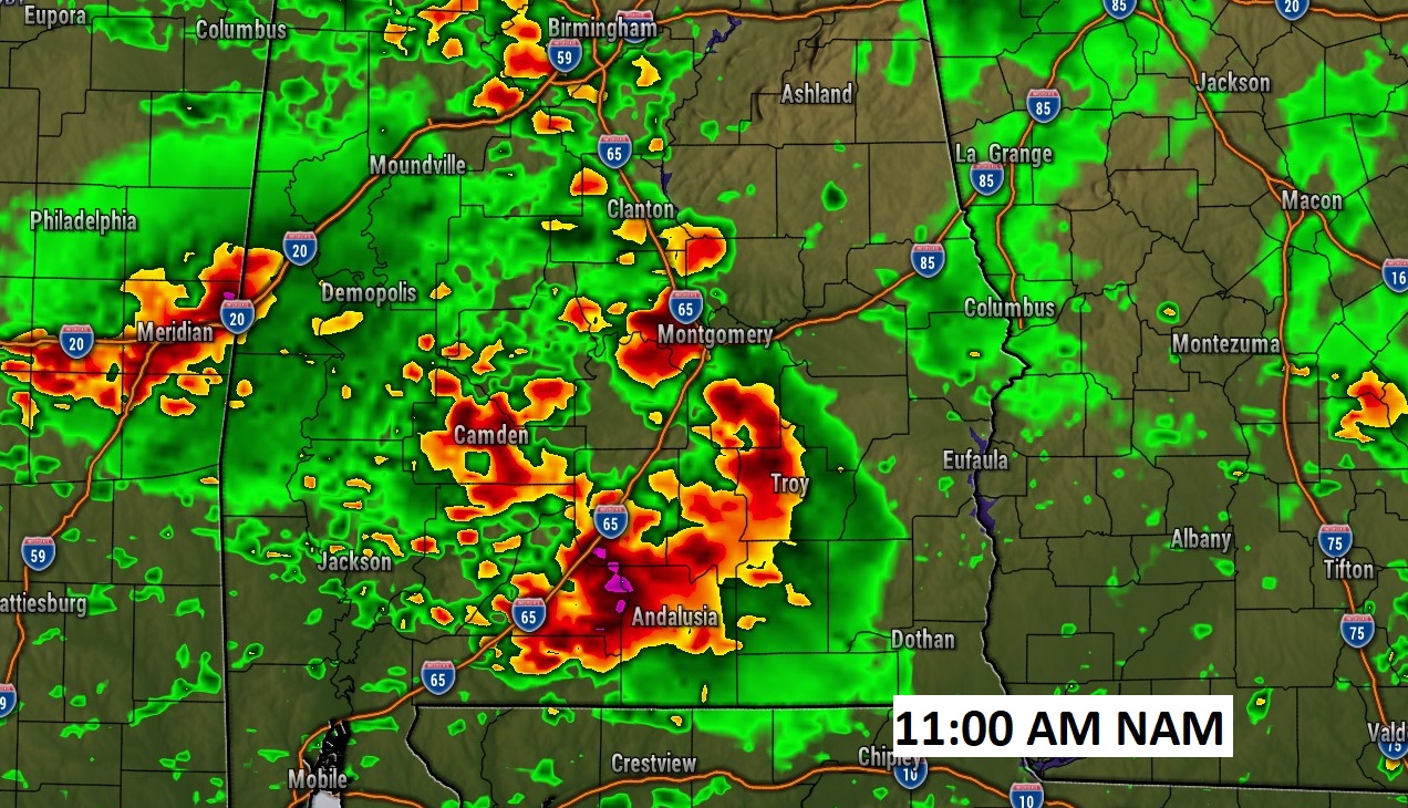
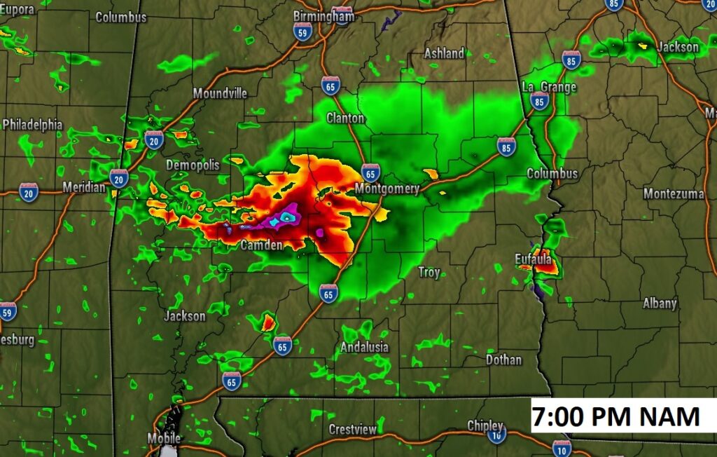
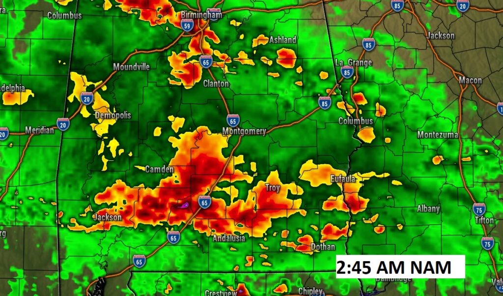
FUTURE RADAR: The next 30 hours are complicated. I wrestled with what model to show you. They are all a bit different. But, I’ll show you a few examples of the NAM model. It shows the morning round of storms may be ongoing even mid to late morning. Then, the atmosphere will “re-set” as we prepare for an intense evening and overnight event with a significant amount of available energy.
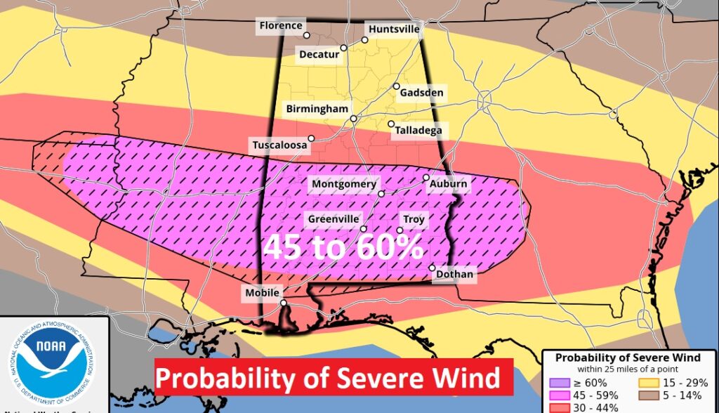
HAIL, WIND & TORNADO THREAT: The damaging wind threat is EXTREMELY high today. 45 to 60% threat of damaging winds within 25 miles on any point.
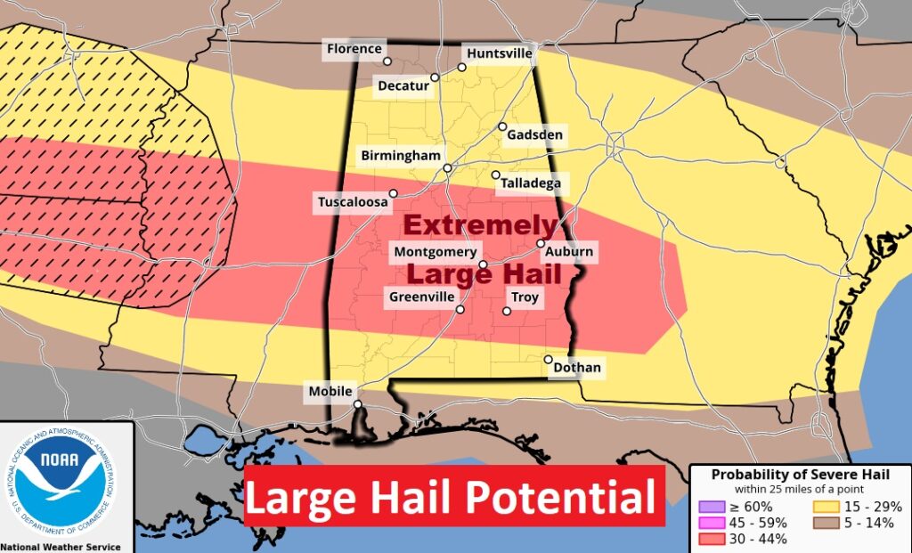
There could be EPIC size hail in spots. Tennis ball? Baseball? Softball? There will be strong updrafts capable of hoisting the hail aloft before it falls.
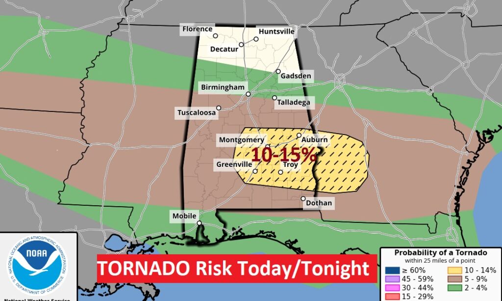
I can’t remember a tornado risk this strong in June. 10 to 15% in that hatched area. That certainly gets our attention.
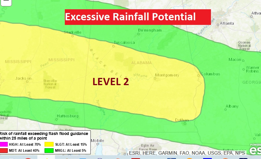
Not to mention the threat for locally excessive rainfall amounts.
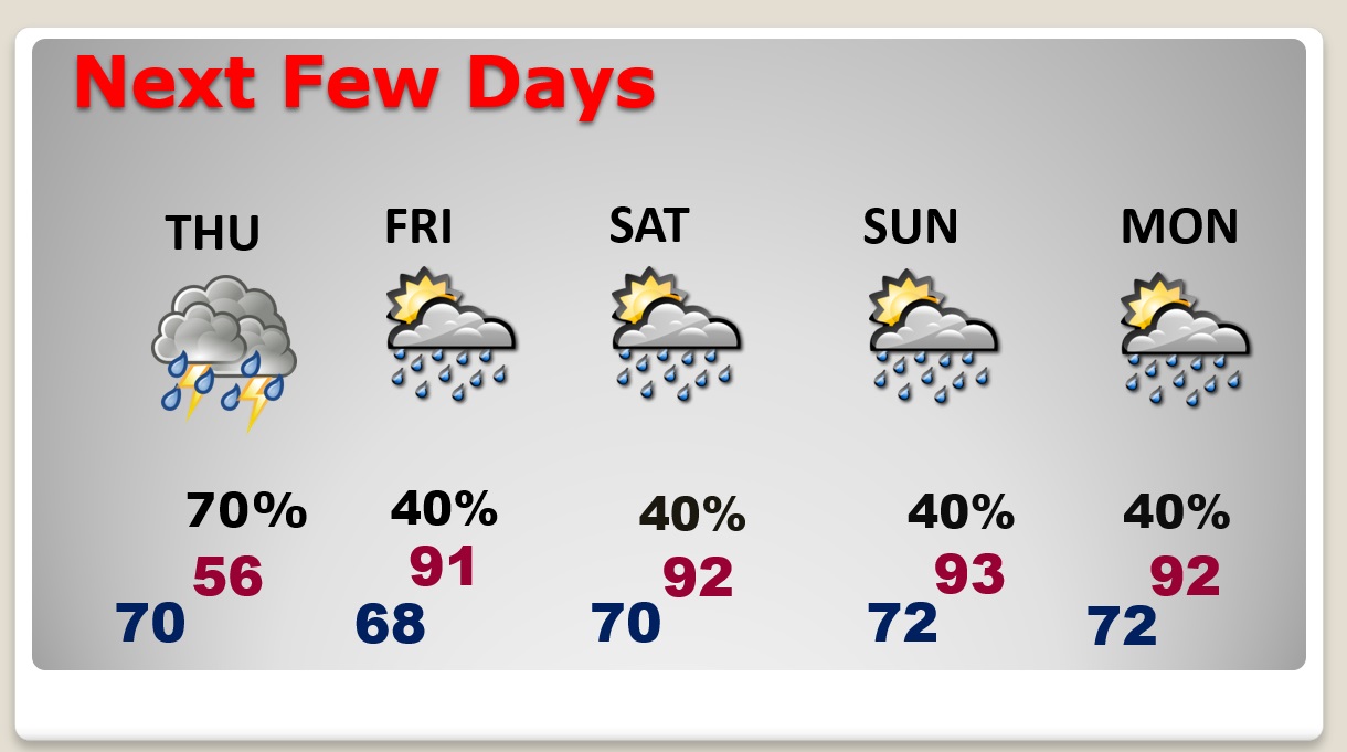
NEXT FEW DAYS: Scattered to numerous showers and strong storms through Thursday. Highs will be mostly in the upper 80’s. Lows at night around 70. Storms start to thin out in number by about Friday and Saturday. Highs will return to the 90’s over the weekend.
Thanks for reading this Blog this morning! This morning we are LIVE on the radio from 6 to 9 on NewsTalk 93.1. Watch us on TV on CBS 8 and ABC 32. I’ll have another update for you in the morning. Stay Weather Aware!
–Rich