
Good morning! It has been a very turbulent series of days, with multiple rounds of severe weather. Cluster after cluster of strong storms. The overnight hours have been very busy with many south Alabama warnings. Today, again, the better than normal rain chances continue. Rainfall will be locally heavy at times. Even Friday, another cluster of strong storms could touch off a few warnings. It will continue Hot and very humid. Particularly Friday through Tuesday. The number of storms will start to thin out Friday, Saturday & Sunday. Highs return to the lower 90’s.
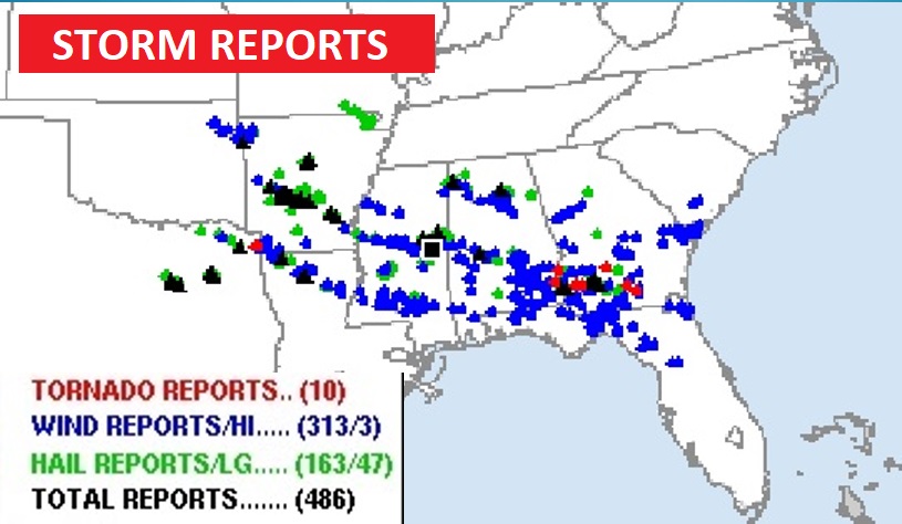
STORM REPORTS: There have been nearly 500 severe weather reports in the last 24 hours, including 10 tornado reports and over 300 wind damage reports in a corridor from Arkansas, across Mississippi and Alabama to Georgia and Florida. Most notable was the tornado in Eufaula Wednesday morning. And, the severe weather threat continues for today and Friday. It has been a most unusual June Severe Weather Outbreak.
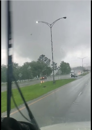
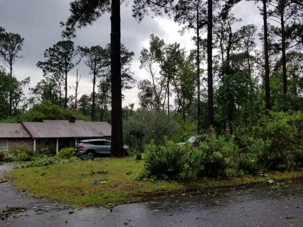
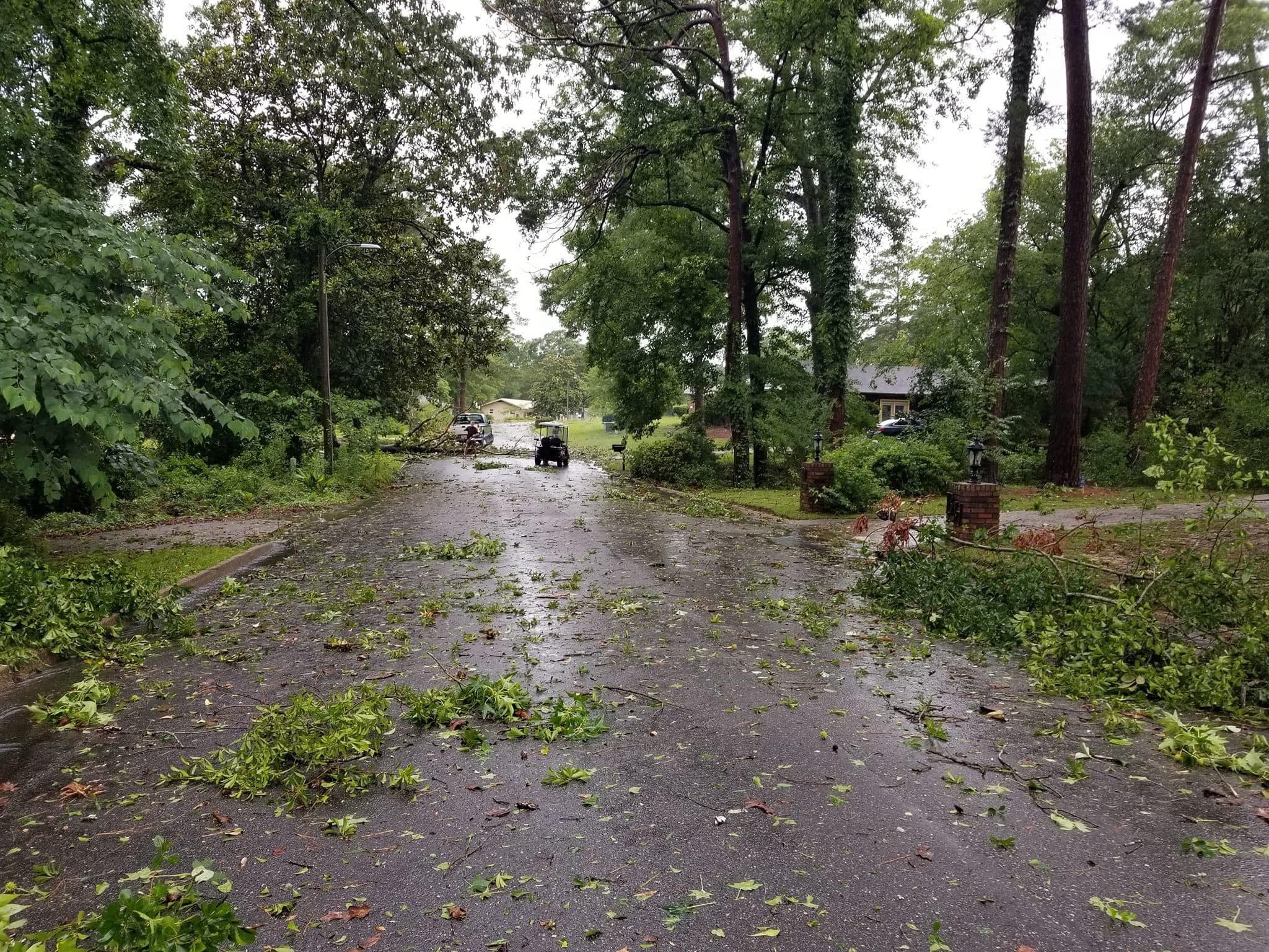
Snapshots of the lunchtime Eufala tornado on Wednesday. Thanks to Chris Beam.
TODAY: Once again today, a better than normal chance of showers and locally strong storms. Locally heavy downpours & intense lightning. The risk of storms continues this evening and overnight tonight. High today mid 80’s Low tonight upper 60’s.
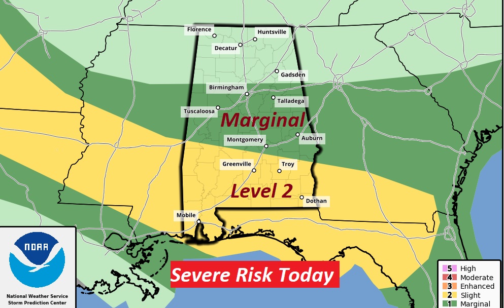
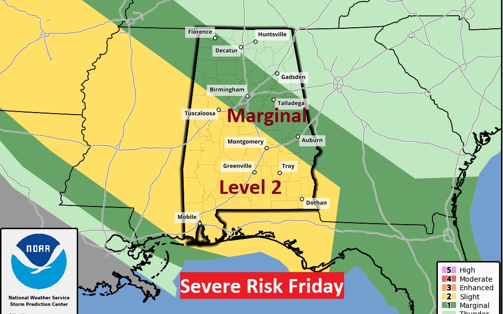
SPC has most of south Alabama in a Level 2 Severe Weather Risk again today. The rest of us are in a Marginal Risk. Damaging wind gusts and large hail are the main threat.
FUTURE RADAR: No comment needed here. Here are some Future Radar snapshots today. Are you ready for another stormy day?
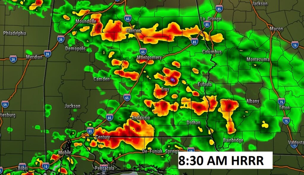
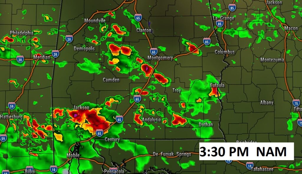
A couple more stormy days ahead across the Deep South.
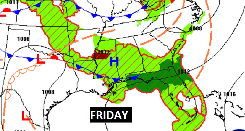
FRIDAY SEVERE RISK: The multi-day Severe Weather Outbreak continues Friday. Much of the area, again, is under a Level 2 Severe Risk, as clusters of severe storms ride southeastward across the area.
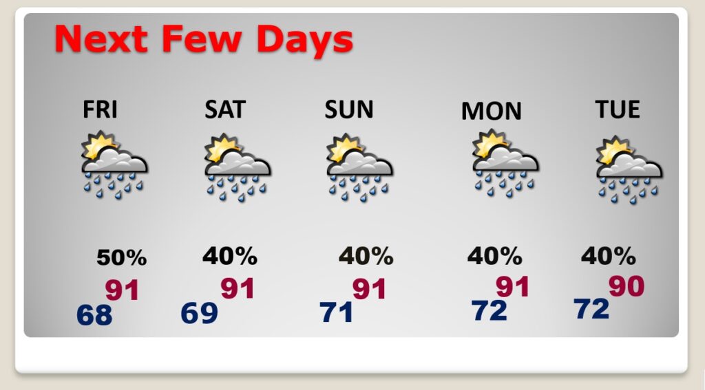
NEXT FEW DAYS: Scattered showers and locally strong storms through Friday. Storms start to thin out in number by Saturday through Tuesday. Highs will be back in the lower 90’s next few days. Lows at night 70 to 72.
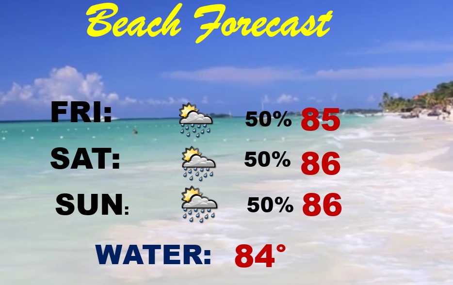
BEACH FORECAST: Not a terrible forecast. But, have a Plan B. There will be a generous supply of storms roaming around each day. Warm & humid. Mid 80’s. Gulf Water Temperature 84.
Thanks for reading this Blog this morning! This morning we are LIVE on the radio from 6 to 9 on NewsTalk 93.1. Watch us on TV on CBS 8 and ABC 32. I’ll have another update for you in the morning.
–Rich