
Good morning! Our series of unusually stormy days continues. Today will be a repeat performance. In fact, we are stuck in the daily Severe Weather Risk zone through Sunday. Radar will be quite active through Father’s Day. Even Monday and Tuesday looks quite active. Thunderstorm season. Damaging wind gusts and large hail are the main threat. Here’s my brief forecast discussion.
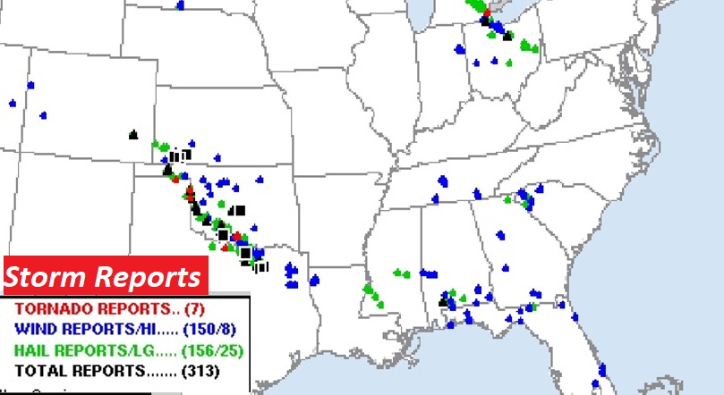
STORM REPORTS: There have been over 300 severe weather reports in the last 24 hours across a multi-state area. Not as many in Mississippi and Alabama, Georgia and Florida, but still very active. It was a very stormy night from coastal Alabama across northern Florida. Significant outbreak in the Plains, including a devastating tornado in Perryton, Tx.
TODAY: Once again today, a better than normal chance of showers and locally strong storms. Locally heavy downpours & intense lightning. The risk of storms continues this evening and overnight tonight. High today upper 80’s Low tonight near 70.
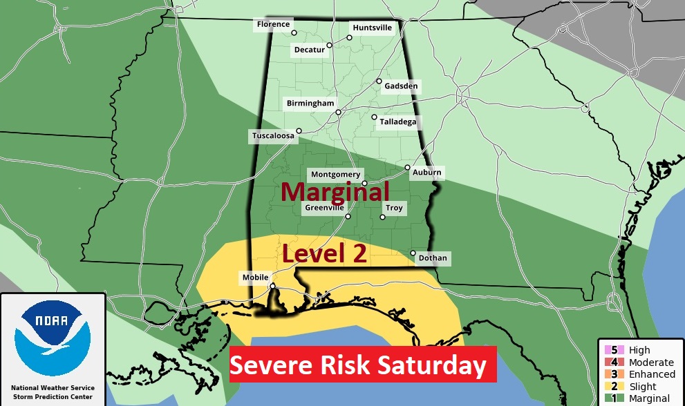
SPC has most of south and part of central Alabama in a Level 2 Severe Weather Risk again today, south of a Tuscaloosa, Montgomery, Eufaula line. The rest of the area in a Marginal Risk. Damaging wind gusts and large hail are the main threat.

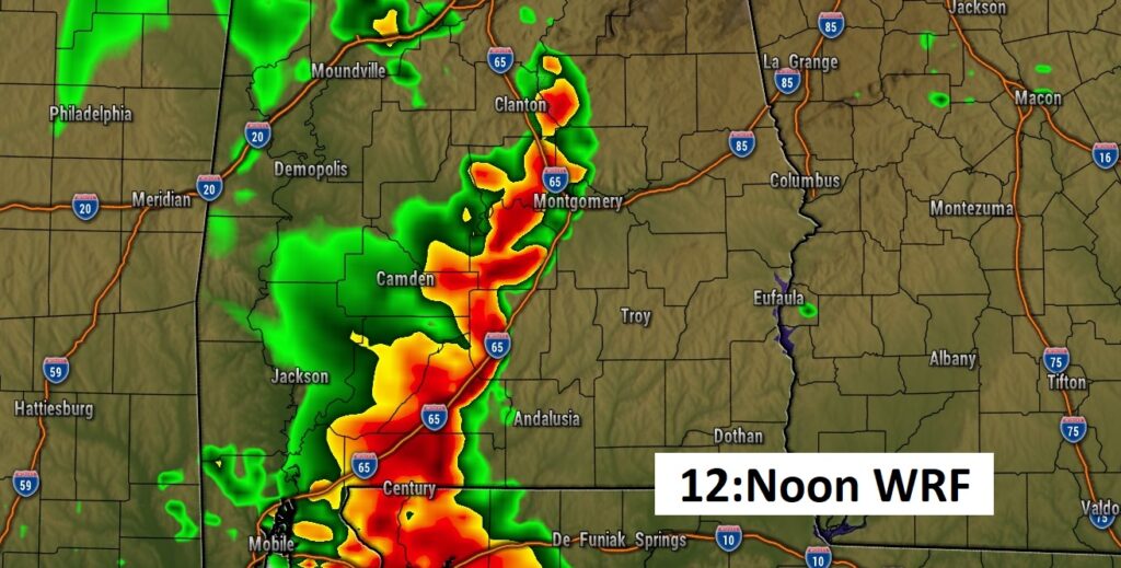
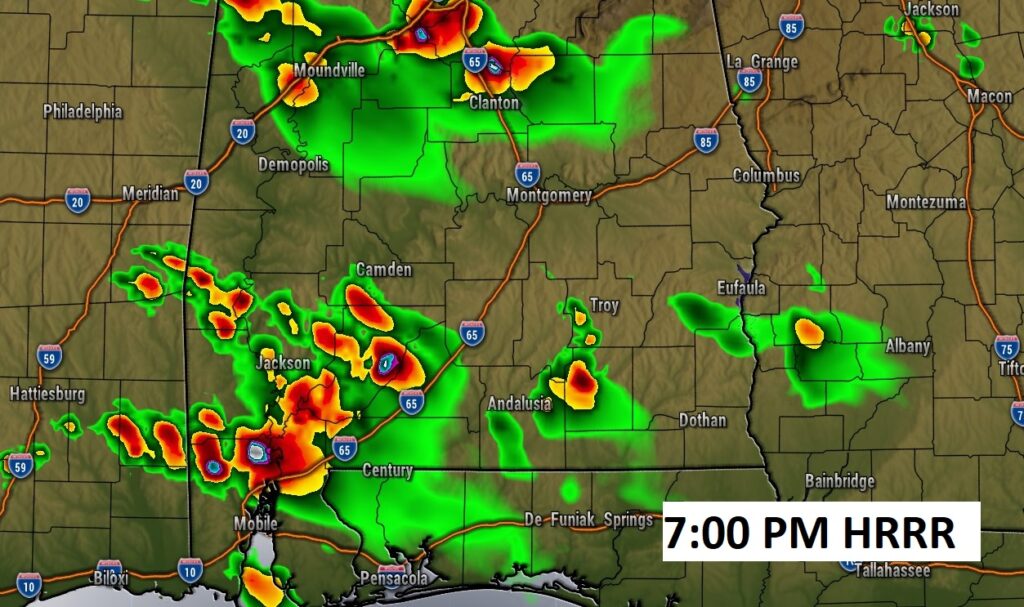
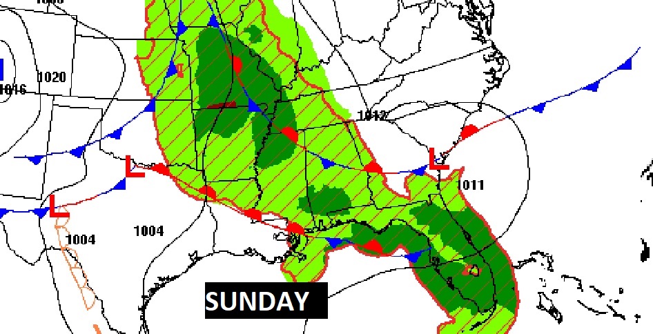
FUTURE RADAR: Here’s a couple of Future Radar samples. More of the same. The radar will be very active with more storm clusters today and into tonight.
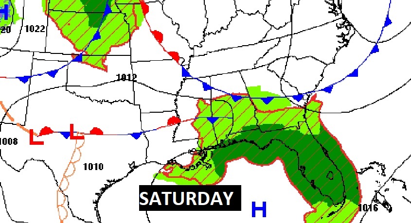
WEEKEND SEVERE RISK: The multi-day Severe Weather Outbreak continues Saturday & Sunday. Saturday, the greatest threat of Severe Storms is on the Coast.
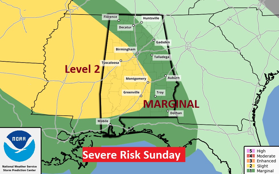
On Father’s Day Sunday, much of the area, again, is under a Level 2 Severe Risk, as clusters of severe storms ride southeastward across the area.
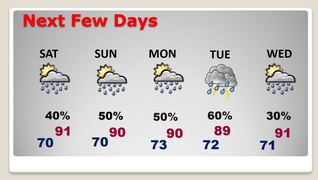
NEXT FEW DAYS: Scattered showers and locally strong storms through the weekend. Highs will be back in the upper 80’s to lower 90’s next few days. Lows at night 70 to 73. Even Monday and Tuesday, the stormier than normal pattern continues.
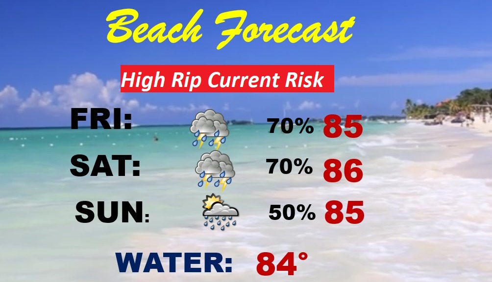
BEACH FORECAST: Have a Plan B. There will be a generous supply of storms roaming around each day. In fact, some storms could be severe. Warm & humid. Mid 80’s. Gulf Water Temperature 84. High rip current risk.
Thanks for reading this Blog this morning! This morning we are LIVE on the radio from 6 to 9 on NewsTalk 93.1. Watch us on TV on CBS 8 and ABC 32. I’ll have another update for you in the morning. Have a nice weekend!
–Rich