Good morning! On this Father’s Day we will be Radar Watching. There will be various clusters of storms riding southeastward into Alabama. There will be storms during the day..then a lull, then another intense round in the overnight hours tonight. Some of the storms will be severe with damaging wind gusts and large hail. Much of the area in in an enhanced risk today and tonight. Expect numerous showers and storms Monday and Tuesday. We are still in a Severe Risk even Monday and Tuesday. That will be the seventh day in a row that parts of Alabama will be in a severe risk. It looks like an active week ahead. Thunderstorm season.
TODAY: Today there will be various clusters of storms riding southeastward into Alabama. There will be storms during the day..then a lull, then another strong round (MCS) in the overnight hours tonight. Some of the storms will be severe with damaging wind gusts and large hail. Much of the area in in an enhanced risk today and tonight. near 90. Low tonight near 71.
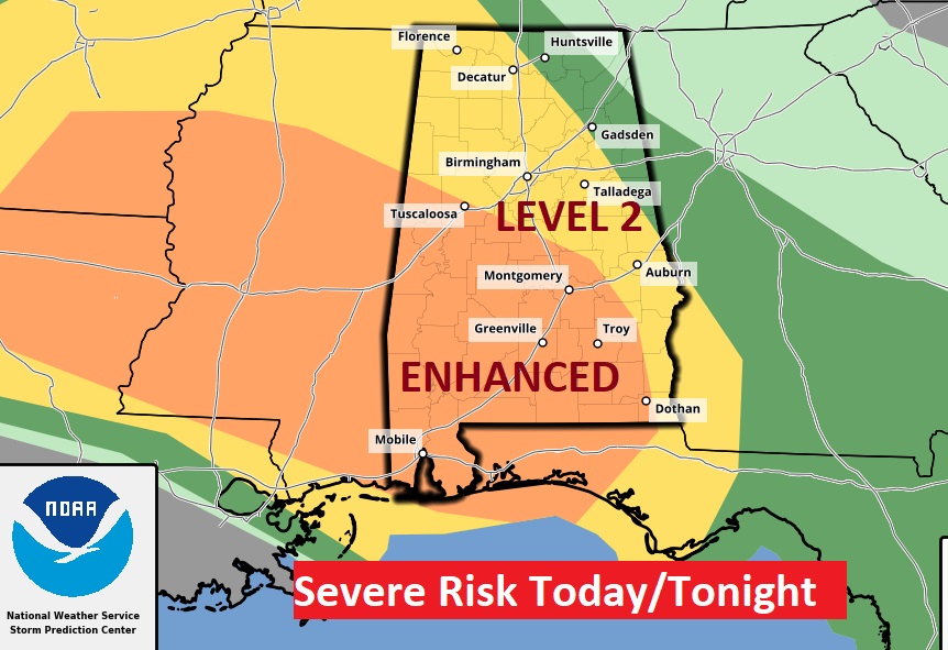
SPC has most of central & south Alabama in an Enhanced Severe Weather Risk. Scattered damaging wind gusts to 70 mph and very large hail are the main threats.
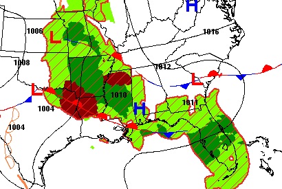
The pattern is complicated. Two boundaries are in the mix in Alabama, but that’s not all. If you a weather nerd and want to see the whole meat and potatoes on our turbulent situation, click this link.
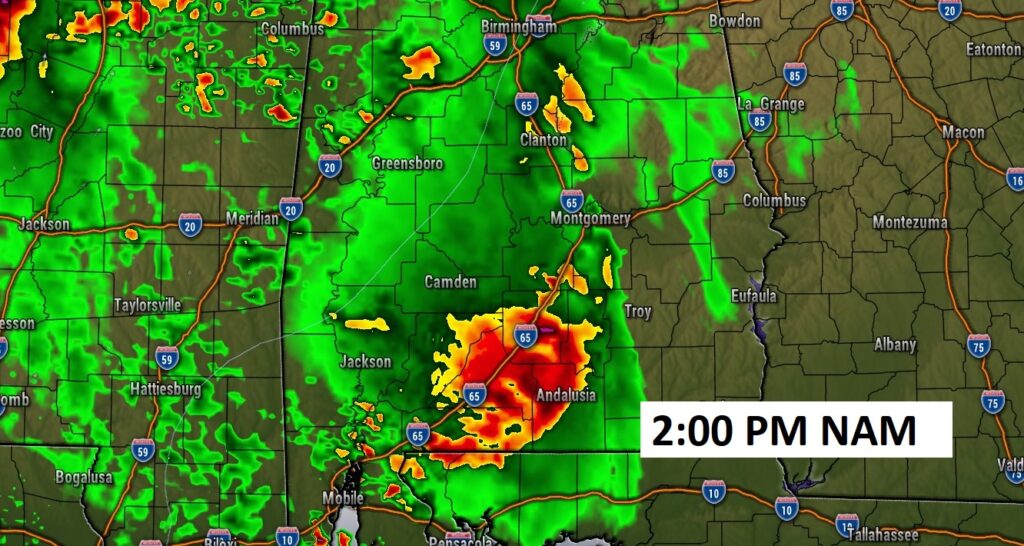
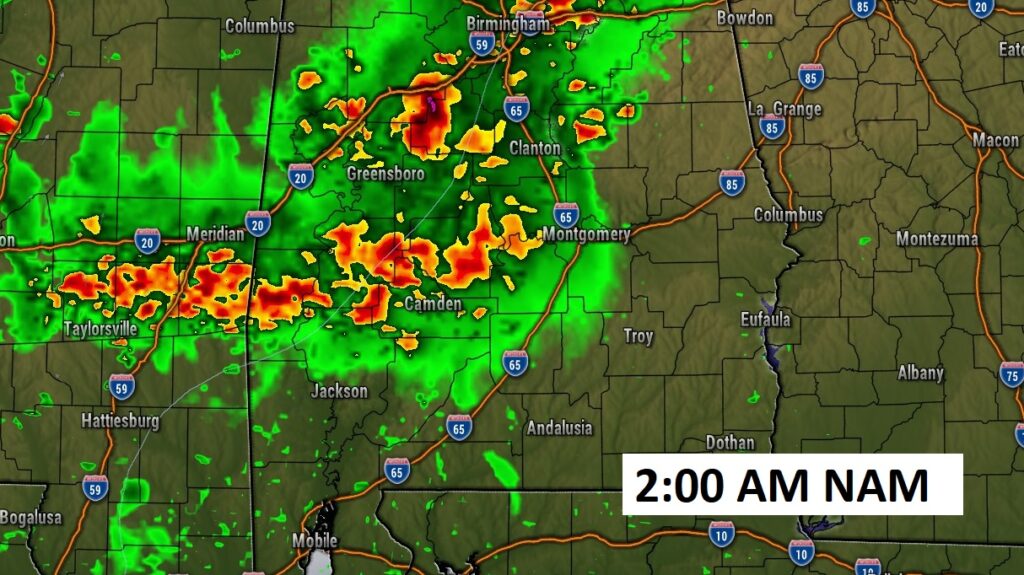
FUTURE RADAR: Here’s one hi-res model. The 3K NAM. It shows a round of storms mid-day today and another cluster in the overnight hours tonight. I think the stronger round of storms will be tonight.
SEVERE WEATHER RISK: The multi-day Severe Weather Outbreak continues Monday and Tuesday.
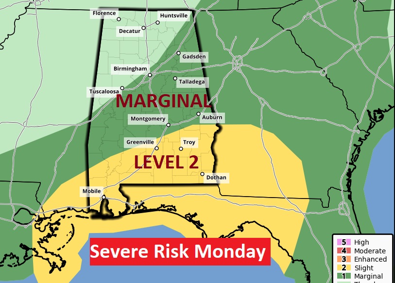
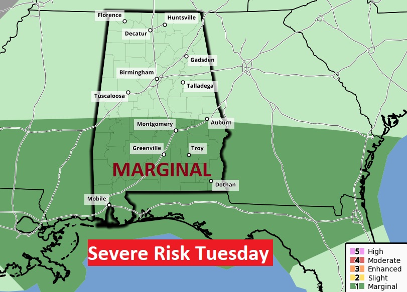
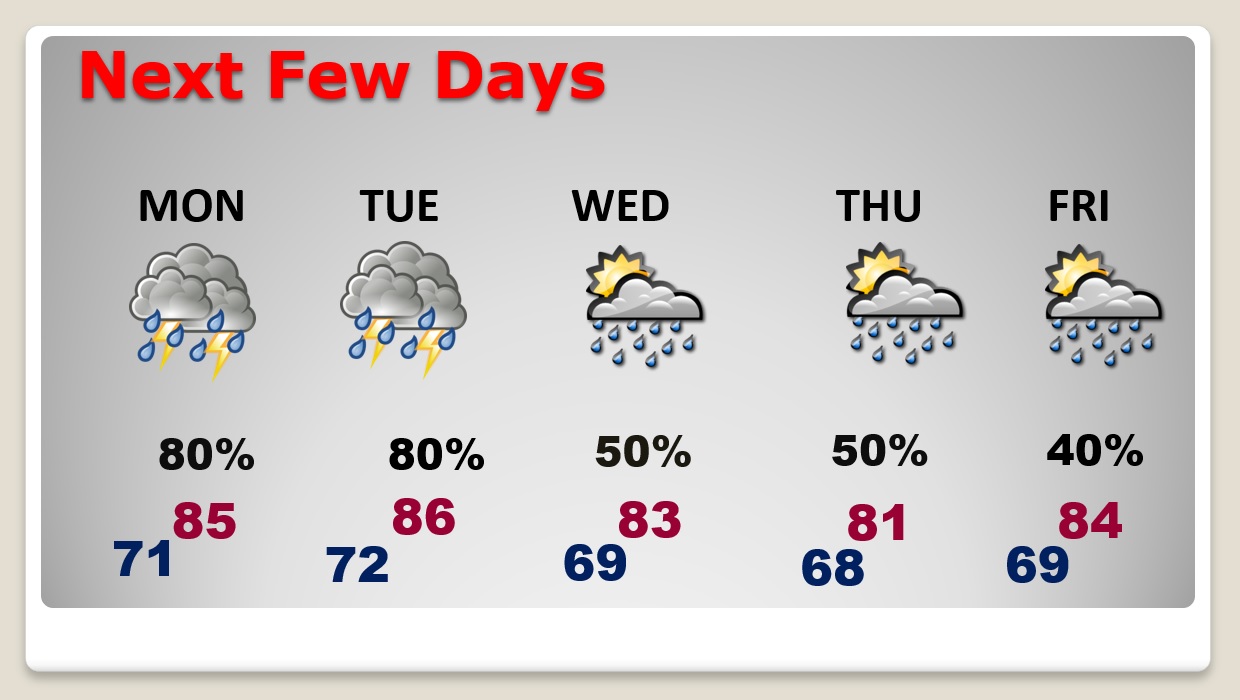
NEXT FEW DAYS: Scattered to numerous showers and locally strong storms are most likely Monday and Tuesday. A better than normal chance of showers and storms continue for the rest of the week. Temperatures will be held down by clouds and showers.
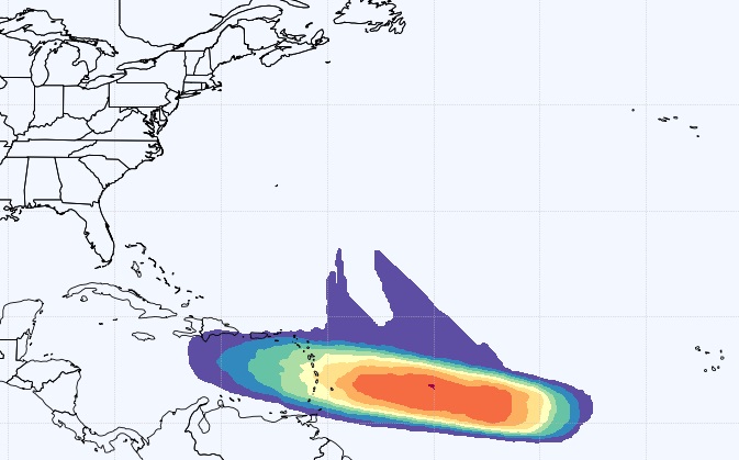
TROPICAL UPDATE: Invest 92-L is becoming better organized in the Tropical Atlantic. There is now a 90% chance that this system will become a depression in the next day or two.
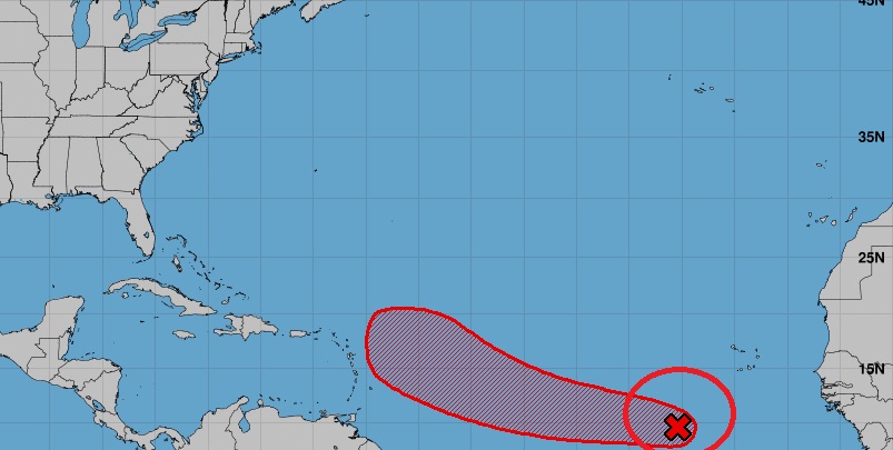
The Euro model gives this system a strong chance of becoming tropical storm Bret in the weekend ahead.
Thanks for reading this Blog this morning! I’ll have another update for you in the morning. Happy Father’s Day to all the Dads
–Rich
There is simply nobody alive who didn’t love, my dad, Harold.
“Happy Birthday, and Happy Father’s Day in heaven, daddy! There’s so much of YOU that lives in ME. “.