
A Severe thunderstorm Watch has been extended and now includes parts of western and central Alabama , until 3AM. This severe threat includes the risk from multiple thunderstorm clusters. Scattered wind gusts to 70 mph. Hail up to ping pong size. Intense lightning. Stay Weather Aware. Our weather App will keep you on top of the action with instant push notifications. Go to the App store and search Rich Thomas Weather.

Good morning! We are easing more and more into a deep summer pattern. Saturday was hot. Today will be hotter in terms of the Heat Index, which will be near or possibly above 100 by this afternoon. Not only that. Another one of those strong thunderstorm clusters (MCS) will be sliding southward through the state, into central Alabama by evening. Some of those storms will be strong/severe with damaging wind gusts possible. The big story in the week ahead will be building heat. By mid to late week, the Heat Index will be near the 105 danger range. Storms will thin out in number, again, Tuesday through Friday. Only isolated storms. Welcome to Deep Summer. Here’s my brief forecast discussion.
5:30 PM UPDATE:
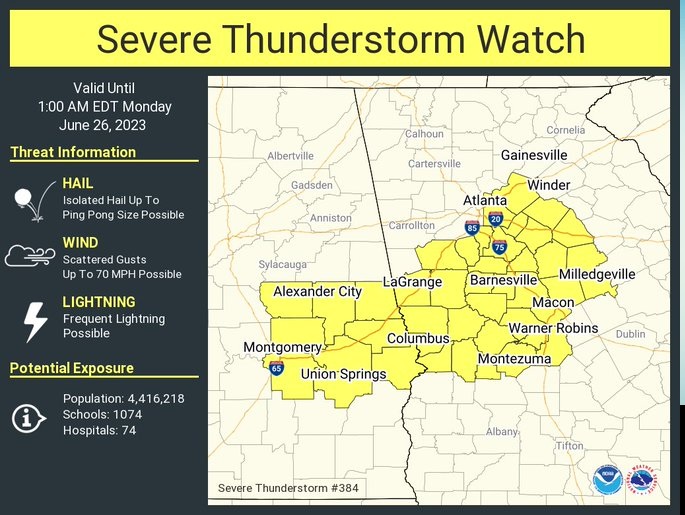
A Severe thunderstorm Watch has been extended and now includes parts of central and east central Alabama, until 1AM. Scattered wind gusts to 70 mph. Hail up to ping pong size. Intense lightning. Stay Weather Aware. #ALWX
TODAY: Get ready for a Hot Sunday. Triple digit heat index possible by afternoon. High today 92. Sun/cloud mix. Increasing risk of thunderstorms, especially by late afternoon and into the evening. A southward moving thunderstorm cluster could bring some strong/severe storms, with damaging wind gusts. Low tonight 74. Very humid.
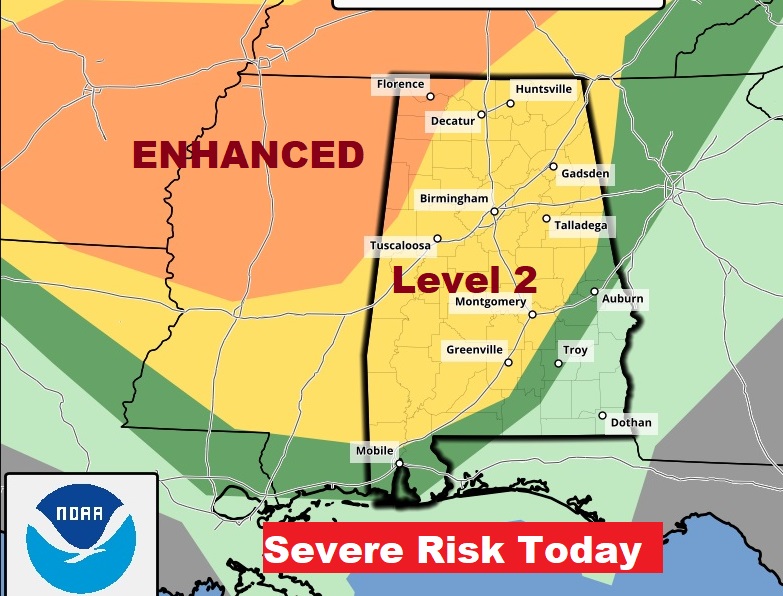
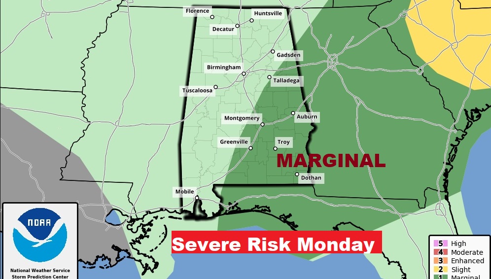
The Storm Prediction Center has much of Alabama in a Severe Weather Risk. The risk level is as high as Level 3 ENHANCED in the northwest counties, tapering off to a Marginal Risk as far southeast as Troy. The main threat is damaging wind gusts. On Monday SPC shifts the severe threat to southeast Alabama.
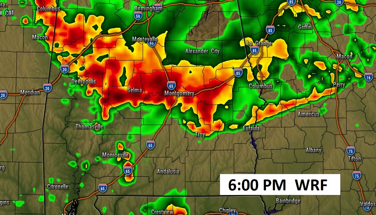
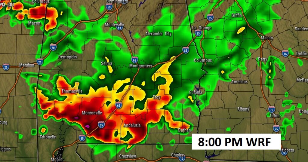
Here’s one of the hi-res Future Radar models. The WRF model shows that impressive southward moving thunderstorm cluster reaching the US 80/I-85 corridor by early evening, and into south Alabama tonight. (Don’t take the times literally. This is just one model idea on how this could unfold)
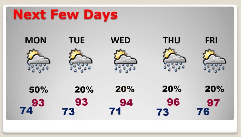
NEXT FEW DAYS: Scattered storms are a good bet Monday. The number of storms will thin out Tuesday through Friday, becoming widely scattered or isolated. The heat will build. Mid 90’s by mid-week. Mid to upper 90’s late week. By mid to late week, the Heat Index will be near the 105 danger range.
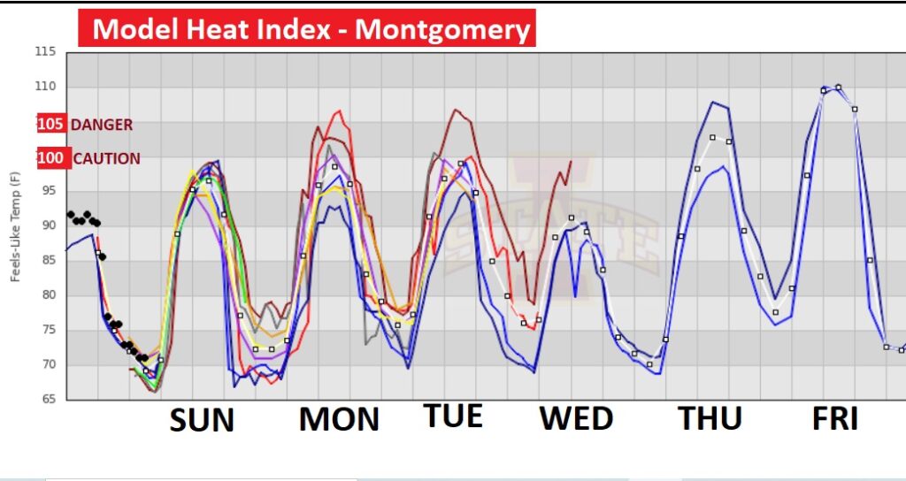
Here’s a snapshot of several models showing Triple Digit heat indices in the week ahead. 100 if the caution range. 105 is the danger range.
Here’s a snapshot of the model blend Heat Index numbers on Thursday. Look at some of those numbers in Mississippi and Louisiana especially. Serious business.

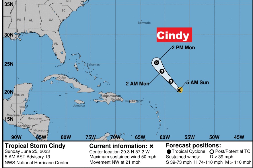
TROPICAL UPDATE: Tropical Storm Bret dissipated in a hostile environment in the Caribbean. Meanwhile, Cindy is a 50 mph Tropical Storm in the tropical Atlantic. Cindy is not long for this world. Also, encountering a hostile environment and is expected to dissipate Monday.
Thanks for reading this Blog this morning! I’ll have another update for you in the morning. Have a great weekend. Stay weather aware.
–Rich