
Good morning! Yesterday was the hottest day of the year with 94 and a Heat Index of 106. Big Heat produces big storms. We dealt with Two of those summertime thunderstorm clusters called MCS. The storms put on quite a show, There were several watches and warnings. There may be at least another MCS affecting the state today. The southeast third of the state is in a Marginal Severe Risk. Meanwhile, the big story this week is intense heat. We’ll be in the the middle 90’s mid-week and perhaps upper 90’s late week. The Heat index is headed for Dangerous triple digit levels. Late July August heat levels in late June. Daily storms will thin out. Here’s my brief forecast discussion.
CLIMATE DATA: Sunday tied the hottest of the year so far with 94. Maximum Heat Index 106. Sunday’s morning low 73. Normal 93/73. Airport Rainfall: TRACE . East Montgomery: .59”
Wow. Crazy day yesterday. 500+ severe weather reports from the Great Lakes to Alabama.

TODAY: Hot and Humid again. Risk of more scattered random storms. High 92. Heat index near or above 100. Low tonight 74.
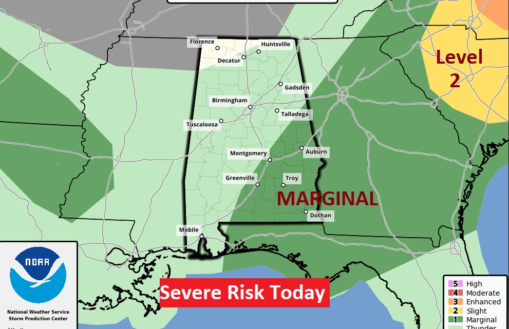
The Storm Prediction Center has the southeast third of the state in a Marginal Severe Risk. as far southeast as Troy. Damaging wind gusts are the main threat.
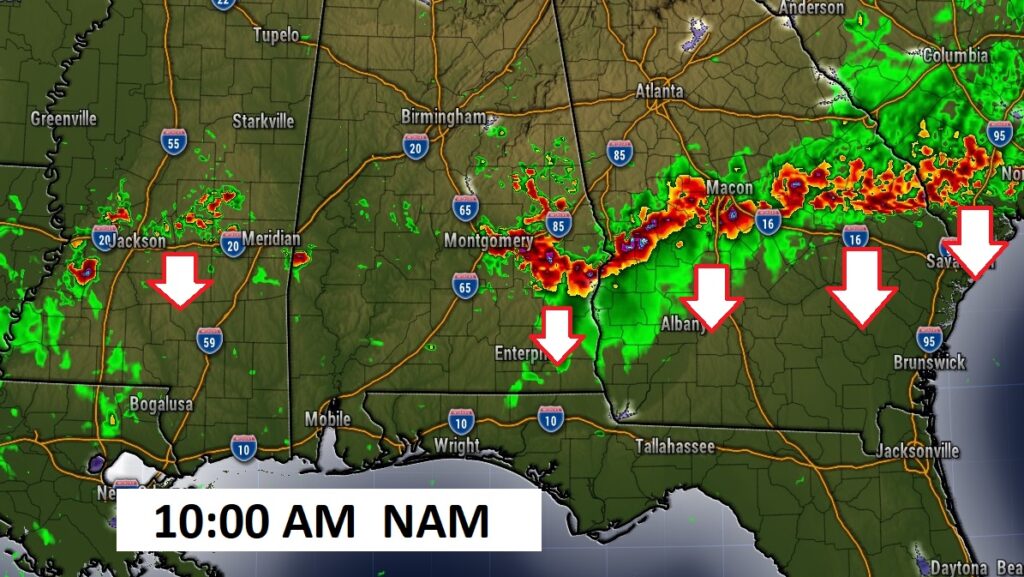
Here’s one of the hi-res Future Radar models. The NAM shows another one of those thunderstorm clusters (MCS) marching southward through Georgia and east central Alabama. Will things play out that way? We’ll see… Models suggest this afternoon could be quieter than Sunday afternoon.
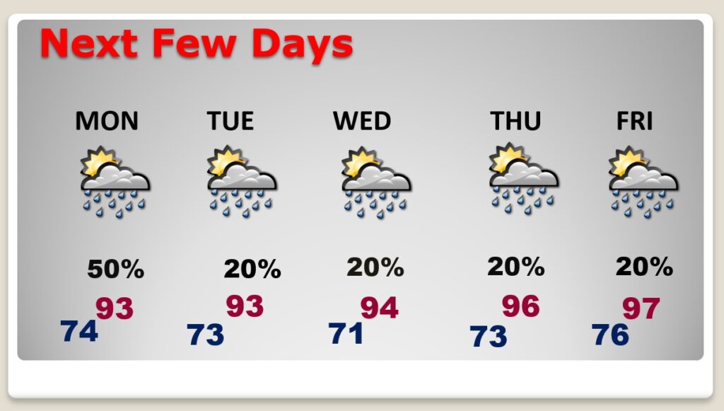
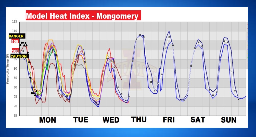
NEXT FEW DAYS: The heat will build. Mid 90’s by mid-week. Mid to upper 90’s late week. By mid to late week, the Heat Index will be near or above the 105 danger range. Storms thin out in number. Widely scattered hit or miss storms.
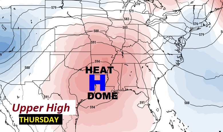
A big Upper High Heat Bubble will spread eastward from the Ark/La/Tex region. Get ready for a very hot week ahead. Dangerous heat indices later in the week.
Here’s a snapshot of the model blend Heat Index guidance for the week ahead. 100 is the Extreme Caution Range. 105 is the Danger Range. Look at this graph. Late July/August kind of heat in late June. Expect some Heat Advisories.
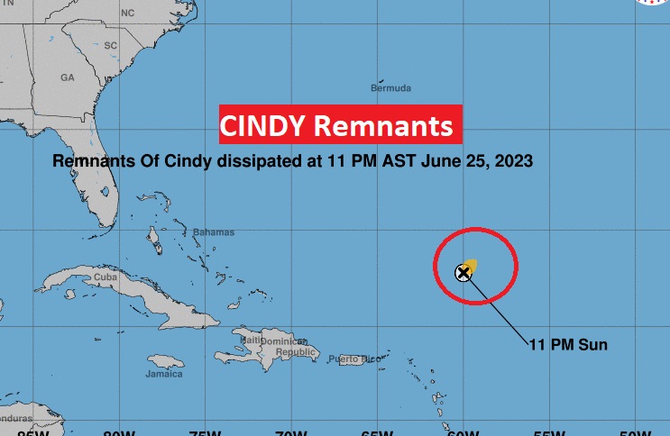
TROPICAL UPDATE: NHC wrote the last advisory on Tropical Storm Cindy at 10 PM last night. It is now a remnant low. The rest of the Atlantic, Caribbean and Gulf of Mexico are quiet.
Thanks for reading this Blog this morning! This morning we are LIVE on the radio from 6 to 9 on NewsTalk 93.1. Watch us on TV on CBS 8 and ABC 32. I’ll have another update for you in the morning. Have a nice day!
–Rich