
Good morning! Extreme Heat continues at least through the weekend. Some of us are under a Heat Alert. Some are under an Excessive Heat Warning. It doesn’t matter. The heat indices will reach Dangerous levels, especially through Sunday. Big heat sometimes can produce Big Storms. Storms will be random and scattered, but some storms can put on quite a show, with intense lightning and gusty winds. Marginal Severe Risk today and tomorrow for a big chunk of the state. Storms become more numerous on the 4th of July and particularly Wednesday and Thursday. Still hot & humid for several days. Slow down. Stay hydrated. Stay cool. There will be NO blog update Sunday. The next update will be Monday morning.
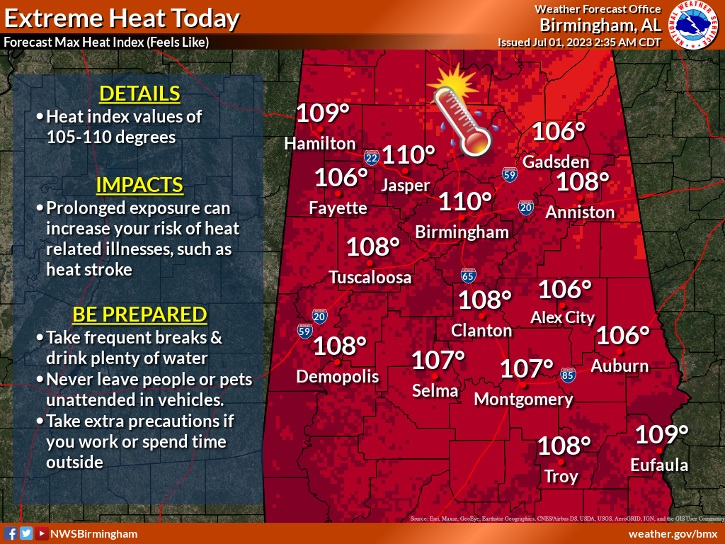
SATURDAY: Extreme Heat continues. Heat Advisory for many, Excessive Heat Warning for some. High near 100. Heat index 107 to 115. Spotty widely scattered locally strong storms. Low tonight 77.
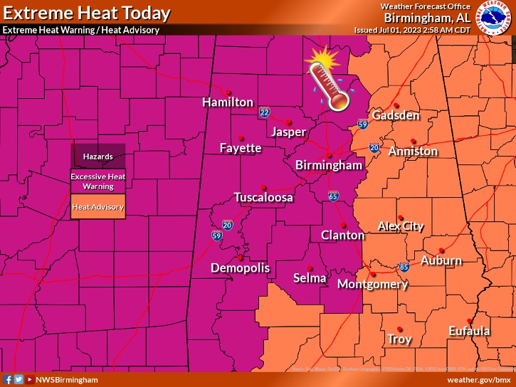
Excessive Heat Warning covers all of the western half of the state. Heat Advisory covers the eastern half of the state. Doesn’t matter. It’s going to be crazy hot. Not much change , at all, on Sunday.
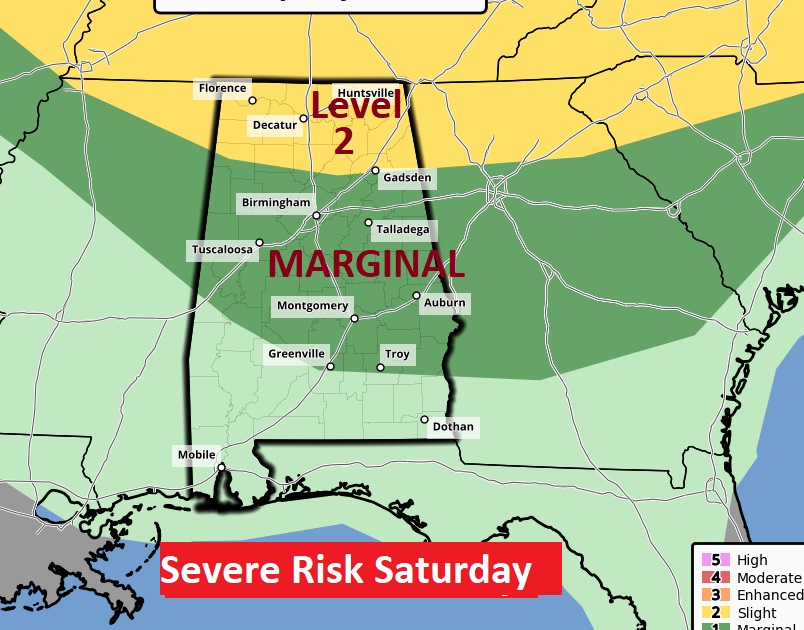
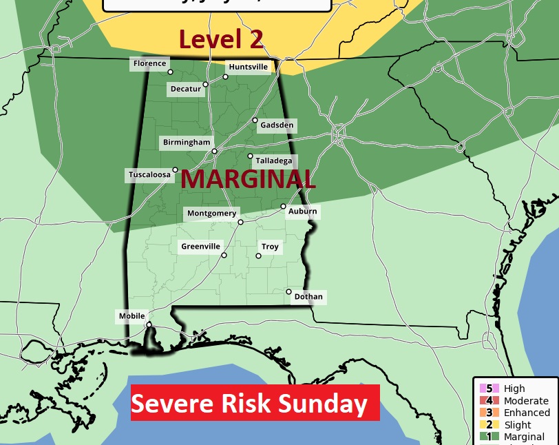
SPC has the Marginal Severe Risk as far south as a Greenville/Troy line on Saturday. Sunday’s outlook is not vastly different. We’ll be monitoring potential thunderstorm clusters.
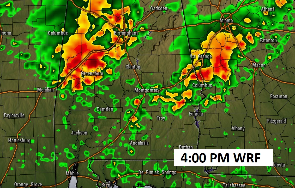
The hi-res models are struggling with the thunderstorm outlook. Some models show absolutely NO activity. The WRF model, below, is probably overdone. But, the point is, Big Heat produces Big storms. If storm clusters can get going, they have the potential for some strong storms with gusty winds and intense lightning.
SUNDAY: Very similar. Dangerous heat. High in the upper 90’s. Heat Index 105 to 110. Scattered random strong storms.
Marginal Severe risk for many.
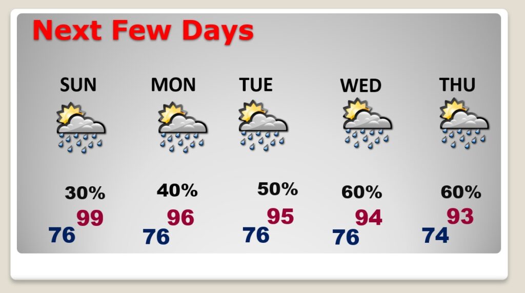
NEXT FEW DAYS: No doubt about it, even Monday and Tuesday, it may not be QUITE as hot, but we’re talking intense heat. Triple digit heat indices. Random scattered storms Monday. Storms will be in more generous supply on the 4th of July. Storms become more likely Wednesday and Thursday. Highs in the mid 90’s.
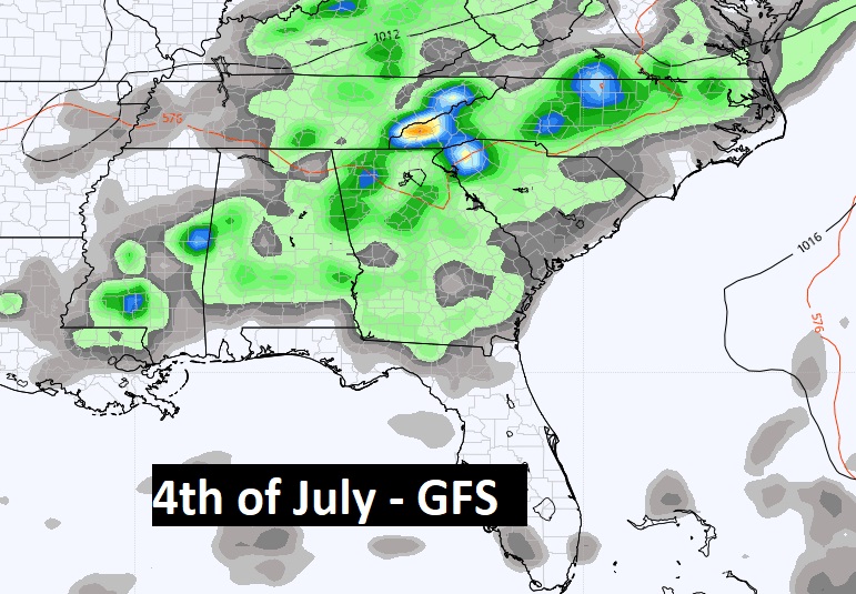
Your 4th of July will not be a washout. There will just be a lot more hit or miss storms to go around. Be flexible. Have a Plan B.
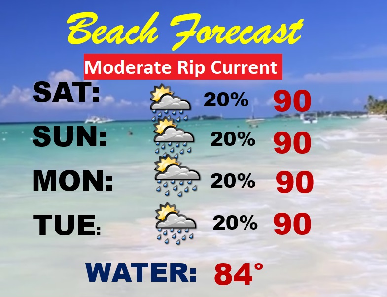
BEACH FORECAST: Just crazy heat indices this weekend. Maybe 113-119 through the weekend. Stay hydrated. Even the beach sand will be blazing hot. Widely scattered storms. Better rain chances begin Tuesday. PLEASE respect the Flags on the Beach. Moderate Rip Current Risk continues. 11 people have lost there lives in just the last two weeks along the Alabama and NW Florida coast due to dangerous rip currents.
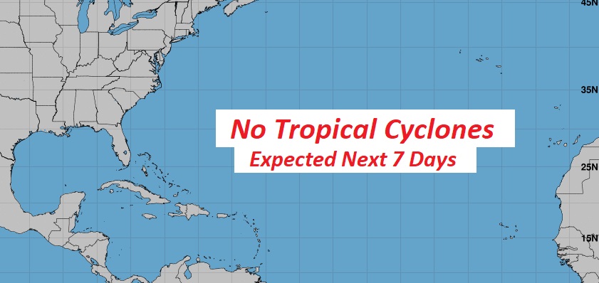
TROPICAL UPDATE: Good news. There’s nothing in the tropics. The Atlantic Caribbean and Gulf of Mexico are quiet for now.
Thanks for reading this Blog this morning! There will NOT be a Blog Update on Sunday morning. Sorry. I’ll have another update for you on MONDAY morning. Have a nice day!
–Rich